This is the day that I have finally had it with Highway 17.
I have a high tolerance for traffic, but this is simply not safe for the solo cyclIst. We rode for at least 10 miles with support vehicles in the front and rear of our pack for protection because there was no shoulder and we needed to take the right lane (and I could easily be undercounting). We had at least as many more miles where we could stick to a narrow shoulder, shrunk by almost constant rumble strips on the left side that jar your brain when forced to cross over and dodging chunks of rubber tire and other crud in the space that was left. It was ride in a pack, regroup when there was a break, get water if possible, hope you remembered to slather on more sunscreen, and repeat. You didn’t dare drop back or stop if it meant losing your posse. No lunch break either, just another Clif bar (at least for me) to keep you going. I think breakfast and lunch equaled 3 bars, and then it was just waiting for that group dinner.
Imagine if you were doing this on your own or with a few friends. Forget it.
I thought the East Coast Greenway‘s Trenton-to-Philadelphia stretch was bad, but this is far worse. I know it’s a new interim on-road route, shorter than going further inland, and road options are limited by the need to cross so much water in the low country. Yes, the Spanish Moss Trail in Beaufort is still under construction, with plans to expand that could help a bit. And we had some quiet stretches away from the highway.
Thankfully, Charleston has the nice West Ashley Greenway used by a wide range of people (just pave the middle section!) and hopefully will end the insane bike/ped situation over the river. Here we are doing last-minute preparations before taking the lane on the approach to the bridge:
But there is lots of work needed to make the entire stretch merely acceptable. Once again, it highlights the need for the East Coast Greenway Alliance, which strives for a route connecting cities up and down the East Coast that serves everyone from 8 years old to those who are 80.
Just putting up the tiniest “share the road” signs ever doesn’t cut it, SCDOT. We’re not all John Forester-style vehicular cyclists, let alone crazy vehicular cyclists. And given the pervasiveness of fire ants, a decent shoulder is needed not just for cyclists (as a minimum) but also for motorists dealing with a breakdown. Who wants to try fixing a flat car tire and end up itching from ant bites?
One star (out of five).
And I’m glad I live in a part of the country where the most basic infrastructure isn’t an afterthought.
Finally! Some trail riding in this year’s weeklong East Coast Greenway ride.
And note to the rest of South Carolina: A bicycle trail doesn’t have to be super fancy.
We rode for many miles today along the Waccamaw Neck Bikeway. Sometimes it was parallel to Highway 17, hidden in the woods with some nice curves but certainly not out of hearing range (and sometimes eyesight) of all that traffic. At some points, it turned narrow and bumpy because of tree roots pushing up. While that just slows down cyclists, it does make that portion unsuitable for those in wheelchairs. And, given the area, golf carts too.
It made us think of where we’d ridden on Sunday and Monday where we had biked long stretches of busy roads with unused land just off to the side that could be turned into a simple trail/sidepath. And that would let workers without a car have a basic but safe way to get to work at all the strip malls we passed.
Given the good number of people biking on this trail on a Tuesday morning, I’d say this isn’t just some luxury. We called out “bikers up” more often than we have all week — shorthand for move over to the right so oncoming cyclists have half the trail to go by.
(Just wish there had been some signposting for the Brookgreen Gardens. One group found it and spent hours there.)
Other sections were along newer developments along golf courses — wide enough for getting to the neighboring golf course on your cart, if you desire. (We only saw someone using the trail in a golf cart at the beginning of this section.) While some might object to this use on a multi-use trail because of conflicts with cyclists, walkers and runners, I believe you have to be pragmatic. If those driving golf carts aren’t going to take to the road and their support is what gets politicians to build the trail, accept that reality. Better a trail than no trail.
One more nice thing about the Waccamaw Neck trail: it connected to the library, a shopping center, a middle school and an elementary school. Real destinations! So it was cool to hear a little boy at recess yell out “there’s a bike train” as we rode by. Maybe he rides his bike to school that way?
I’m learning a lot about the rain and humidity in South Carolina’s Low Country.
I’m learning a few things about the weather here.
You know how during a northern winter, your glasses fog up when you go inside? Here they fog up when you head outside in the humidity from an air-conditioned room.
And the rain!
The light showers are actually nice because it cools you off given the crazy humidity. And the rain is warm.
Last year’s Week-a-Year ride on the East Coast Greenway was supposed to end with a ribbon-cutting for a new section of trail and a trailhead at the southern end of Myrtle Beach. Hurricane Matthew spoiled those plans, so city officials waited until we came back to hold this ceremony.
This is bigger than just another piece of trail in the East Coast Greenway jigsaw; Myrtle Beach is the first city (not to be confused with town or other form of government) to finish its section of the route.
That’s particularly impressive for a state that has completed a mere 14% of the Greenway.
Unfortunately, right after we pass this kiosk, we’re outside city limits and back on an ugly road. So there is still much to do.
Hats off to Myrtle Beach for a big turnout for this ribbon-cutting — maybe 100 or so people. Some arrived by bike. Here are some of the riders before they took off from Warbird Park. Props to those who can identify the plane in the background.
This East Coast Greenway mile marker is at the kiosk on the southern end of Myrtle Beach.
And Barb and Bev are among a handful of riders in our group who have biked all 2,000 miles from Calais, Maine, taking it one week a year.
Me? I’ve ridden south from Newark, NJ, plus 350 miles from Calais to Portland, Maine, and some of the Connecticut trails and the New York City route. Got a bit of catching up to do!
A crazy amount of rain, plus an alligator sighting.
Wow did we get drenched today. Even though we tried to wait out the worst of it. And the flooding on Ocean Boulevard in Myrtle Beach … at one point I swear I biked through water halfway up my wheel. At least my chain got “washed.” And, yes, my shoes are soaked. I’m on the hunt for newspaper to help dry them out.
Thankfully the ride through heavy rain was only for 4 miles, with rear light flashing for visibility and almost no traffic to cope with. And it wasn’t a cold October rain like it would have been up north.
Still, when you show up at a hotel soaking wet, you are grateful for a hot-out-of-the-dryer towel and a warm chocolate-y cookie before you even check in. 300-and-some-odd calories be damned. Thank you, Lillie.
(Oh, and when you say that county name in the photo at the state line, it’s a silent H. Otherwise it sounds illicit.)
Photo of the day: an alligator in a neighborhood pond just off the road. How it got there… and why it can stay there … is beyond me. Last night, a kid at the general store’s fish counter explained to us how to hunt alligator (bait is bits of chicken dangling from a string, followed by a bullet to the head). He was selling a block of frozen Georgia gator meat for $17.99 a pound, but who knew North Carolina meat was so close? (Why you will pay that much for gator and then essentially turn it into chicken-like nuggets when chicken breasts are regularly on sale for $1.99 a pound is something someone still needs to explain to me.)
You never want to call a gator friendly, so let’s say this one was … curious. He kept drifting closer to where we were standing, as if wanting to check us out as much as we wanted to check out him.
And why do I say 40ish miles? It was supposed to be a 46-miler but at one point in North Myrtle Beach, some riders started following East Coast Greenway signs instead of our cue sheets. The signs date back to an interim on-road route with bike lanes that follows Ocean Boulevard rather than the new trail route further inland. Just another opportunity to debate the route! I ended up with the road group. Think the long side of the triangle. Maybe I lopped off 6 miles? But I missed the only real trail segment of the day.
We were just 4 miles from our Myrtle Beach hotel when some other riders called out from a meh beachside grill restaurant. Most of what was left of our group stopped to eat, figuring we could still find the trail afterwards — and then came the deluge. At least we could hide out and watch a bit of baseball; others were on the trail with no place to hide for quite a while.
I gave up trying to talk myself into driving in one day to Wilmington for the start of the East Coast Greenway’s annual weeklong ride, deciding to break it up with a stop in Richmond.
The appeal: the Virginia Capital Trail, 50 miles of off-road trail from Richmond (the state capital) to Jamestown, the first settlement. It was finished a few years ago and is a spur route of the East Coast Greenway.
I had time for an afternoon ride and debated where to start: Richmond or somewhere mid-trail? I only knew of Charles City, so that’s where I went. Turns out I was 20 miles from Jamestown … that would be 40 miles round trip. Could I do it?
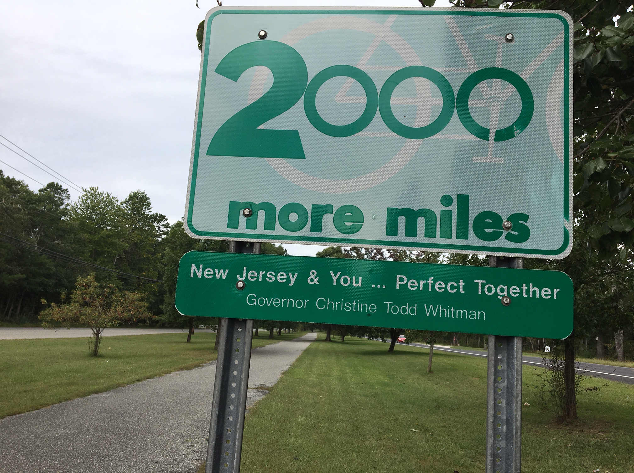
See the bike in the background of the sign? I figured the 2,000 miles referred to bike miles, hopefully in the form of trails and not just paint on the side of the road or, worse, sharrows. After all, it was right by a paved trail.
And I thought: Imagine if this really was what government wanted to do. New Jersey has 21 counties, so divided equally, it would be nearly 100 miles per county. Or do it by population, which would come at the expense of those really south and west, where they are too far to commute to the job hubs of NYC and Philadelphia. And if ideas for trails that were at least 5 miles long were prioritized, encouraging projects across municipalities and reducing the odds of random, disjointed trails not even connected by bike lanes … wow. (And the East Coast Greenway in New Jersey would be done! So would the Capital to Coast Trail, which may be coming back to life.)
But this is why I know this was all just talk around the time of the millennium: the governor on the sign is Christine Todd Whitman, who left office in early 2001. Usually every new governor gets his name on every sign possible as quickly as possible. Guess none of them wanted to own this one.
And the trail itself? We stopped at the Woodbine municipal center on the other side of the grassy median to ask where it goes. The receptionist had no idea. No clue about the name either. Turns out it’s the 3-mile Woodbine Railroad Trail following a section of the Pennsylvania and Reading Railroad. It connects the Cape May National Wildlife Refuge and Belleplain State Forest. Or at least peters out on what I hope are quiet roads. Downtown Woodbine looks like it has seen better days; the only commercial activity we saw was a Family Dollar store and a butcher’s shop/grocery. Would promoting the trail (and creating a small loop for casual riders) create a bit of economic pop?
I’m going to be blunt: This stretch of the East Coast Greenway is desperately in need of improvement — i.e. trails. I’m told that’s coming, but for now this is a one-star section.
This is a saner section.
Three of us rode from Trenton to Philadelphia on Sept. 15, 2017 as part of the East Coast Greenway’s River Relay that covers the entire 3,000-mile stretch: 25 years of East Coast Greenway, 50-plus rivers and one Greenway.
This was all urban riding– no trail, no suburban residential streets, nothing to give you a break from city biking and city traffic. To be honest, our “Portugal to India” ride, from Newark to Metro Park and then onward to New Brunswick was more pleasant and more interesting — and that’s not something most people associate with North Jersey, let alone Newark.
We started out from downtown Trenton aiming for the Calhoun Street Bridge. At one point, I thought we were headed for a busy highway, but the road forks in an odd spot and dropped us on the bridge. Chaotic Jersey road design and signposting, I thought…
At least the view of the Delaware River from the bridge was pretty:
On the Pennsylvania side, we picked up state Bike Route E (as in East Coast Greenway) … but don’t be fooled. This is hardly great bike infrastructure. Oh, it started out OK. West Trenton Road looks like a main suburban road, but it’s wide and there wasn’t much traffic. After several miles, though, we were on State Road 413. This is for hardy cyclists only; think wide, major road with strip malls, plus crossing an intersection with a road leading to Interstate 276 and of course traffic coming off the interstate too. Drivers saw us coming, so nothing scary happened. I know this is the reality of a route that connects cities rather than sticking to the middle of nowhere — there is always a bad stretch. The good news is that the route will look very different in four years when some projects are finished (pardon my cynicism when I bet it will be 6). Certainly the map showing the future ECG route looks much more appealing.
2019 UPDATE: The remaining obstacles on the D&L trail between Morrisville (opposite Trenton) and Bristol have been removed this year. It’s now a clear trail for 10 miles — and you stay off what we experienced above. Here’s a report of our 2018 experience.
I just kept wondering who’d get a flat from the junk on the shoulder.
So I was quite surprised when Bristol Pike — U.S. Highway 13 — turned out to be far nicer. For one, it was freshly paved. And there was a bike lane. It even felt fairly sane. I thought we’d be cruising.
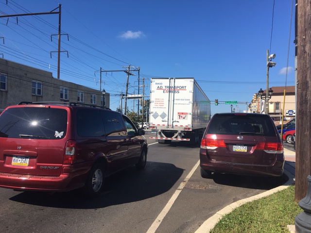
But then one of us got a flat. Yes, of course it was the rear wheel. We pulled over on the sidewalk in front of a used car dealership to swap out the inner tube. The two men working there wandered over to see what was up. They nicely offered us water, use of the restrooms … but also gave us a different perspective on Philadelphia.
Business is slow, I heard, and it’s due to the bad economy — in this case, too many drugs. And these days, drugs means opioids and heroin. We apparently had just gone through a town with lots of (unregulated) halfway houses for addicts who had gone through substance-abuse treatment and were not far from a north Philadelphia neighborhood that he described as the epicenter of the opioid crisis. He never went into Philly without his gun, and he warned us to be careful. We thought he was a bit OTT and we certainly weren’t going to go find ourselves some guns.
Not that our route went through that part of town anyway. We stayed pretty close to the Delaware River but only once actually saw it. That was when we did our special Relay task and collected our sample of Delaware River water in Pleasant Hill Park. We found a bit of trail … but then it’s blocked by the Police Department not wanting anyone near its gun range (not that we heard any shots). Also OTT. This says safety upgrades would mean that section would open in the summer of 2017, but obviously that hasn’t happened. (We did make it through that blocked section in 2018, known as the Baxter Trail — it’s now open on weekends only in the summer.)
Collecting water samples from the Delaware River
Apparently there are a number of unconnected trail segments along the northern Delaware River, and I’d hoped we’d have been able to ride some of them. But nope. Gaps supposedly will be closed in the coming years. Certainly the people of north Philadelphia deserve more trails as well as access to the waterfront. And the East Coast Greenway would have a more direct and scenic route that also would serve riders of all abilities.
And so we stuck to city roads, biggish ones like Torresdale, Frankford and Aramingo, moving away from the waterfront and then back toward it, finally reaching hipster Northern Liberties. Then it was onto the bike lanes on Spring Garden to the Schuylkill River and the train home. Total mileage, including getting to and from our train station and then from the Trenton station to the start: 44 miles.
Did we miss something that would have made the ride more rewarding?
Thank you, East Coast Greenway and Bicycle Coalition of Philadelphia, for working to create new trails and upgrade the route. Thanks, too, for the bike lanes we found! And thank you Riverfront North for doggedly working to make the waterfront accessible to all from the Philadelphia county line to the Frankford Boat Launch, and the Delaware River Waterfront for picking up the trail work there headed south.
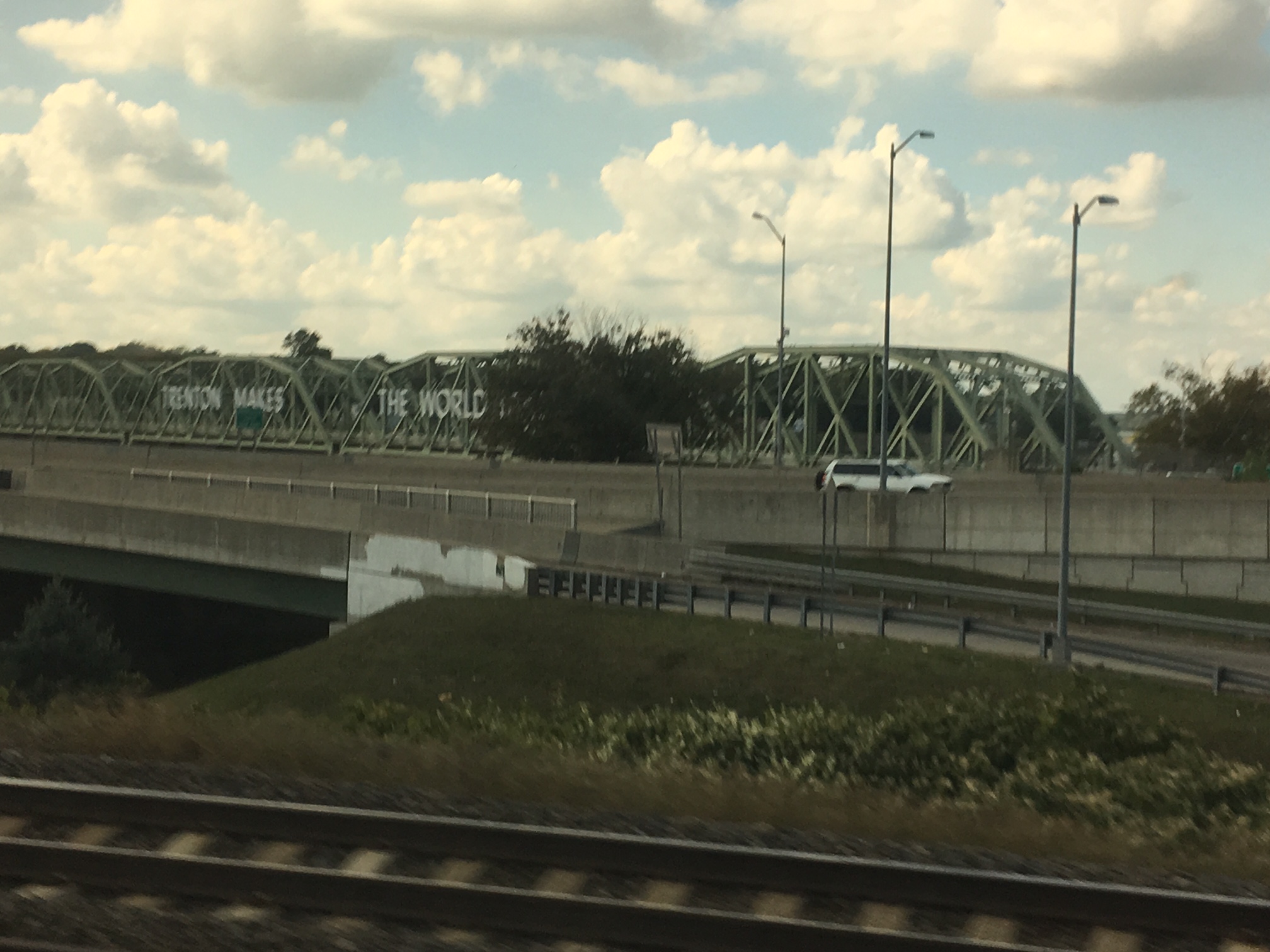
“Trenton Makes, the World Takes” — or at least it used to be that way
What’s is like if you stay on the New Jersey side down to Camden and then cross the Delaware using the Ben Franklin Bridge? Here’s how to do it.

 This is the day that I have finally had it with Highway 17.
 But there is lots of work needed to make the entire stretch merely acceptable. Once again, it highlights the need for the East Coast Greenway Alliance, which strives for a route connecting cities up and down the East Coast that serves everyone from 8 years old to those who are 80.
 Finally! Some trail riding in this year’s weeklong East Coast Greenway ride.
 Other sections were along newer developments along golf courses — wide enough for getting to the neighboring golf course on your cart, if you desire. (We only saw someone using the trail in a golf cart at the beginning of this section.) While some might object to this use on a multi-use trail because of conflicts with cyclists, walkers and runners, I believe you have to be pragmatic. If those driving golf carts aren’t going to take to the road and their support is what gets politicians to build the trail, accept that reality. Better a trail than no trail.
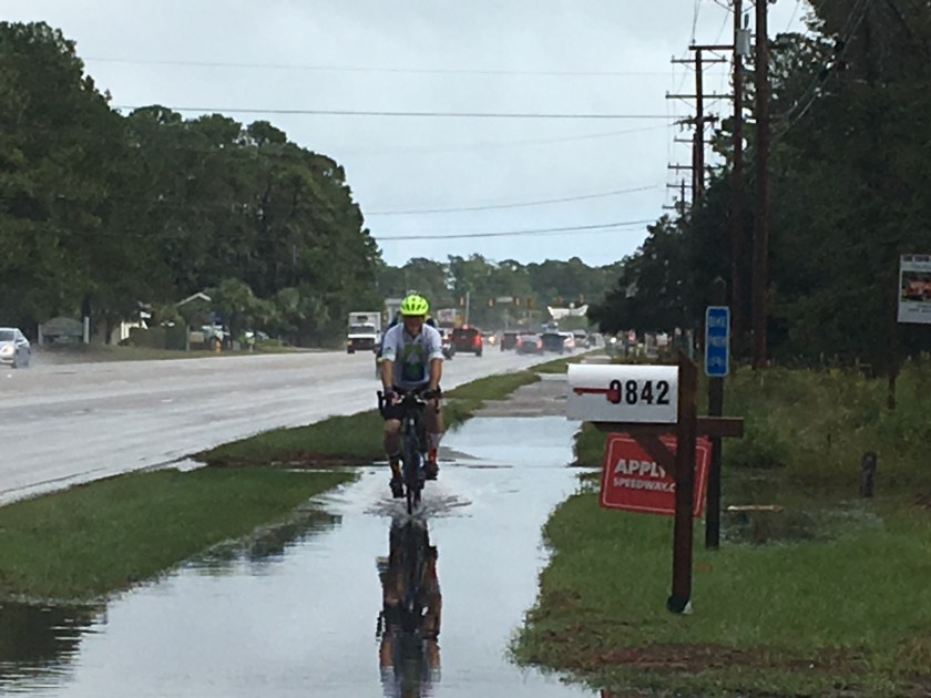 I’m learning a few things about the weather here.
 So we’re only a year late.
 This East Coast Greenway mile marker is at the kiosk on the southern end of Myrtle Beach.
 Wow did we get drenched today. Even though we tried to wait out the worst of it. And the flooding on Ocean Boulevard in Myrtle Beach … at one point I swear I biked through water halfway up my wheel. At least my chain got “washed.” And, yes, my shoes are soaked. I’m on the hunt for newspaper to help dry them out.
 Photo of the day: an alligator in a neighborhood pond just off the road. How it got there… and why it can stay there … is beyond me. Last night, a kid at the general store’s fish counter explained to us how to hunt alligator (bait is bits of chicken dangling from a string, followed by a bullet to the head). He was selling a block of frozen Georgia gator meat for $17.99 a pound, but who knew North Carolina meat was so close? (Why you will pay that much for gator and then essentially turn it into chicken-like nuggets when chicken breasts are regularly on sale for $1.99 a pound is something someone still needs to explain to me.)
 First, the
 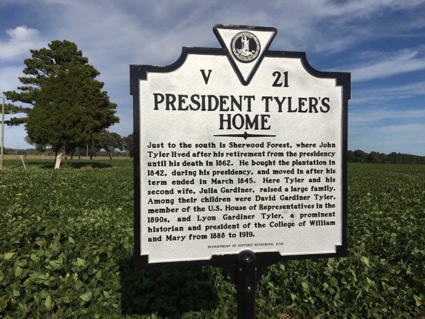 I gave up trying to talk myself into driving in one day to Wilmington for the start of the East Coast Greenway’s annual weeklong ride, deciding to break it up with a stop in Richmond.