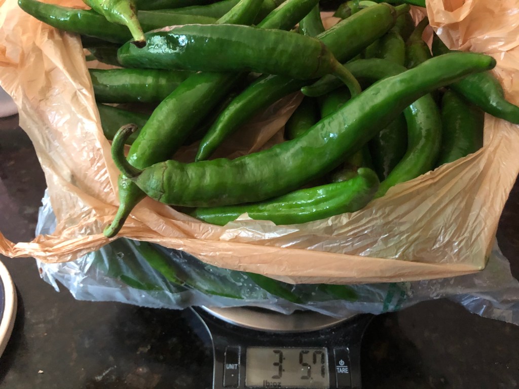
We’re still trying to figure out how to cook with all those peppers.
Time for a new destination.
We settled on Evergreen Farm in Hamilton. A neighbor had suggested it in the spring as a possible place to buy shishito pepper seedlings. We never made it then, but we wanted a flat ride today. Just under 30 miles sounded perfect given the heat.
Besides, maybe we’d come home with mysterious fruits and vegetables.
Discovering the Northwest Lancaster County River Trail, the Heritage Rail Trail County Park and the Enola Low-Grade Trail.
We needed a break from work. But with coronavirus still raging (even if the numbers are way, way better), we didn’t want to go far. And we weren’t ready for a hotel.
So … Lancaster and York counties in southeastern Pennsylvania. Three trails. Two nights of camping. Here’s what we found.
The museum celebrates the company that built the Brooklyn Bridge, which opened 137 years ago to the day of our ride. I admit, I only learned that after we got home, but still, pretty cool. (And yes, the museum is closed because of coronavirus but it was the turn-around point for a ride a couple of years ago. Then we could say we’d ridden all the way to Riverside, about 5 1/2 miles from the Tacony-Palmyra Bridge into Philadelphia)
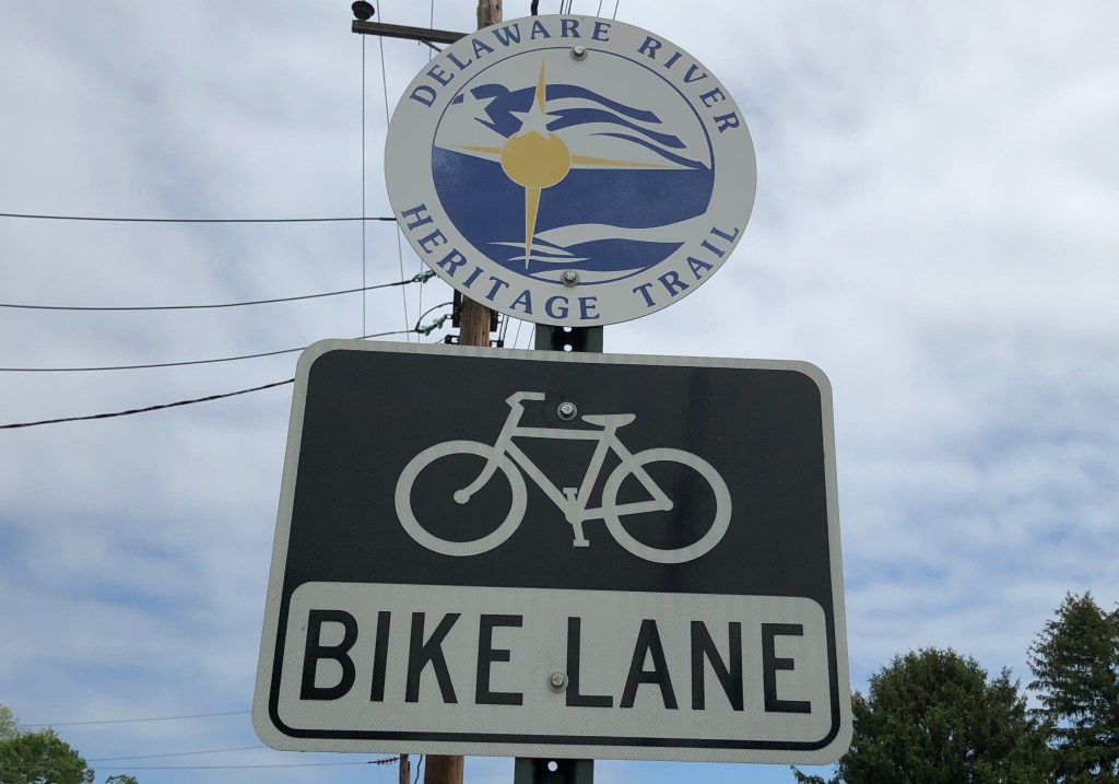
The more immediate reason is that a new section of the Delaware River Heritage Trail is under construction and will push the route south to Roebling (and eventually all the way to Camden and the Ben Franklin Bridge to the heart of Philadelphia). Right now it’s the alt route for the East Coast Greenway between Trenton and Philadelphia — we’ll see which route gets finished first.
So I wanted a look.
We used an app called Komoot to map out our route. Enter start point, enter end point and it maps out a bike route for you. Think Google Maps, and easier for mapping than Ride With GPS. And it was super easy to tinker with (for example, it kept us on Old Trenton Road toward Mercer County Community College longer than I’d like, rather than having us turn left at a traffic light onto Robbinsville-Edinburgh Road and then right onto Line Road, where there’s no through traffic for motorized vehicles at the West Windsor-Hamilton line but is open to bikes.) It was going to be about 21 miles each way.
The new trail didn’t show up, but hey, it’s not quite finished. We heard it was rideable anyway… Add on a few miles for that — maybe 25 miles each way?
But first we had to get through Hamilton, Mercer County’s largest city. I had to wonder if officials there have heard of bike lanes …
Traffic was light, but I credit the coronavirus for that. Otherwise we were biking on a road that crossed one major retail strip and crossed roads that led to other big retail centers. We crossed Interstate 195 and then US 130 a couple of times. I’d be happy to weave through residential neighborhoods, but not to get dumped out on an even busier road. (If I ever try this during normal traffic, I’m avoiding Hamilton and adding on a few miles via Allentown.)
Bordentown also is where we picked up the Delaware River Heritage Trail. It does go north toward Trenton — it shows up on Google Maps as the D&R Canal, but I’m told the entrance from Trenton is hard to spot, that it doesn’t connect with the D&R Canal sections further north.
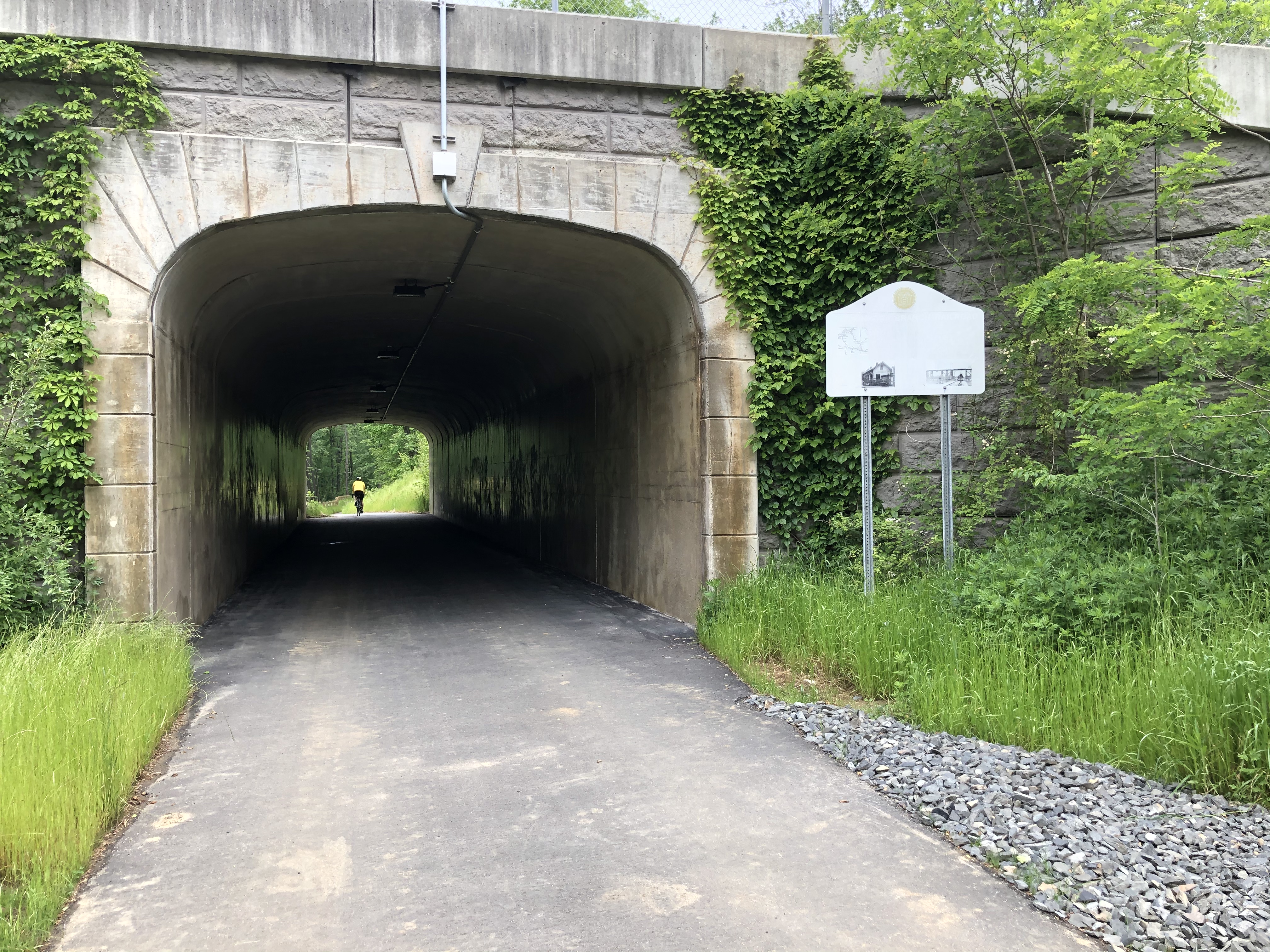
However, we were headed south, through Fieldsboro and to the QuickChek gas station at the corner of US 130 where the new segment of trail begins and lets us avoid this busy highway. Green paint at an intersection for bikes — that’s new for my part of NJ! The trail took us through Crystal Lake Park, onto a quiet road (fresh sidewalk for those who want it), then back to trail and under US 130.
And then …
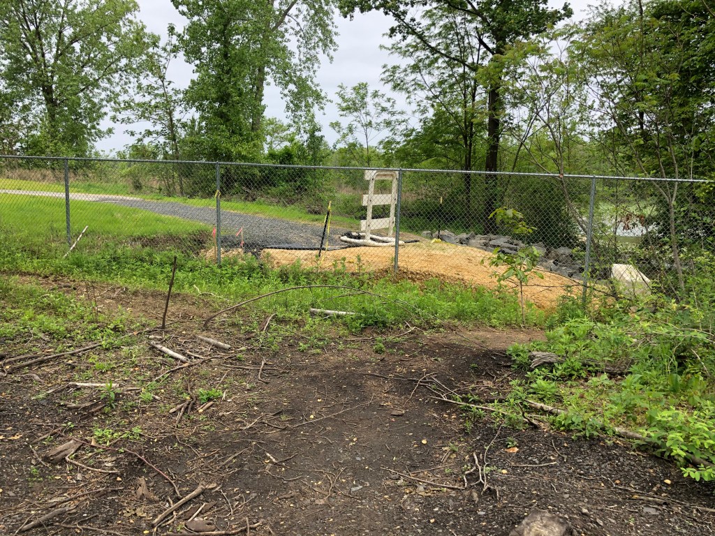
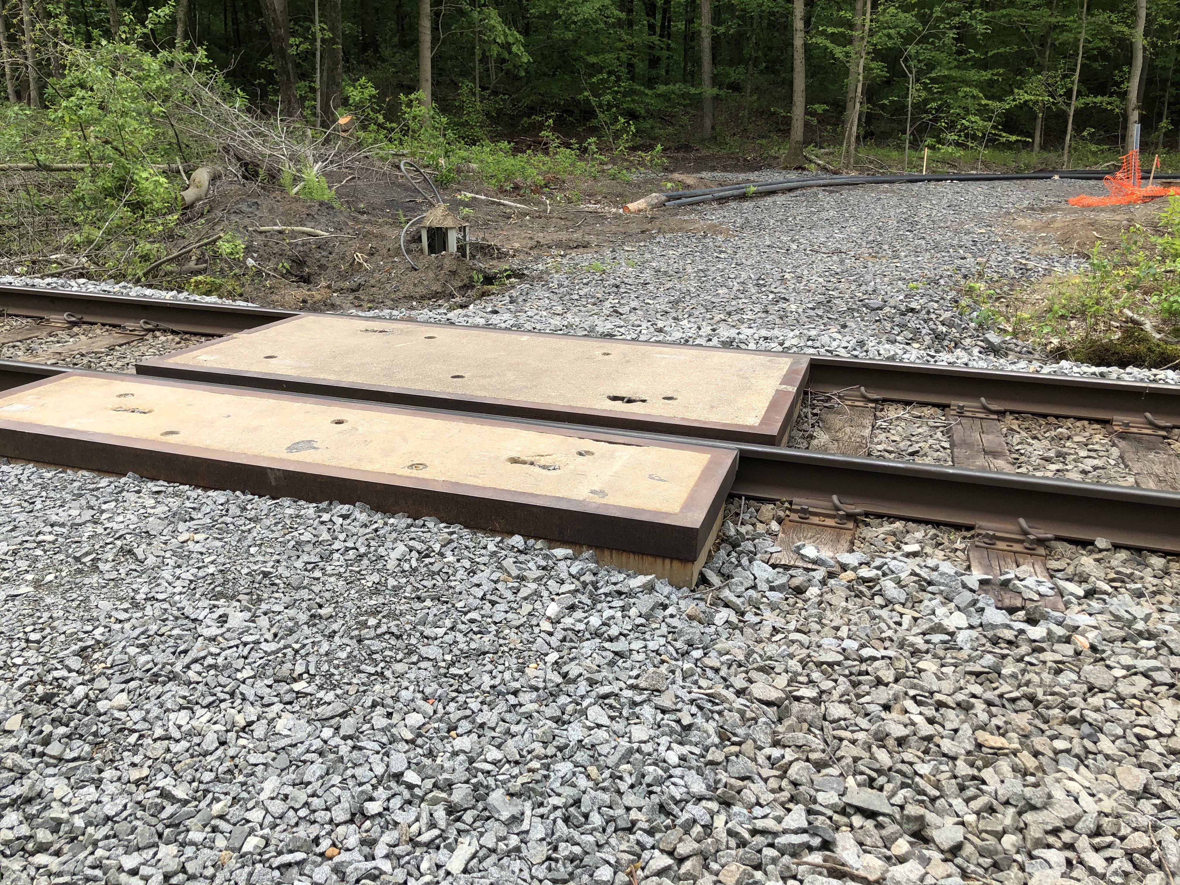
New Jersey Transit isn’t quite ready for this trail to cross the RiverLine tracks. It has blocked off the next section of already-paved trail with a fence, and we weren’t ready to look for the goat paths to get around it.
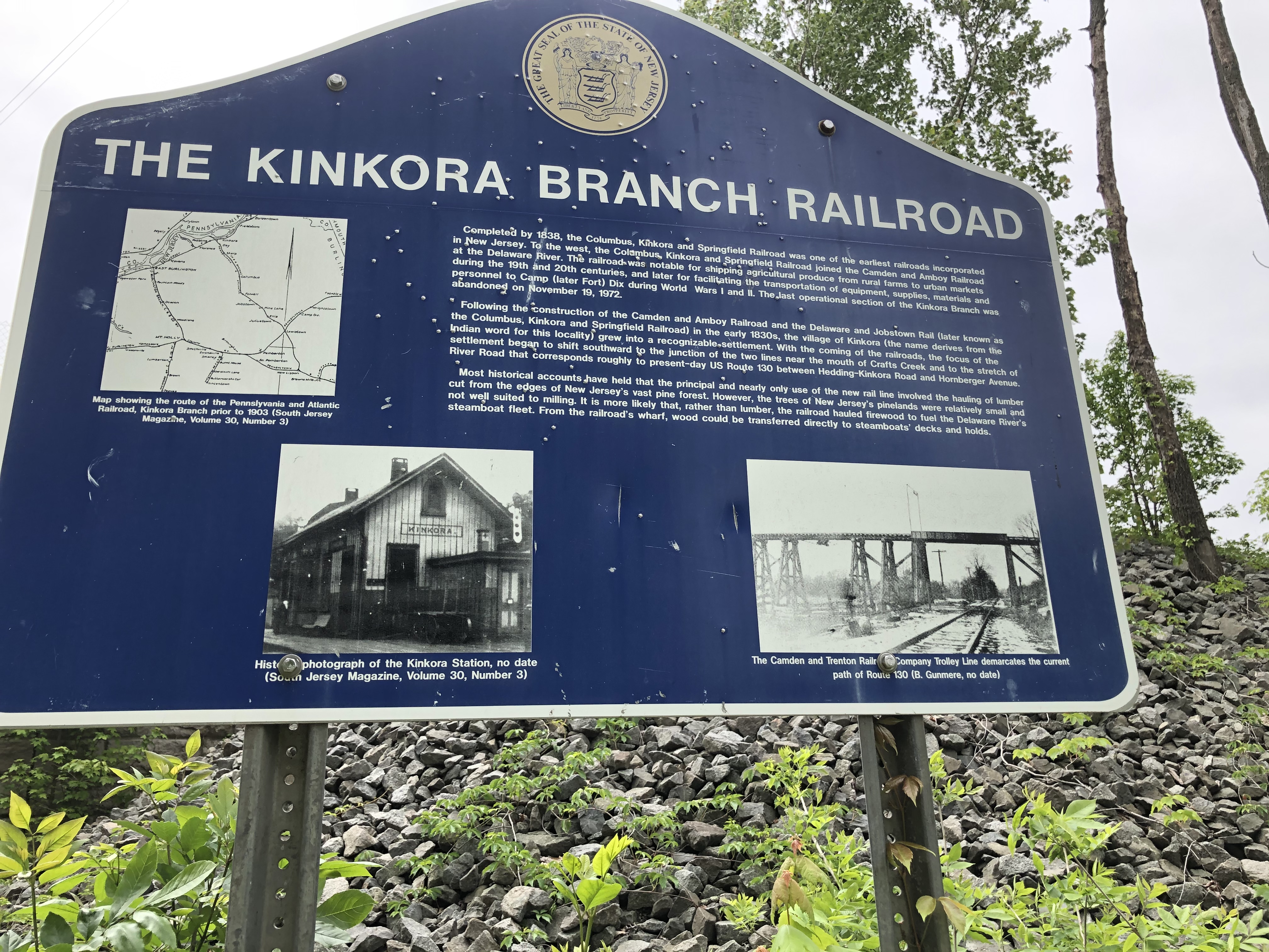
More of what we saw at the railroad crossing:
Nor was there an easy way to get onto US 130 at that point and brave two lanes of fast-moving traffic by using the shoulder for a mile or so until we could turn right into Roebling.
So we turned back, just a few miles from our goal. We’ll try again when this section of the Philadelphia region’s Circuit Trails has its ribbon-cutting. (Actually, we didn’t wait for that and biked from Trenton to Camden — here’s how)
A gorgeous day, and a trail has reopened. What more could we want?
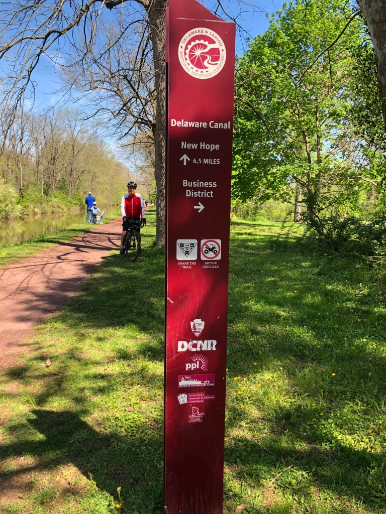
The D&R Canal towpath has reopened — yay! And it’s finally sunny and warm! Time for a longish but easy bike ride.
So on Saturday we headed to the blue water tower along the Delaware River in Morrisville, Pa., the same place we met friends last year for a “weird beer” ride to Neshaminy Creek. Only this time we were headed north, chatting with a friend as we went (with social distance, of course) along the Delaware & Lehigh Trail.
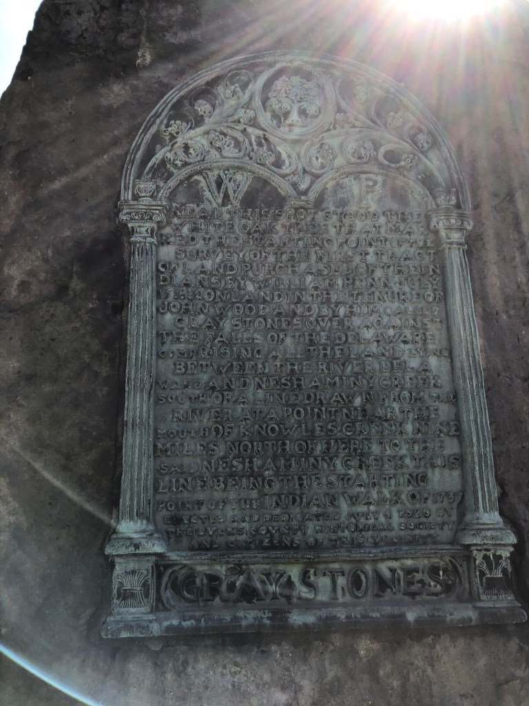
Our first stop: this odd historical marker at the edge of Morrisville. It’s taller than me and commemorates the nearby spot where William Penn bought the first section of Pennsylvania.
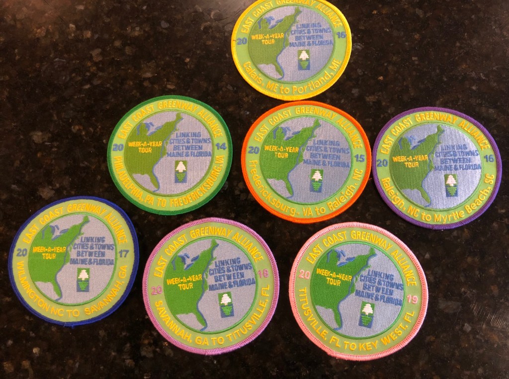
Just about everyone who knows me knows that I’m a big fan of the East Coast Greenway, a 3,000-mile route connecting cities from the Canadian border in Calais, Maine, down to Key West in Florida. I’ve ridden almost all of it, admittedly liking some parts more than others, and remain hopeful that I’ll be able to meet up with some of my Greenway buddies at the end of the summer to close my final gap.
But when we have to social distance when we get on our bikes and can’t head out for multi-day rides, all thanks to the coronavirus, and it’s rainy or threatening to rain, like this entire weekend, we need a little something to dream about.
And so I offer this video from one of my Greenway buddies about the nine weeks (one a year) that a semi-permanent cast of characters spent biking the 3,000 miles.
If you want to follow in our tire tracks, you can get free cue sheets in the maps section of the Greenway’s website. Enter your start and end point (because no one says you have to do the whole thing, or all at once), and it will spit out every left and right turn you need. Yes, they are good for walkers too. And of course you can read about my experiences on the Greenway by clicking through on this blog. I’d also recommend this blog chronicling an end-to-end ride.
WFH = I’m eating too much. I need a bike ride. Where to?
It’s not even been a week of working from home and staying indoors a lot. This is going to be hard. I’m eating too much, even if I (futilely) try to barricade the door to the kitchen. I can always go outside to fight the war against the evil hairy bittercress weed that would take over the yard in a heartbeat, of course. But sometimes you just need a bike ride.
Saturday afternoon was sunny and fairly warm (missed the true hot day on Friday because, you know, work). Where to go?
I’d been getting emails most of the week from Flounder Brewing, that nano brewery we checked out last fall as part of my “weird beer” rides. I couldn’t tell if they were still open and selling crowlers (32-ounce cans), but we figured it was as good a destination as any. 17 miles each way, a mix of trail and road.
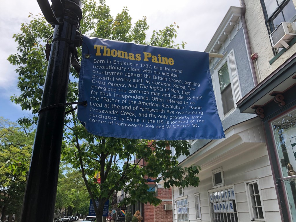
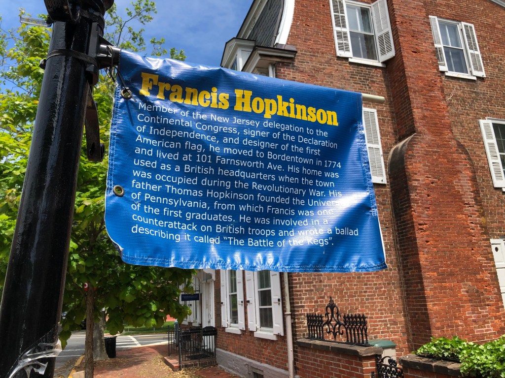
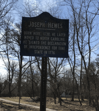
I found the home of a signer of the Declaration of Independence — but the wrinkle is he didn’t represent New Jersey.
Today was a sunny, unusually warm Presidents Day … so of course I went for a bike ride. The destination: A history talk. Not on George Washington (too obvious!), but on Teddy Roosevelt.
Here’s the history bonus: I stumbled across the home of a signer of the Declaration of Independence — but the wrinkle is he didn’t represent New Jersey. (There are several New Jersey signers around here — John Witherspoon, Richard Stockton and John Hart.) This sign is on Snowden Lane in Princeton, just outside a home on the National Register of Historic Places.
It was 60 degrees in January. We had to go for a bike ride.
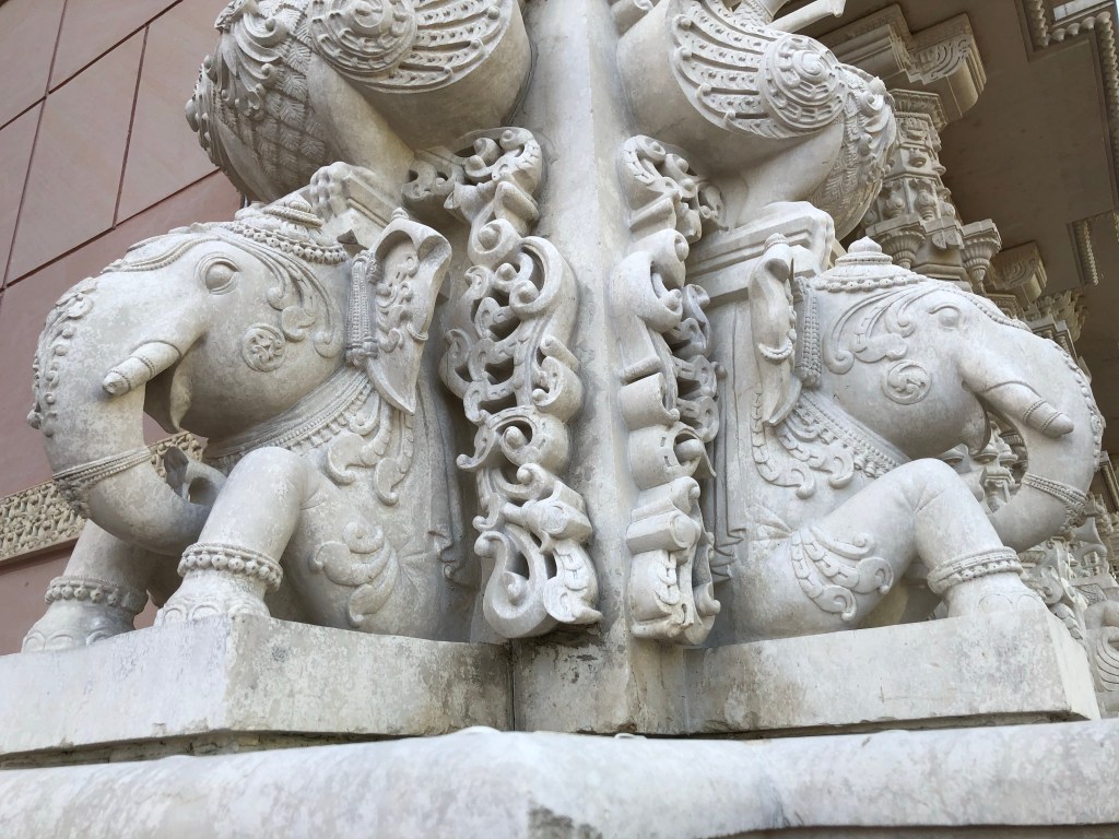
When it tops 60 degrees in January, how do you not go for a bike ride? And so we did, riding a loop of nearly 20 miles with the BAPS Shri Swaminarayan Mandir in Robbinsville as our midway destination.
A mandir is a Hindu temple, and this one is immense — I would call it the equivalent of a cathedral. It’s been open for about 5 1/2 years and is part of a five-building complex still under construction. Like a cathedral, you can come in for services, pray on your own or just gawk at marble carvings.
This marks the end of the Week a Year rides along the East Coast Greenway.
Done!
We have made it to Key West and the end of the 3,000-mile East Coast Greenway. It’s an especially happy moment for those who have now ridden the entire route, with its ups and downs (I’m envious; I still need to ride from Providence to New York). It’s also a sad moment because the end of the annual Week A Year rides means we won’t have an obvious reason to gather every year. Hopefully some of us will still ride together.
So, yes, we ended at the oversized buoy marking the southernmost point in the U.S. There’s a line of people all waiting to get their photo taken there, so it feels, well, like a tourist trap. Far cooler, I thought, and more suitable for us was the multi-colored arch of bike wheels the city of Key West created for us in a park a couple of blocks away.
We weren’t the only ones loving it. City officials said non-cyclists were taking photos there all day. It will get even more attention on Saturday, when the two-day, 165-mile Miami-to-Key-West Smart Ride wraps up, and I hope city officials then give it a permanent spot.
Actually, it’s a cool idea to borrow for the East Coast Greenway’s NYC-PHL ride next year.
Our luck finally ran out. We were chased by storm clouds all the way to Marathon.
Our luck finally ran out. We’d woken up to rain in Titusville, but it was sunny by the time we left for our first day on this year’s Week A Year Tour.. There was a torrential downpour in Palm Beach the day before we arrived, and more rain the day after. Sunshine, though, when we were there.
But today … it was raining when we woke up, and the weather radar that claimed it would be gone by 8:45 a.m. was dead wrong. We waited a bit longer, but at one point you just get impatient. Plus it was a warm rain, close to 80 degrees. How bad could it be?
So we swooped by Doc’s Diner (where you can get breakfast with a dozen scrambled eggs, sausage links, crispy bacon, thick ham steak, pancakes, French toast, homemade sausage gravy, freshly grilled hash browns, creamy grits, hot biscuits and fresh fruit for $36 — and it supposedly feeds just four to five people?) to pick up one rider, and off we went in the rain.
The rain got worse.
We were on a sidepath along U.S. 1 (really the only road in the Keys) and dodging puddles for a few miles, but it was about to run out and put us onto a bike lane on the road, with trucks and cars going by. Suddenly there, across the road, was the Key Lime Pie Factory (ok, really probably just a store, but factory sounds better in a name). We decided this was the place to seek shelter. Of course the air conditioning was freezing. So we stood outside under an overhang, sharing a slice of pie and staring at the sky. Finally it looked like it was lightening up, and we decided for the second time to just go for it.
This time it really did stop raining, at least for a while. By afternoon, though, we were being chased by this giant dark cloud on the Atlantic side. Every once in a while, we’d get rain again, though thankfully just for a few minutes. It was harder to escape the puddles, though, and my feet were sloshing in my bike shoes by the time we reached the hotel.