
We needed a break from work. But with coronavirus still raging (even if the numbers are way, way better), we didn’t want to go far. And we weren’t ready for a hotel.
So … Lancaster and York counties in southeastern Pennsylvania. Three trails. Two nights of camping. Here’s what we found.
Day 1: Northwest Lancaster County River Trail
The 14-mile Northwest Lancaster County River Trail is incredibly popular, so popular that we were lucky to find a parking spot at the Columbia Crossing River Trails Center spillover lot at noon on a Sunday.
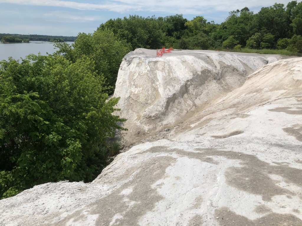
I quickly understood why people are drawn to it. (Click here for a map.) Yes, it’s flat and therefore family-friendly (and we saw so many kids with their parents). But so are the others. It’s the variety that you get here — woods, sunny fields of Indian grass and views of both the Susquehanna River and a Bald Eagles nesting site (with permanent binoculars), cliffs for rock climbers (so not me!) where the trail meets Chickies Rock County Park and the White Cliffs of Conoy (really the byproduct from a limestone quarry) for the rest of us to scramble up (just don’t get too close to the edge). Lots of curves, unlike a rail-trail, where they need to be wide and infrequent. (The rail line is nearby — still active, apparently. We only saw a locomotive.) It’s mostly paved, which is always a treat, though the final 3 miles definitely aren’t.
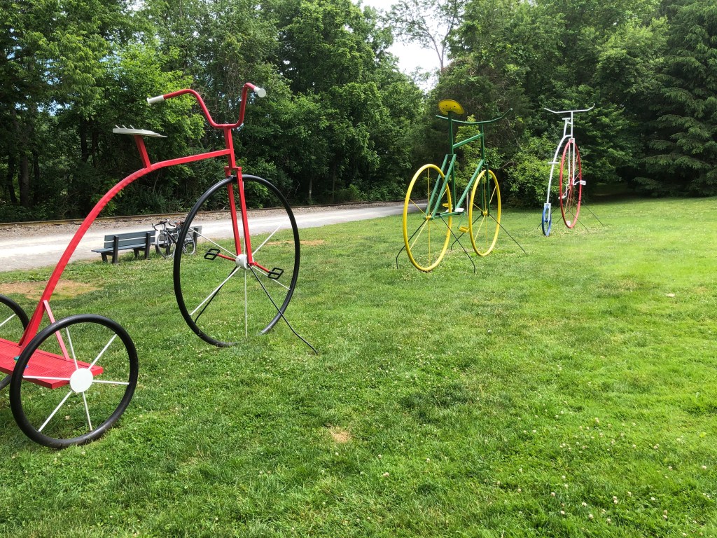
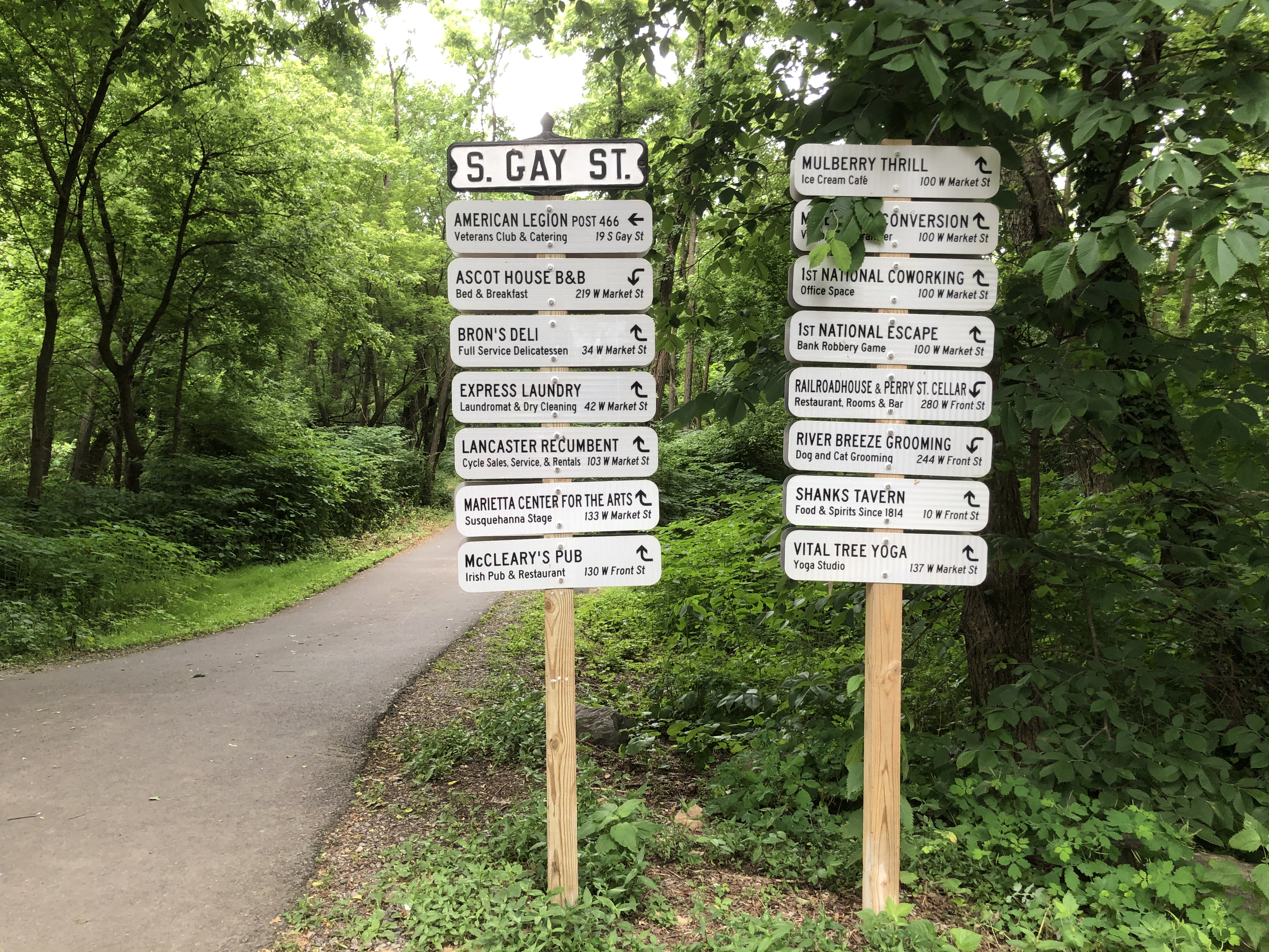
I was also impressed with how the towns capitalize on the trail. These are the signs for businesses in Marietta, a borough of just 2,600 people a few miles from the Columbia trailhead. Don’t they make you want to stop?

In Columbia, there’s an ice cream shop across from the parking lot, with the trail running by it. No surprise that there was a line.
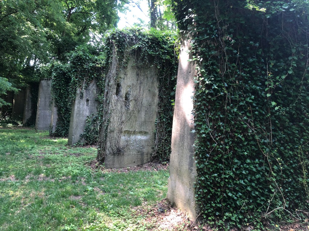
I was fasinated by the remains of the Musselman/Vesta Iron Furnace and the self-guided outdoor tour. The rail cars arrived on top of these columns so that anthracite coal could be dumped out to power the furnaces that smelted iron ore.
The Northwest Lancaster County River Trail was my favorite of the three trails. And it’s exciting to read that officials are looking to link it with the Enola Low-Grade Trail just to the east and eventually create 40 miles of trail. Part of that trail was Day 3’s ride, so more on that later.
But I do wish they’d also look at a way to link the trail from Falmouth (the western end) or Bainbridge (where asphalt begins) to Elizabethtown and the Amtrak station. Even a marked and marketed on-road route that was deemed the least hilly and least busy (perhaps with a shoulder?) would help create the potential for a loop. It’s less than 6 miles.
UPDATE: The vision is to create a trail all the way to Harrisburg. But when? Nothing happens fast in the world of trails.
Where did we spend the night? In a lovely, quiet state park. But we decided it was too out of the way.
Day 2: Heritage Rail-Trail County Park

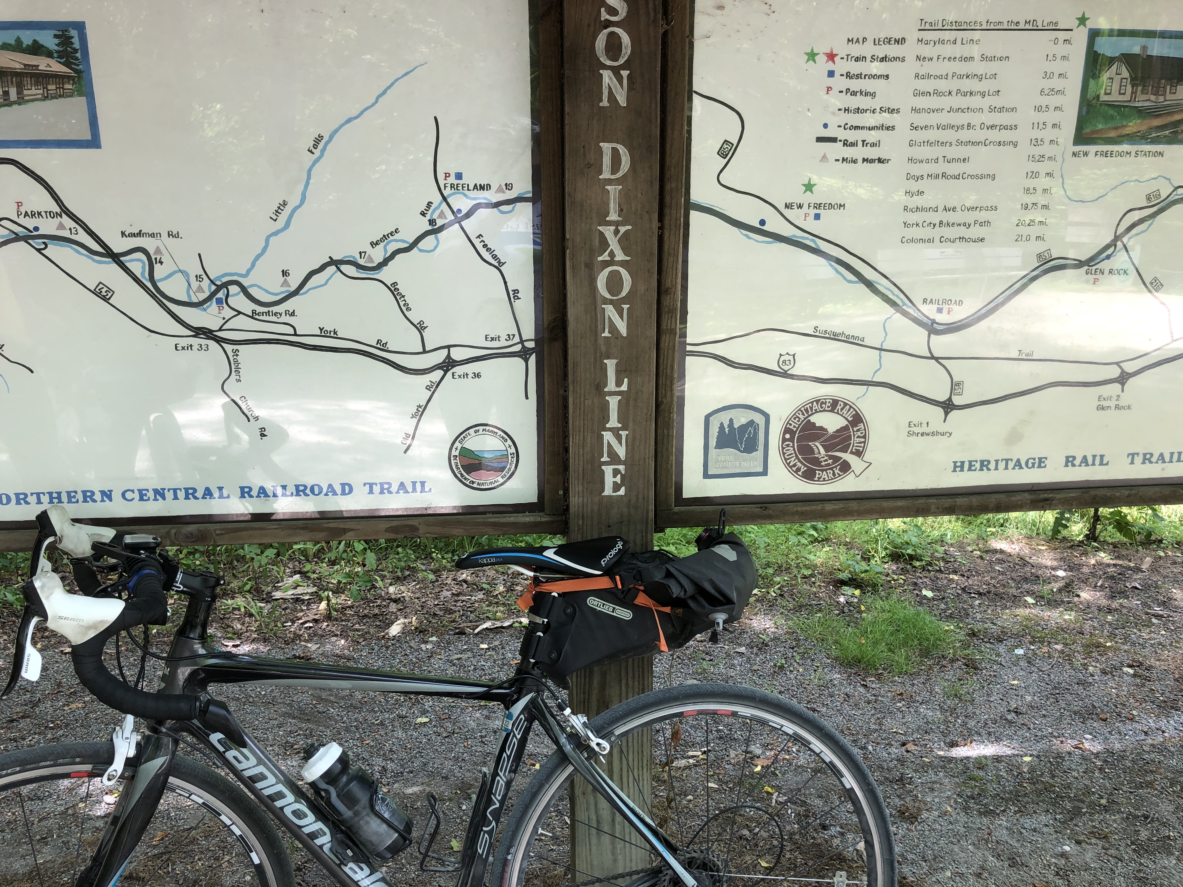
This was our longest trail at 27 miles (2 of those miles are on York city streets). And we could have kept going almost all the way to Baltimore — it becomes the 19.7-mile Torrie C. Brown Trail at the Maryland line. (The East Coast Greenway uses the southern part of the trail, so really we could have kept on going all the way to Key West.) We began at the tip of the new extention, in John Rudy County Park. To be honest, my first thought had been downtown York, in part because I didn’t realize there was an extension, but parking was problematic. The county park was perfect.
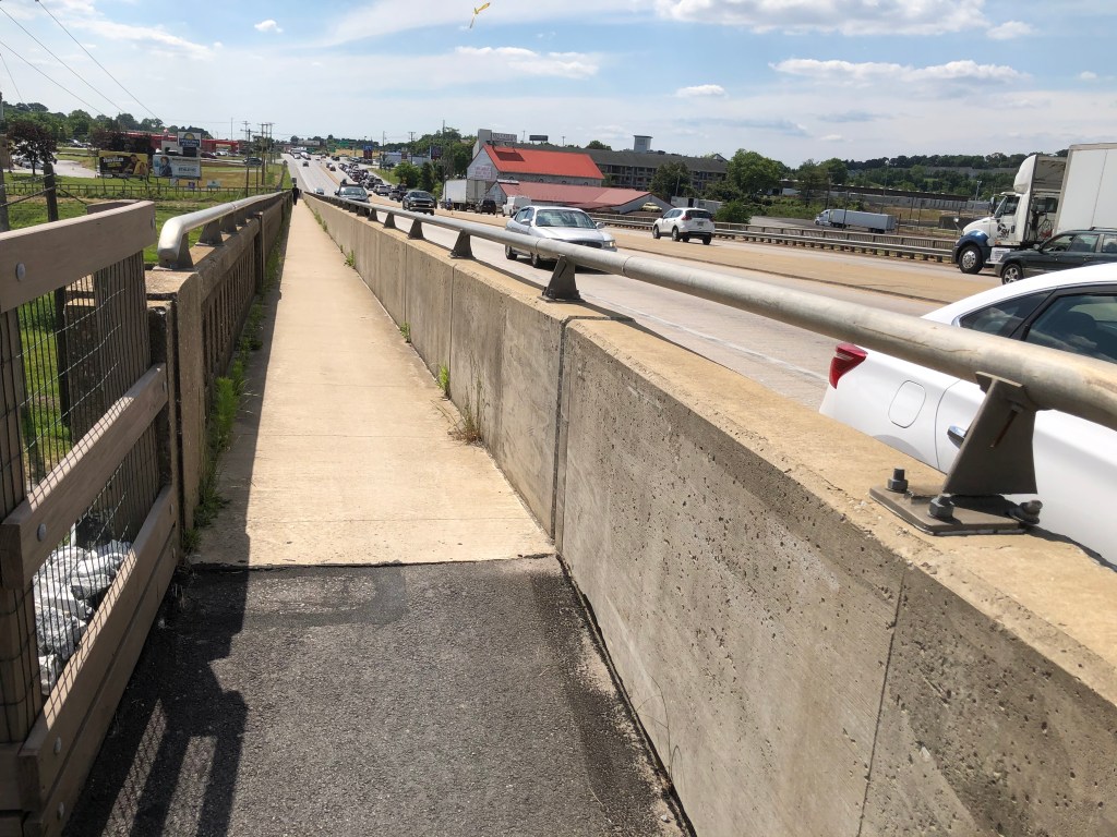
The route in part follows the Codorus Creek, which eventually dumps into the Susquehanna. We followed it south to U.S. 30, where there is a parking lot for the trail. Then you take switchbacks up to road. I’m so impressed at the walkway on the bridge. Did they have to take over a shoulder, or was it always there? A solid concrete divider too, instead of those Jersey barriers on the westbound side. Narrow, but serviceable.
Tip for travelers: the Day’s Inn on U.S. 30 abuts the trail. There’s a Tru hotel just behind it and what looks like a third hotel under construction in between. There are a few hotels on the other side of the highway, assuming you can cut through parking lots to Toronita Street and then go under the highway.
More travel tips: Indian Rock Campground is just off the trail south of York (pro tip: within a minute of crossing Indian Rock Dam Road (a busy road with fast-moving traffic — do look before crossing!), watch for the green-painted tree trunk and the backdoor path to the campsite. (This would have been a better first-night camping choice; note that you do hear the road, especially when traffic picks up in the morning. But after 54 miles round trip, I was ready to sleep as soon as it got dark.)
For those who want more comfort, 3 miles from the Maryland Line is Jackson House B&B.

Back to the route: it was busy on a Monday. Lots of bikers, including families. Impressive! You will be biking along train tracks from York south until just before the state line. We never saw a train. Well, we saw some parked on the tracks in New Freedom, just before the state line — they belong to the Northern Central Railway of York, a tourist train that goes north up to 11 miles to Hanover Junction, halfway to York. Yes, it can take a couple of bikes. The “Steam Into History” trips are starting back up.
Hanover Junction, by the way, was raided by Confederate calvary just before the Battle of Gettysburg. They cut telegraph wires and burned railroad bridges. President Lincoln’s train came through 5 months later on his way to the battlefield to deliver what we now know as the Gettysburg Address. His funeral train did too.
A couple of historical markers along the route:


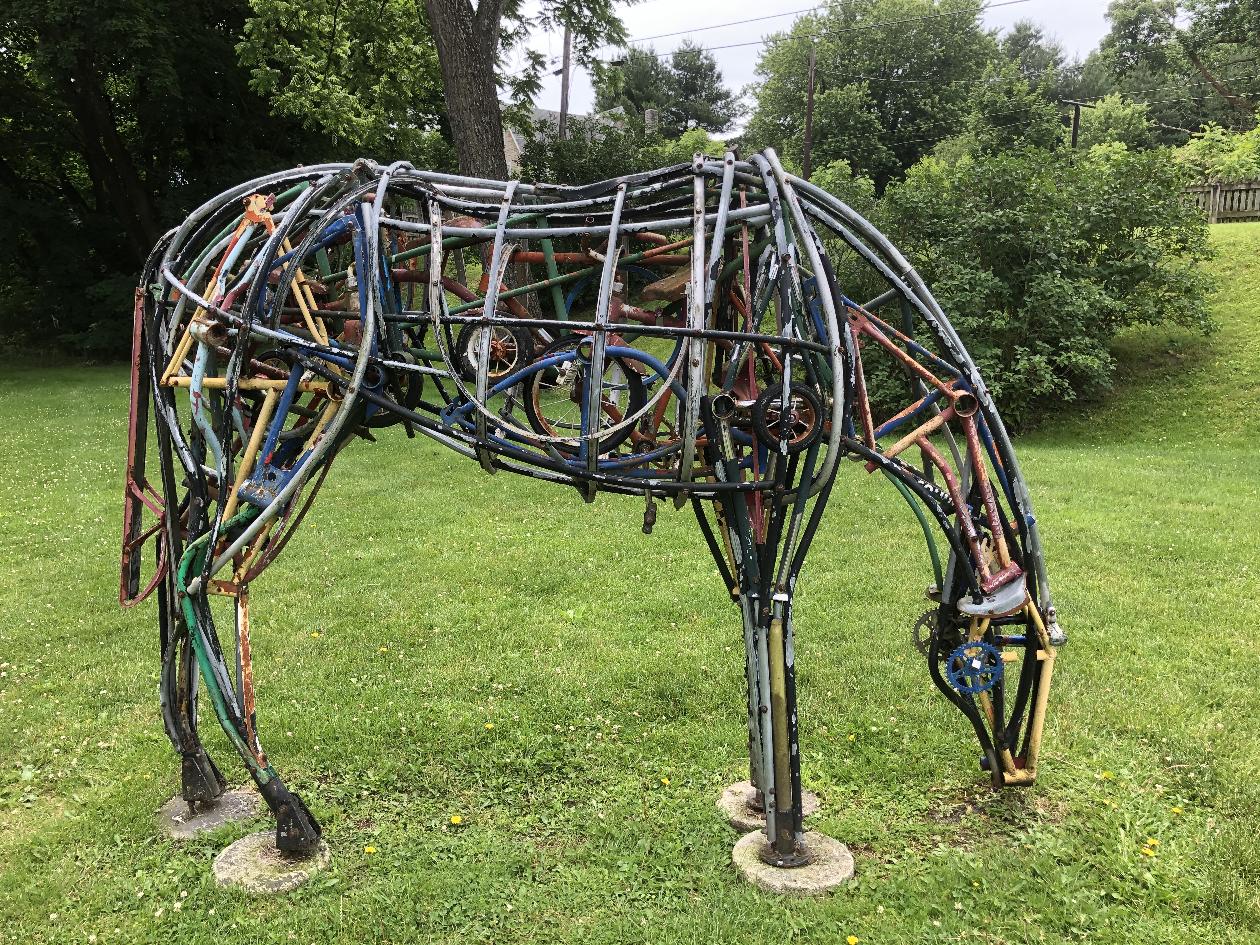
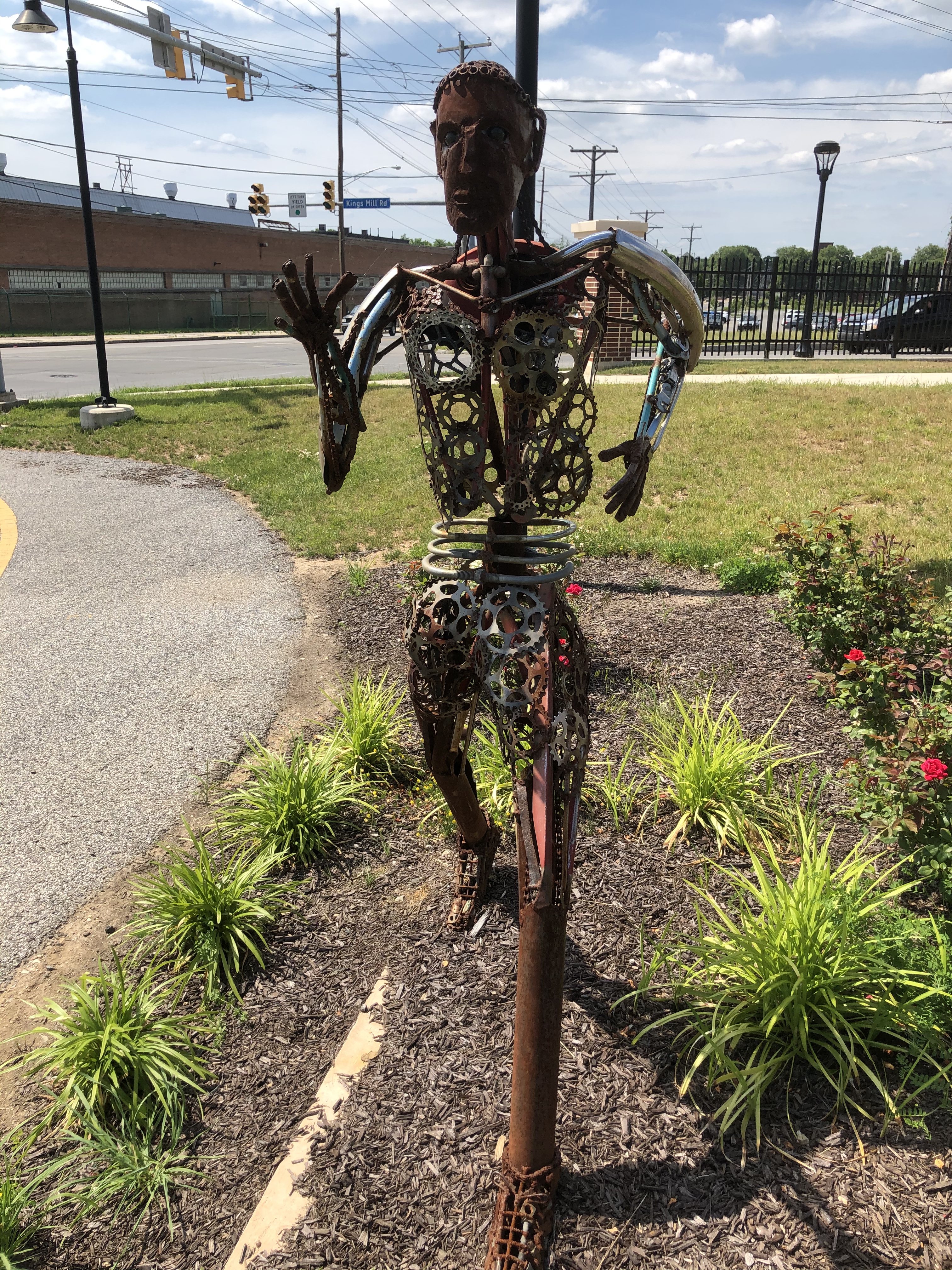
And some of the fun sculptures we saw. Can you spot the bike parts in the horse?
Or need a closeup of its belly?

Finally, the state line, ie the Mason-Dixon Line. And where one railroad ended and another began.

So why does this long trail rank only second?
In part it’s because the scenery isn’t as varied, especially south of York. I also feel like York County Park is missing a step on signage. Oh, the mile markers are there. Too bad so many explanatory signs, the kind that you read looking down, are installed backwards, at least in my view. You can’t just pull up to them — you have to go around so you are between the sign and the edge of the trail.
Worse, there is nothing to direct riders toward local businesses. Ice cream is an obvious, of course, but also lunch and snack spots that aren’t visible from the trail. We’re not the only ones who would have stopped with a bit more of a nudge. This trail goes through so many small towns. Learn from Marietta! Learn from the Great Allegheny Passage!
An extra thought: Work toward a safe and marked on-road route (likely easier than a trail) to Wrightsville and the quieter bridge over the Susquehanna to Columbia and the Northwest Lancaster County River Trail. (And I mean more than just “Bicycle Route S”.) Imagine the riding you could then do!
Day 3: The Enola Low-Grade Trail
This is the flattest of the flat. The Pennsylvania Railroad blasted through hills and kept the track so level that the grade moves up or down no more than 1%, all in the name of moving freight faster a century ago.
Unfortunately, the trail is in three parts. (Click here for a map.)
The western section — the part that could one day link to the Northwest Lancaster County River Trail — follows the Susquehanna until the Safe Harbor Dam. What’s missing is a bridge over the Conestoga River to the second section. There was once talk that the rehabilitation of the Safe Harbor Trestle — 140 feet high and 1,560 feet long — would be done by 2016. Now it’s 2022. What a view that promises!
The middle section turns away from the river ends at the Martic Forge Trestle only because of a 2018 fire. A 20-year-old is being charged with arson. But when will the bridge be fixed?

The third section is the longest piece and the section we rode. We found the parking lot just east of Quarryville and biked 9 1/2 miles west, until the trail ends because of the fire. It’s flat as a pancake, all in the sun and lined with utility poles on one side. If you look to the side, you sometimes realize you are riding through a “cut” and are grateful you don’t have to go up and down those hills.
UPDATE: Those three sections are now connected for a trail that’s close to 20 miles (and then you turn back). Our 2023 experience here.
But east of Quarryville, the crushed stonedust disappears and it becomes much rougher. We quickly turned around. Apparently there is money to improve this section, which runs another 9 1/2 miles to Atglen. Do that and then people can start imagining a connection to a trail in the Philadelphia suburbs that will soon connect to the Schuylkill River Trail, which in turn goes to Center City.
UPDATE: Talk is that the Enola Low-Grade Trail could be completed in five years … and Chester County might get a one-mile extension east from the county line then too.
But when Quarryville looks at other towns with envy for the business a trail brings, as articles have suggested… well, I’ve got a few cheap suggestions.
First, put up a sign for the trailhead. As an out-of-towner, I shouldn’t have to rely on directions on Traillink and then be keeping my eyes peeled for a parking lot. I should be able to punch it in on Google Maps and it actually shows up. Even better, put some road signs up before the turnoff to show me the way. Make it easy for me to find the trail.
Second, add a sign in the parking lot with a map of the town and note the amenities. Yes, I could look on my phone, but then it’s just as easy to head somewhere else. Make it easy for me to stay and spend some money.
My third suggestion is more complicated … but look to build a spur off the trail into town. I thought I saw an improvised path that was essentially at grade. Barring that, try for a multi-use path along the road. Again, make it easy for me to go spend some money.

Bravo Silvia! Glad you are well. Am self isolating Until a vaccine has been proved safe. Fondest to you and Clive, Louise
>
LikeLike
Three of my favorite trails, as I live in Lancaster. Ride theses trails all the time, great comments by U all. Can’t wait until they connect all these trails. Someday like to ride from Marietta to Philly, stay the night then ride back the next.
LikeLike
Great report Silvia and Clive! I had figured out that the ELG has a rough surface and is poorly connected at the ends, thus have already changed my planning to the Adventure Cycling / Route S path from Valley Forge to Columbia, but great to see an on-the-ground report. I agree that this could be a great network if all the sections are connected, Columbia-York is improved, and the Atglen-Exton gap had a path or safe route.
The northern extension of the York trail really is the best part, isn’t it? I’m surprised you didn’t have a photo from the wonderful tree-covered section along the creek – far more scenic than the main trail which is far above the river.
I also agree completely with your repeated comments to provide business guides from trail intersections. I have been suggesting this to every tourism, C of Commerce, or economic development person I come across. And it helps us because if businesses see business from trails, they will become another voice in support of trails.
LikeLike