

Now that the new Goethals Bridge connecting Staten Island and New Jersey is finished — and it has a bike lane — the East Coast Greenway has revised its route from Jersey City to Rahway. So of course I had to check it out.
The new route is more urban. It takes cyclists through Liberty State Park (a bit of a detour but so worth it) and through Bayonne, over the Bayonne Bridge into Staten Island, then to the Goethals into Elizabeth and through a few communities into Rahway, where it picks up the original interim route.
It’s shorter and it avoids the sidewalk option on otherwise unrideable Truck Route 1&9 (I would always opt for the PATH train), but it also means no Newark, no trails through the Union County Parks … and missing a lot of my global food tour. Not that I can’t redo it.
Until the proposed Essex-Hudson Greenway is a reality (and help make it one by telling Gov. Murphy to put up some money), this could be the new main North Jersey route.
So how is it?
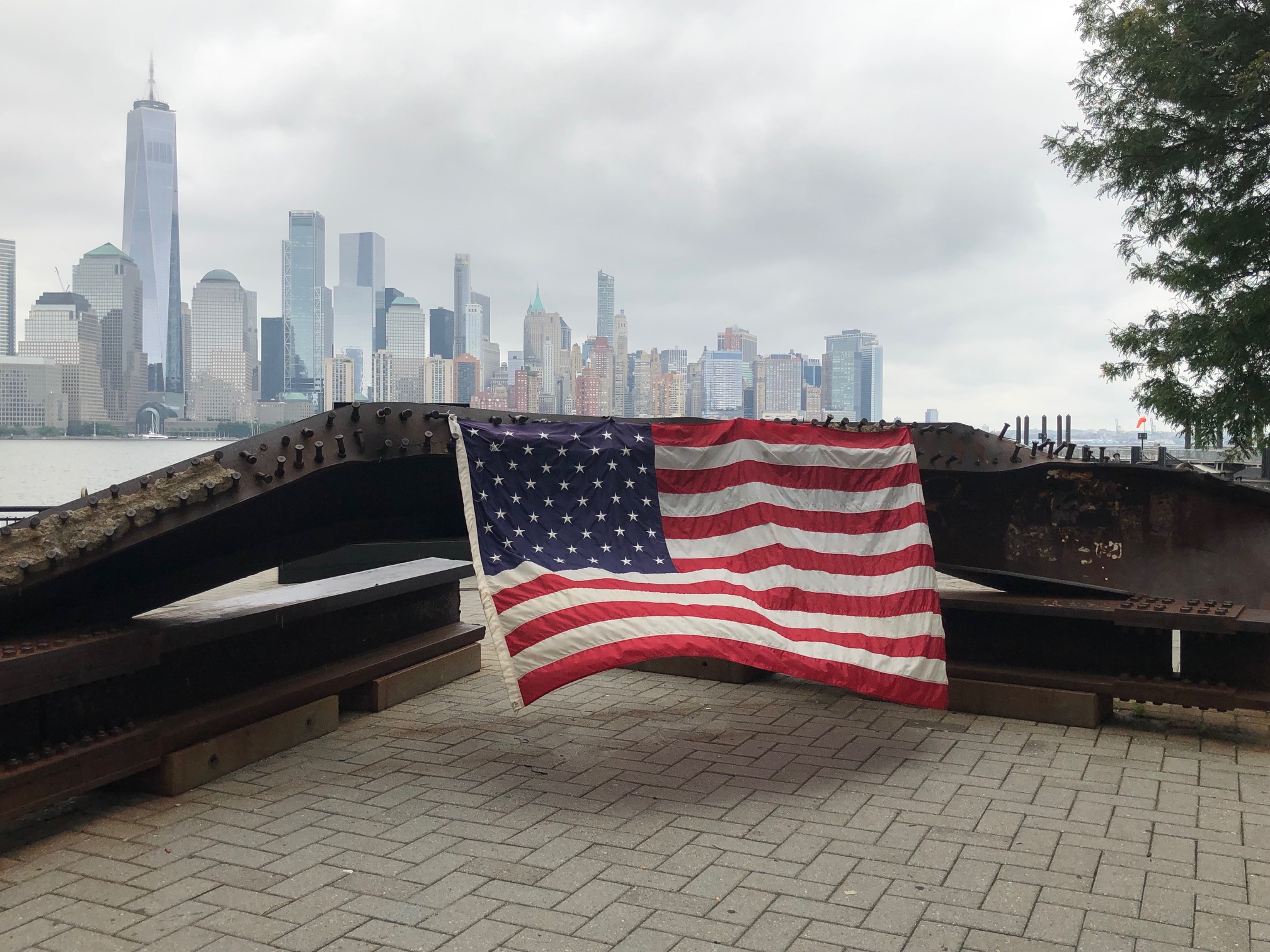
The route starts along the Hudson. Decide whether you’ll cross the river on PATH (Exchange Place is one stop from World Trade Center, though the Grove Street PATH station works too) or the ferry to Paulus Hook. Walk your bike along the waterfront until you get to Grand Street, about halfway between the two. You’ll know you’ve reached it when you come to this Sept. 11 memorial:
Keep an eye out for this one too. Look closely in the briefcase; there’s a calculator. Remember when it wasn’t in your phone?


You could detour to the end of the waterfront walkway to see the Colgate clock (next time!). We just went to Grand Street and followed it to Jersey Avenue (thanks for the protected bike lane). Turn left and it will take you to Liberty State Park.
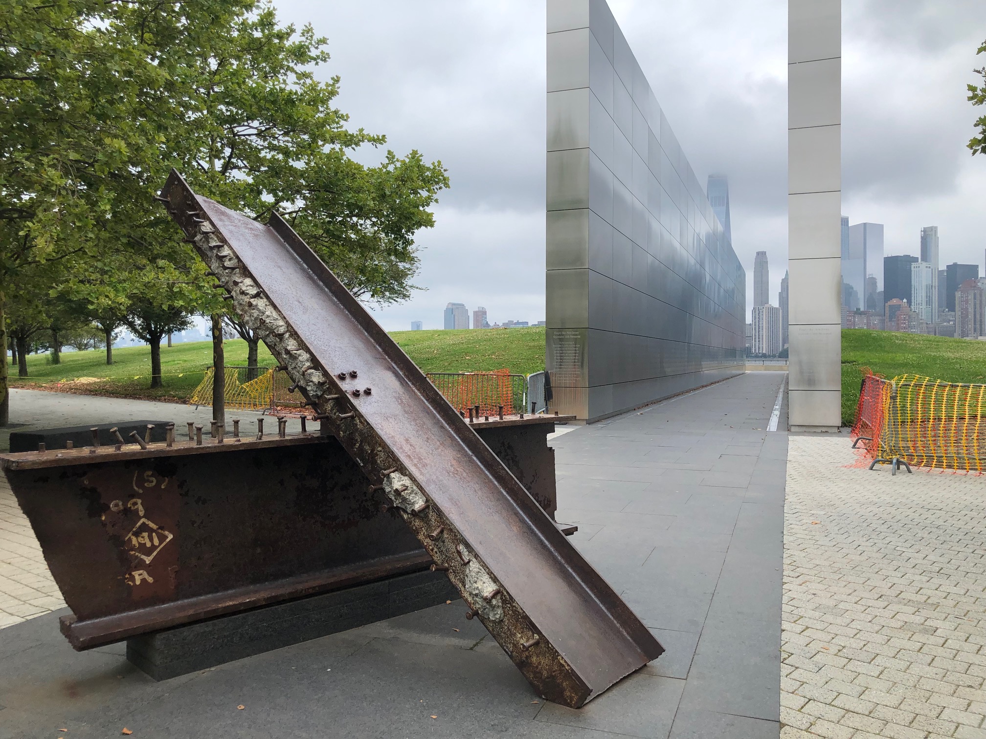
Now you could keep going straight and skip Liberty State Park (you could even go further on Grand and truly bypass it), but I think that’s a mistake.
You’d miss New Jersey’s 9/11 Memorial, the train station that is where millions of people who came through Ellis Island dispersed (and that’s not the only train history you’d find), a walkway that gives you views of the back of Ellis Island, the Statue of Liberty as well as the tip of Manhattan … and then this memorial of a World War II soldier carrying an emaciated concentration camp survivor.


I suppose you could go further and get a look at the controversial golf course that wants to infringe on an environmentally sensitive part of the park, but we took Morris Pesin Drive through the roundabout, under the New Jersey Turnpike and up Bayview to Garfield, where we turned left.
Garfield took us to Bayonne, where it becomes Broadway. Lots of food options. Lots of traffic lights. But eventually you get close to the Bayonne Bridge. A few more turns, then cross Kennedy Boulevard at 6th Avenue and get on the sidewalk. It’s only a few dozen feet to your right until you’re on the wide bridge path. Don’t try to reach it by turning right and sticking to the road.
The backstory behind this arch bridge, built in the 2010s to replace raise the 1930s model, is an interesting one. As told by the Hackensack Riverkeeper nonprofit organization (which does amazing boat rides in the Meadowlands and down into Newark Bay), permission was granted to deepen the shipping channel to handle bigger cargo ships. Once that started, there was this oops moment (I’m being charitable), a taller bridge was needed to make this work. So $2 billion later, here we are. Apparently had the bridge been included in the original proposal, the cost-benefit analysis would have meant rejection. You think no one knew ahead of time?

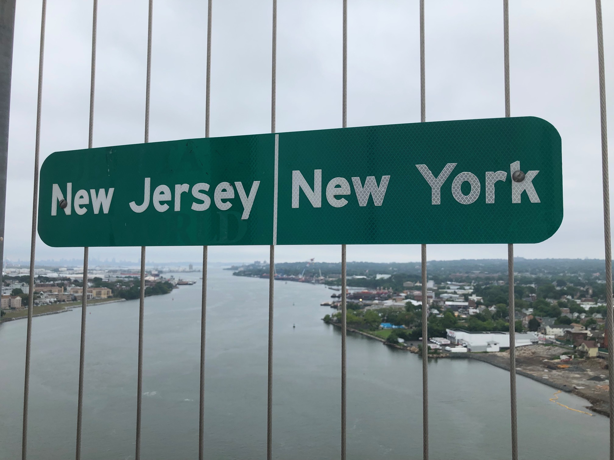
But up we went, 215 feet above the water. Nice of them to mark the line between the states. At least we didn’t have to pay the $16 toll.
All in all, you’re not in Staten Island for long. But the approach to the Goethals Bridge is a little tricky.
We took Forest Avenue to the end, so under the bridge and to the National Grid building. Then we were puzzled. The roads to our right are one way, going the other way. The sidewalk? Then we looked down and saw a bicycle symbol. Yup this is the way.

The sidewalk doesn’t last long until you’re on a two-way bike lane along Gulf Avenue and going back under the Goethals. At the traffic light, you’re back to a one-way road going the wrong way. But you want to cross over on your right and onto the sidewalk … because the bridge entrance for cyclists and walkers is essentially an opening in the fence on that side.
Sure you could skip this 270-degree circle and take Goethals Road North (a one-way road). Just know it’s a three-lane road with fast-moving traffic headed for the container terminal. You’ll need to be in the left lane so you can swerve onto the sidewalk at the bridge opening with no warning.
This bridge is only 141 feet above the water. Same $16 toll (only charged going into Staten Island) that we were spared as cyclists. Take a moment at the top to admire the vertical lift railroad bridge at the container terminal.

Back in New Jersey and I have to say that the Elizabeth side of the bridge access could use some work too. Watch for the orange dividers that create a two-way bike lane to the right. Only use them for that short distance until you turn right. Stick with them after that and the bike lane will end at a traffic light … and then you’ll want to go straight but you’re on the wrong side for a two-way street.
After that it’s pretty straightforward. No sections away from traffic, but suddenly you’re in Rahway and back on the old route from Newark. For descriptions for the rest of the way to Princeton, see here and here. If instead you want to head back to New York or Jersey City, you’re only a few blocks from the Rahway train station.
All told, it’s about 24 miles. You can get customized cue sheets using the East Coast Greenway’s mapping tool. Next time I’ll look for some yummy food stops.

Impressive!!
>
LikeLike
The Bayonne Bridge wasn’t replaced, it was raised. The arch remained the same, they constructed a new roadway above the old roadway, then demolished the old roadway and walking path
LikeLike
Thanks for correcting me!
LikeLike