
 It’s exciting to see the progress this 22-mile loop of a trail is making. Earlier this year, we biked on a new section of the Lawrence-Hopewell Trail and some other parts that we hadn’t yet discovered.
This past weekend, on a version of our usual ride out to Hopewell and the Sourlands, we found a bit more. This piece doesn’t even show up on the map on the trail’s website, maybe because it doesn’t yet really link to anything.
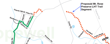
See that white section between the two strips of red dots? It’s in there, to the left of Carter Road. It’s paved, until it’s not, on the way to (I think) Bailey Drive.
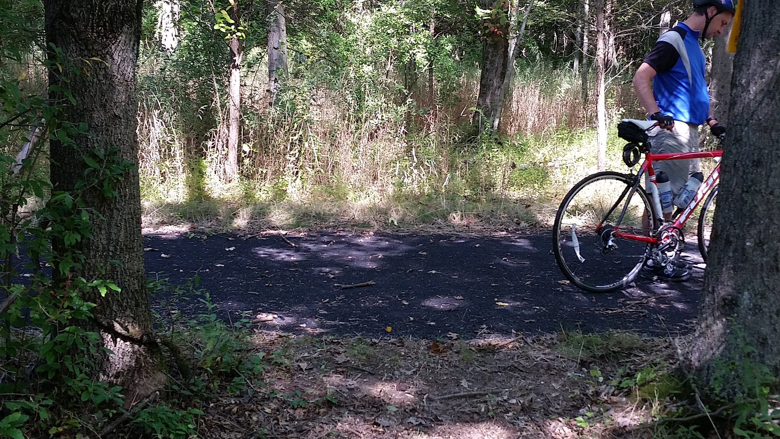
We found this “secret” section when we turned into the Mount Rose Preserve to see where the road took us and discovered a kiosk and map in a somewhat derelict parking lot. (Turns out this was home to an AT&T corporate educational facility that was torn down last year — and part of the nation’s first corporate campus.) And the map pointed us to a 0.2-mile uneven dirt path full of tree roots and ruts (we walked our road bikes) that spilled out onto the trail. Where dirt meets blacktop is the photo at the very top.
We then turned east, toward Carter Road. It meets the road via what I always took to be a driveway to some hidden home.
Opposite it, though, are signs that another section of the trail is coming.
 The LHT received a $1 million grant for a 1-mile segment that will go behind two buildings, including a Bristol-Myers Squibb office, and connect to Cleveland Road. That’s great news for cyclists who don’t feel comfortable on Carter, a busy road (and a fast, bumpy one too with no real shoulder when headed downhill toward Princeton). Cleveland is quiet, as is the continuation known as Pretty Brook, though both lack shoulders. I could see a mowed section off to the side where I could imagine the trail going for part of this section, unless it just sticks to the road, as it does in some residential areas. (I also think it ran out of possible right of way for a trail, but that’s without looking at a map.)And when you turn south on Province Line Road, you’re on the section where a bridge has been closed to traffic, so it’s quiet too. Just brace yourself for a steep climb after the bridge. And while we turned left onto Ettl Drive to make our way to Princeton, the LHT will one day go right art that point, to ETS and another completed section.
But back to the BMS site. What we couldn’t figure out is whether the work we’re seeing is part of the trail — or a spur that will link the main door of the Bristol-Myers Squibb building to the trail.
Regardless, when this extra mile is done, the trail will be 93% finished.
This little discovery was part of a 33-mile ride. Saturday night we rode a bit more of the Lawrence-Hopewell Trail as we did two loops (12 miles total) in the Full Moon Bike Ride through the woods and around a lake (with admittedly less than a full moon). An excuse to light up the bike! (Thanks again for the present, Ken.)
And finally, back-to-back days on the bike. 51 miles to Lambertville and back. Hilly. On a low-energy day. Here’s to a flat East Coast Greenway ride!

One thought on “We discover a ‘secret’ part of New Jersey’s Lawrence-Hopewell Trail”