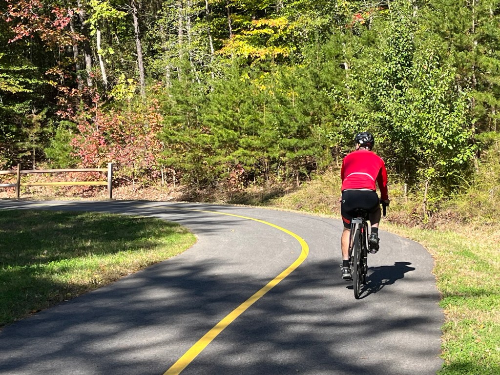
One 180-degree turn, then another. That next one — a third, or just a squiggle?
Continue reading “Great swoops! The WB&A Trail bridge over the Patuxent River is finally open — and we found some surprises”
Here’s what the trail straddling two counties is like.
One 180-degree turn, then another. That next one — a third, or just a squiggle?
Continue reading “Great swoops! The WB&A Trail bridge over the Patuxent River is finally open — and we found some surprises”Five years after my first bike ride along the B&A Trail in Maryland, I was back.
Back in 2014, I biked this trail as part of the East Coast Greenway’s Week A Year Ride between Philadelphia and Fredericksburg, Virginia. This year we were in the area for a wedding, so we brought the bikes and headed out for a ride starting just north of Annapolis.
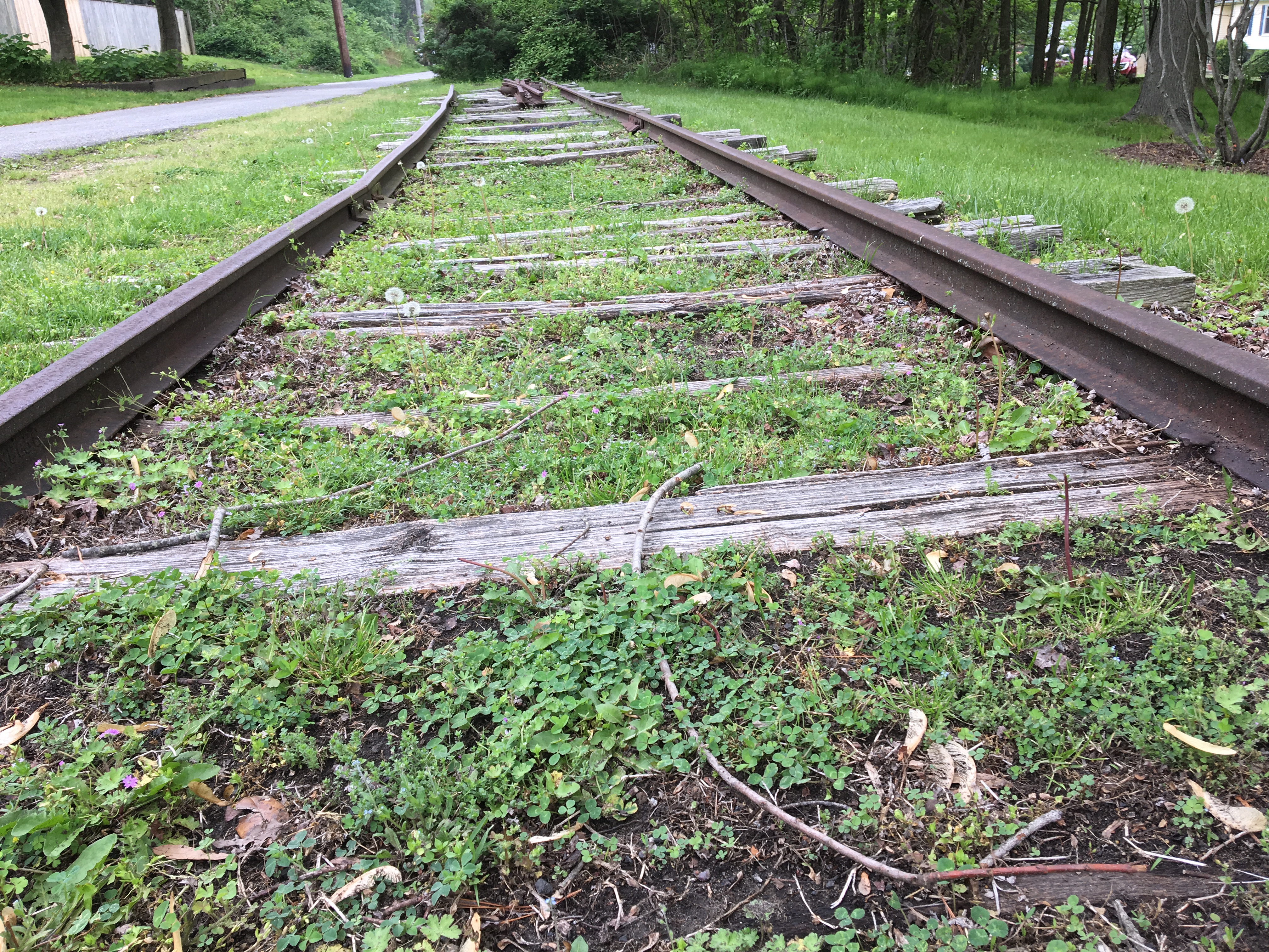
The B&A Trail uses an old rail line that connected, well, Baltimore and Annapolis. Today it’s a well-used 13-mile trail along part of that line that ties into the BWI Trail around the airport with the help of a short connector. Loved seeing the private connections from yards to the trail!
Continue reading “Rediscovering the B&A Trail between Baltimore and Annapolis”It’s always exciting to read about gaps in the East Coast Greenway being closed. There’s been good news in Delaware and Maryland (and of course Connecticut, which I’ve written about earlier).

Back in 2014, I took part in my first East Coast Greenway Week-A-Year ride, pedaling from Philadelphia to Fredericksburg, Va. We rode on some great trails, of course, but we also were on roads plenty of times (some good, some bad).
So I was excited to come across two items Friday that show gaps on the trail are being closed.
In Delaware, the state’s General Assembly just approved a record $20.7 million for bicycling and walking improvements, and the state has a very pro-biking, pro-East Coast Greenway governor (who took the time to meet us on the 2014 ride). As Bike Delaware reports:
One of the most ambitious projects that will now be completed with this authorized funding is the Wilmington-New Castle Greenway, a safe, direct, paved, flat and nearly uninterrupted non-motorized six-mile travel route between the Wilmington Riverfront and downtown New Castle. Another project that will gain additional momentum is the Lewes-Georgetown Trail, a 10 foot wide paved trail that will extend a total of 17 miles all the way from Lewes to Georgetown, creating the longest trail in Delaware.
The East Coast Greenway goes from Wilmington to New Castle; maybe one day there will be a direct Wilmington-Newark route. No word yet on how quickly construction can happen, but it’s still a great step.
The Lewes-Georgetown Trail isn’t part of the East Coast Greenway but it’s about getting people to and around the beaches. and of course people already are biking on vacation — here’s a recent news article about some badly needed signage down in Rehoboth. Another bonus: it connects to New Jersey and the Cape May area via the ferry at Lewes.
The day’s other news is that the bridge over the Susquehanna River between Perryville and Havre de Grace opened for bikes on Friday. This is a great victory! Sure, there are some complaints (and yes, we have to pay the toll too), but it’s far better than being barred. When we were here in 2014, the boats that were to shuttle us over never showed (they got the wrong day), so we were bused over the bridge.
Bridges. That’s the costly and really time-consuming part. If it had taken a new bridge to close this gap, we’d be waiting a long time. It’s also the gap in the WB&A trail from Washington to Baltimore. We rode part of this trail in 2014 too. The East Coast Greenway route goes from Baltimore to D.C. via Annapolis, and the vision is have a traffic-free route there too. A 1.7-mile gap on that leg closed in May because a developer realized it made sense for his own project (no doubt with some prompting).
A bridge is also the $1 million question in closing a gap in South Portland, Maine. The Eastern Trail runs 65 miles with gaps from Portland to Kittery, the border (with a bridge) to New Hampshire. The group is fundraising right now because state funding could otherwise disappear. I did my small bit. Had I won the Mega Millions jackpot last night, I’d have done much more. (The good part is no one did, so I could try again.) I hope they’ll win some grant money from People for Bikes and Rails to Trails via the Doppelt Family Trail Development Fund.
But I always wonder what could be done to make bike bridges less expensive. Would more prefab parts help, vs. constructing on site? Do construction standards require that they be able to support something as heavy as an ambulance and that adds to the cost? Can anything be done? Or is this just the unfortunate reality?
How I could have used the East Coast Greenway when I biked from Alexandria to Annapolis as part of my cross-country ride in 2000!
 How I could have used the East Coast Greenway when I biked from Alexandria to Annapolis as part of my cross-country ride in 2000!
Back then, we couldn’t get a bike map of greater Washington D.C. and advice on the best route out of town. I remember riding on some fairly large roads, though traffic wasn’t bad. (I remember the two flats and the wet weather most clearly).
But this time…
I think Day 5 was even better than Day 4. Traffic was pretty light on our route out of Annapolis and included neighborhood streets and trails. Traffic stayed light and we kept hitting more trails as we got closer to D.C. Incredibly, if we weren’t on trails, we were on residential roads. Given the gridlock you see in D.C. (I mean the traffic kind, not the political kind), it was stunning how easy it was to get to the National Mall.
So here’s to the Washington, Baltimore and Annapolis Trail, the Anacostia Tributary Trail/Northeast Branch Trail and the Northwest Branch Trail, the Metropolitan Branch Trail and of course the Mount Vernon Trail for the last leg into Alexandria.
Here’s what an Alexandria newspaper reported about the ride and meeting with local officials.
In a word, hilly.

