A bigger vision — a U.S.-Canada trail

Imagine the East Coast Greenway connecting to the Trans-Canada Trail, already the longest trail in the world. And there’s more.

ecg plus tct
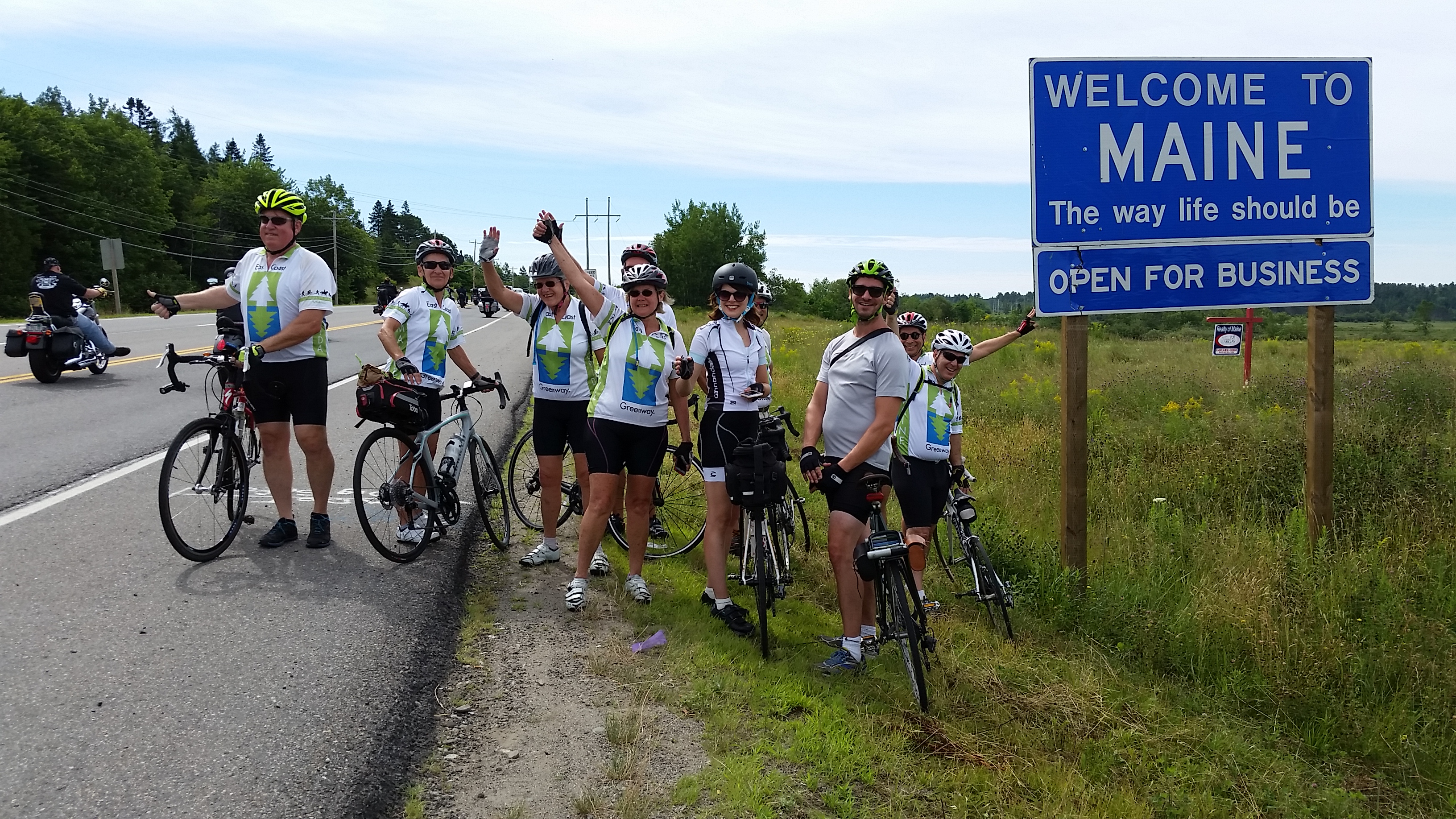
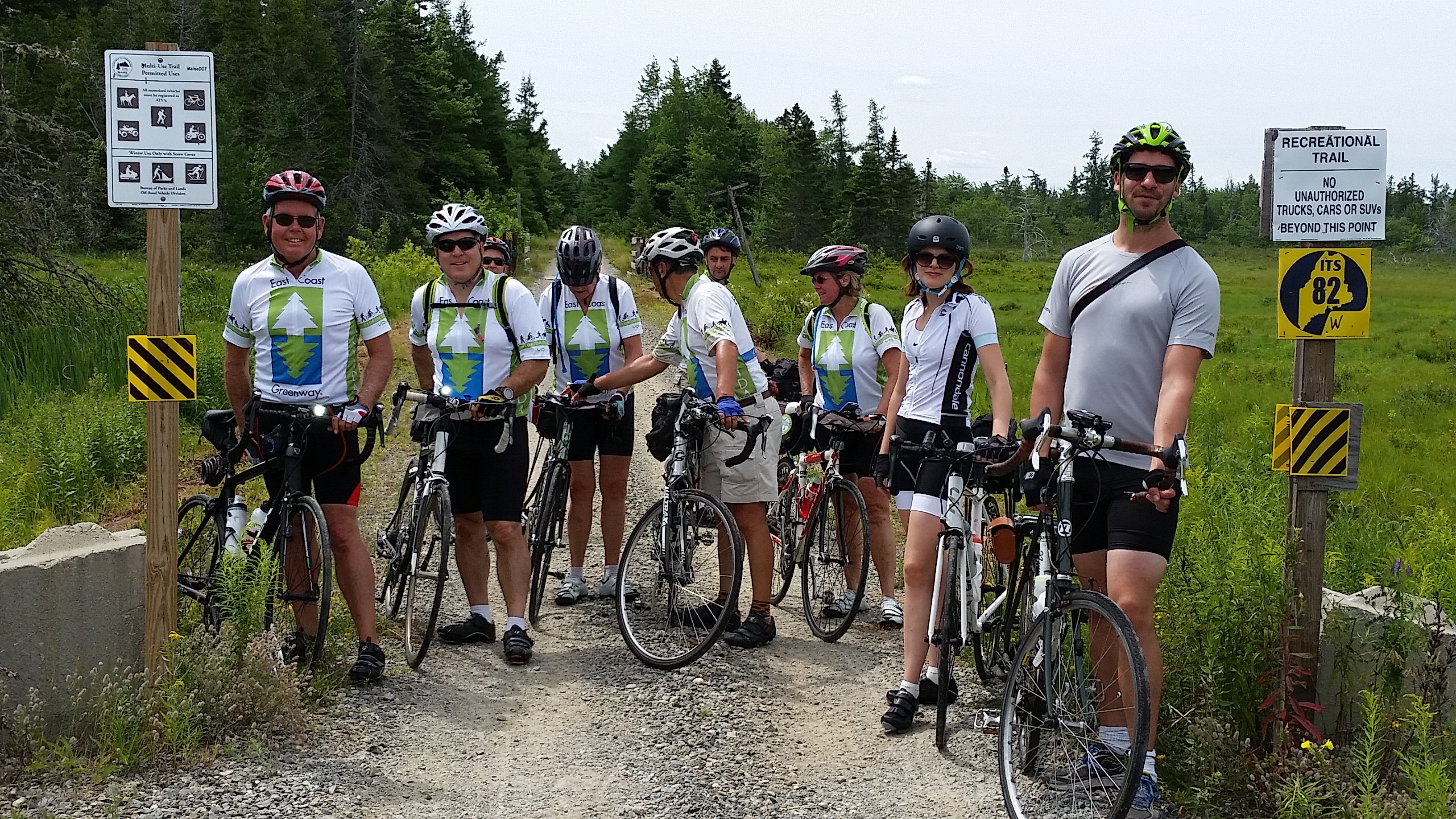
One of the great things about these East Coast Greenway Week-a-Year tours is that you have a chance to hear what’s happening elsewhere on the 3,000-mile route and to talk with local (and sometimes state) officials.

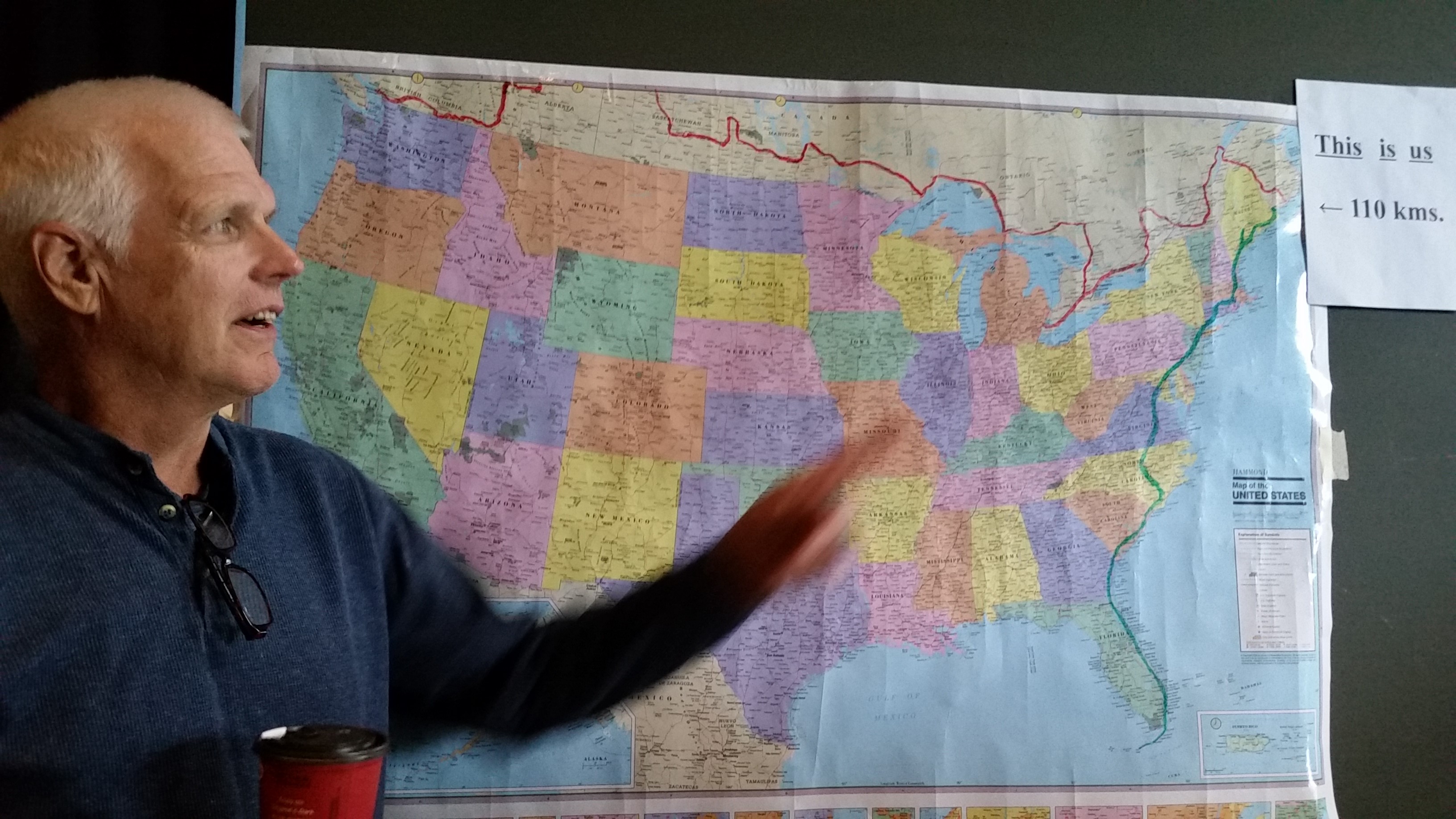
This time, we’ve already heard about the vision to close the 110-kilometer (66-mile) gap in Canada between the East Coast Greenway and the Trans-Canada Trail, which will be completed next year to mark the Canadian sesquicentennial. That trail — a mix of road, trail and even water — stretches from the Pacific to the Atlantic and will be 24,000 kilometers (nearly 15,000 miles) long — the longest trail in the world. But when it crosses the province of New Brunswick, it’s well north of St.  Stephen, the town opposite Calais. So that’s got to change.

Then we heard about an even bigger vision — to link two great national parks, one in each country,  with a linear park. That would be Acadia National Park in the U.S. and Fundy National Park in Canada. The big missing pieces are two bridges on the Canadian side; otherwise the back roads, keeping you away from most of the RVs, already exist.  And it would double as the connection between the East Coast Greenway and the Trans-Canada Trail.

Who knows when it will be done, but we heard support from an MP, among others. And the stars seem aligned in the sense that there is a Liberal government in charge at the national level and a Liberal government in charge at the province level.

Day 1 — 49 miles from Calais to Machias

A wonderful first day of our East Coast Greenway ride in Maine.

maine lakeThis was a wonderful first day of our East Coast Greenway ride in Maine — comfortable temperatures (perhaps it topped 80) and low humidity (especially compared to the heat dome we left behind). The hills were generally undulating and the uphill looked worse from the top of the previous hill than they actually were. They also seemed shorter than the ones at home and only rarely did we have to work hard in our lowest gear. The “official” estimate is we climbed 1,874 feet.

We started with a gathering of local and regional U.S. and Canadian officials near the border (more on that in another post), then headed closer for our own shot of the border. I’m glad we walked over last night because there was no way we were going to convince part of the group to wait for the others to go over and back. As it was, the American border agents didn’t take too kindly to a few of us going halfway across the bridge for a photo and then walking back — and not crossing over to go through U.S. customs. Thankfully, they said that since they had seen us, it was all OK … just don’t do it again!

Apparently they don’t take it easy during the international festival the two towns have. The parade from one side to the other? Get pre-approved if you want to do the whole thing.

This is most of the group well away from the bridge crossing, with Canada across the river. Notice the day’s uniform?

ecg group at the canadian border

We found our welcome to Maine sign a few miles later, after we’d passed the turn-off for the last of the local crossings. The waves are to the friendly motorcyclists passing by who had also spent the night at the Calais Motor Inn.

welcome to maine

Can someone photoshop “and bikes” to the bottom of that “open for business” slogan?

Signage was generally great — both for the East Coast Greenway and Adventure Cycling’s U.S. Bike Route 1. Our cue sheets really were more of a backup than anything else. Maine DOT has done a fabulous job!

bike signs in maine

We crossed the Down East Sunrise Trail quite a few times.

ECG group at DEST

But we made the right choice — the surface is great for ATVs and snowmobilers but awfully bumpy for a cyclist. One of our Mainers told us it’s also plagued with black flies — and our few encounters with them were bad enough.

ECG DEST surface

This was supposed to be a 46-mile day. Where did the other 3 come from? Two are the ride to the border and back. The third is a math mistake on the cue sheets — somehow it added just 0.2 instead of 1.2 miles for one stretch of roadway. Stuff happens. And it was no big deal.

An evening stroll into Canada

Cross the border into Canada and you’re in another time zone.

canada

We’re staying a mile away from the border. So we took an after-dinner walk through downtown Calais, through the pedestrian border checkpoint and into St. Stephen and another time zone. We stayed for just five minutes before heading back.

No passport stamp. 😦

Ready to ride!

We’ve made it to Calais. Now the biking starts.

ECG group and the school bus

We’ve made it to Maine — and taken the five-hour(!) ride in a school bus to Calais from Portland. I was last on a long ride in a school bus in Alaska — and before that to corn detassle as a teenager in Indiana.

But it gave us lots of time to get to know each other. One rider is from Maine (another Maine rider joined us at dinner), and another is from Florida, and the rest of us are from Pennsylvania north. There are quite a few who are on their first East Coast Greenway ride.

As we went up and down the hills on Highway 9 between Bangor and Calais, the group started wondering about Sunday’s route. We knew it would be hilly — but this hilly? Should we have come with fatter tires after all and taken the Down East Sunrise Trail, with its imperceptible 1% grade? Maybe a third of the group has planned to take the trail. One person even brought a second set of tires, so she could swap out for something more road-friendly after two days. Why didn’t we do that?

At least it’s only a 46-mile day.

The Down East Trail is the longest trail on the East Coast Greenway, at around 85 miles. The nonprofit that runs it is now finishing up an extension into Ellsworth, the gateway to Acadia National Park, and is envisioning an extension in the other direction, into the Moosehorn National Wildlife Refuge. Pull out and sell the rails to build the trail seems to be the way it’s done.

And just how isolated is this eastern part of Maine? Our bus driver said you wouldn’t take this highway in the winter because of the snow — you’d stick to the coast. He pointed out signs with the letters TWP and a number. That’s how areas of forest and or other “town without people” get identified in rural Maine. We went through an area where there used to be a lot of logging and paper mills, but there’s much less of that here. A few homes, small — small — grocery stores (think the size of a trailer), one little elementary school and lots and lots of forest and not much else, until we finally saw a sign for a proper supermarket … 7 miles away. That would be in Calais, a town of about 3,000.

And between Calais and Machias? We’re heading out with boxed lunches because there’s nowhere to buy food.

One week to go!

Here’s our itinerary for the Maine ride along the East Coast Greenway.

East-Coast-Greenway-logoNext Saturday afternoon we’ll be on a bus from Portland to Calais (pronounced cal-iss) and the start of our 337-mile ride along the East Coast Greenway. Calais seems to be not quite the most eastern point in the U.S. But it does have a border crossing — passport and Canadian dollars are packed. Dinner? Ice cream? Definitely a passport stamp!

We’ve gotten the cue sheets and here’s how it’s shaping up:

Sunday: Calais to Machias. We’re taking the road option — the Down East Trail looks rocky and we’d rather have our road bikes for the hills that come later. 46 miles.

Monday: Machias to Ellsworth. Once again, road over that rocky trail. Thankfully we have the option. This is our long day — 68 miles. I think we stopped in Ellsworth on our first trip to Maine 11 years ago (destination Acadia National Park) — there’s an L.L. Bean outlet in town. Looks like our hotel is a parking lot away.

Tuesday: Ellsworth to Bangor. This is apparently where the hills start. At least it’s just a 42-mile day.

Wednesday: Bangor to Unity. More hills? But just 38 miles. We’re spending the night in a college dorm. We did the same thing at the start of the charity ride I did for Anchor House three years ago (then it was Burlington, Vermont) — here’s the blog about that year.

Thursday: Unity to Augusta. A 43-mile day, and our hotel at the end has the word “spa” in it. Better pack a swimsuit.

Friday: Augusta to Lewiston/Auburn. The day includes an event with the Maine Department of Transportation just 2 miles from the start, at a trailhead for the Kennebec River Trail. It’s always great to meet local and state officials and help make the case for the East Coast Greenway. And to say thanks too, of course. It looks like we’ll ride most, if not all, of this 6.5-mile trail. I wonder if there are plans to extend it? We end the 44.5-mile day with a much shorter Riverside Greenway.

Saturday: Lewiston/Auburn to Portland. We’re ending the ride with another long day — 56.6 miles, with the option of another 3.5 miles for a victory lap with Maine Adaptive Sports. If people with physical disabilities are coming  to ride with us, heck yes we can do another 3.5 miles!

THANK YOU once again to all who have supported the East Coast Greenway through this ride. If you’d like to donate, you can do it online here. If you prefer to support Clive, go here.