

So much eye candy for cyclists on the Perkiomem Trail.
There’s the Perkiomen Creek, which the trail follows from where it flows into the Schuylkill River just west of Valley Forge National Historic Park north to Green Lane Park in the tiny borough of Green Lane, Pennsylvania. Lots of criss-crossing the creek so you really don’t go far without having water in sight.
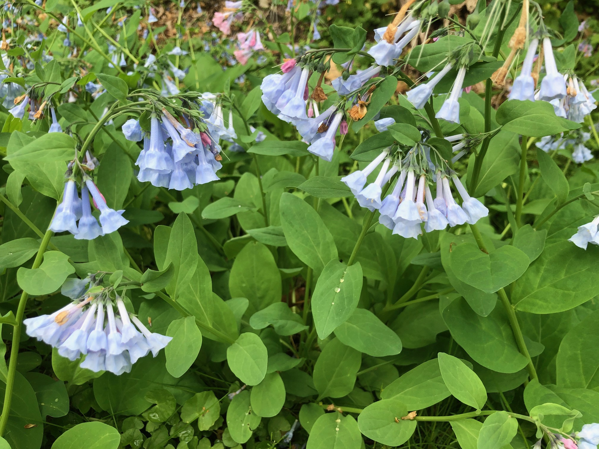
More nature because you’re surrounded by green for most of the 20 miles, and the roar of traffic that you hear in Lower Perkiomen Valley Park disappears as you keep heading north. Masses of bluebells this time of year. The small towns that the trail traverses mean you have food options (and even a bike shop right on the trail in Schwenksville), but the area really gets more rural the further north you go. The trail surface is paved in some areas, but there’s a lot of crushed stone too. No problem with the 28mm tires on my road bike.


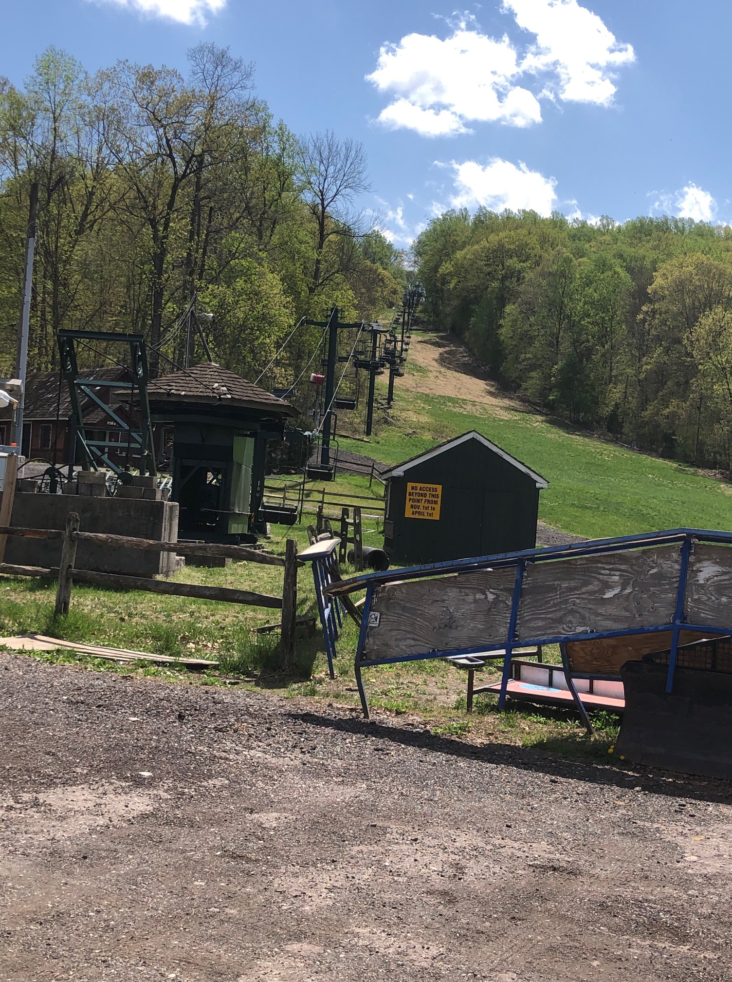
And who’d have thought there’d be a small ski area just off the trail in Spring Mount (another tiny community)? We only spotted it on the way south, and after a tip from another cyclist. It’s just before the big climb — the one with the 12% grade warning. Guess that’s why there can be a ski area. I just wonder what route the Reading Railroad’s Perkiomen Line took back in the day. Today, rail service is just a memory.
The southern of the trail overlaps with the Audubon Loop, which widely encircles the John James Audubon Center at Mill Grove. Yes, this is where Audubon, best known for his paintings of birds, lived for several years after coming to America as an 18-year-old. The center wasn’t open on the day we biked, but you can still park there. It’s convenient if you’re coming via the interstate, as we were, but there are plenty of other parking option along the trail. We headed south on the Audubon Loop at the start to the Schuylkill to pick up the Perkiomen Trail, but on the way back we took the rest of the Audubon Loop. Killer climb!
Here’s an unexpected bit of history along the Perkiomen Trail, courtesy of a historical sign: in the spring of 1939, as war neared in Europe, a Jewish couple and a Jewish organization in Philadelphia were able to get 50 Jewish children out of Vienna at a time when America was hardly welcoming. And it required negotiating with the Nazis too. Only 1,000 unaccompanied children entered the U.S. during the Holocaust, and this is the single largest group. The kids were brought to Camp Sholom in Collegeville, where I spotted the sign and the amazing story it tells. I found it all quite moving, given that my father’s family had to flee Europe and wasn’t allowed into the U.S.

One warning if you’re biking the Perkiomen Trail in 2023: watch out for bridgework over the creek just off Crusher Road and Gravel Pike just shy of Green Lane Park, just over 17 miles from the southern end. We turned around here (without being able to ask anyone how long the work might take), but those comfortable on the road should be able to turn left (south) on Gravel Pike and go about a quarter-mile before turning right onto Deep Creek Road and eventually picking up the trail once again.
There’s camping (with showers) at Green Lane Park, but you need to bring drinking water.

Silvia: I forgot about that hysterical marker. Not far from there, west of Pottstown, I stopped at a used bookstore. I bought a book called “A Well-Read Woman”, about a woman who was sent away from her parents to Switzerland during the war and later worked for the Library of Congress, in Vietnam, and in Thailand and/or Cambodia. The woman’s name? Ruth Rappoport! That was my grandmother’s name. That was part of the reason why I bought the book. My friend, Susan, gets a laugh out of my consumer behavior. I think I stopped there on my way back from spending a couple of days in Ephrata. I went to see the trail that starts at Main St. (US 322) and goes to within a mile of Lititz. About 2 miles from Ephrata is this Gnome. It is out of sight! So many hilarious signs! They are in someone’s backyard. The trail is 8 miles long. A lot of shade. There is an ice cream vendor about a mile from Ephrata. I saw a woman feeding ice cream to her dog. I think the trail should be extended to the NE to join the SRT. south of Reading. Dan
LikeLike
Camping in Green Lane is a great opportunity to do a quick shake down ride to renew your camping chops if you live in the area. Yes, you need to bring drinking water, but there are options not far from the park. After you have pitched your tent, consider the Perkiomen Valley Brewery (https://perkiomenvalleybrewery.com/ ) which is open till 6 on Saturdays and frequently has a food truck for you to grab some dinner. If the food truck isn’t to your liking there is a pizza place across the way. And as you ride back to camp you can stop at a gas station to get a gallon of water so that you can make your morning coffee. As you ride back south on the trail, consider stopping at Snoozy’s cafe in Schwenksville (https://www.facebook.com/SnoozysCafe/) for breakfast or ice cream. It is right on the trail and maybe an hour from Green Lane so you can have your coffee in camp and then stop for a great breakfast before you bike back to Philly.
LikeLike