

Actually, make that two solid metric centuries — 62-plus miles each time — since we — my sister and I — biked back the next day.
I’d ridden a shorter version of this route — Conshohocken to Reading — in 2015, but there have been many improvements to the Schuylkill River Trail since then. In fact, once a multi-use path along a bridge opens in the spring and eliminates a section of road riding, the SRT will essentially be done between Center City Philadelphia and Reading. Wow!
The bigger plan is a 120-mile trail from Frackville in rural Pennsylvania to Fort Mifflin on the Delaware River in Philadelphia… sections are in the works.
Philadelphia and the broader Circuit Trails are so fortunate to have the SRT as a spine. Add the coming link to the Chester Valley Trail — another done-by-spring project — and Philadelphia’s trail network is getting pretty amazing.
But I have to be honest. This long section of the SRT is done only if you accept that some sections will still be on the road. That might scare off some I-won’t-bike-with-traffic people. I can reassure you that it’s mostly quiet roads — but then there’s the Philly neighborhood of Manayunk, where the route is not particularly friendly. (If that’s you, think about starting in Conshohocken instead.)
The route
Our big challenge was nothing the SRT can control. It’s November … and it’s finally turning cold. At least the sun was out on this Monday morning. We headed out from the Art Museum with a bracing headwind, wondering if we had the right gloves, the right number of layers …. Past Boathouse Row we pedaled, catching snatches of the coxswain’s commands as rowers move in unison, then under bridges to East Falls … and then Manayunk.
Workers are putting up giant white snowflake holiday decorations as we bike up the road, no bike lane — and no SRT signage in sight. Apparently there are two options: going up some big hill or taking the unpaved towpath. Luckily I am with someone who knows the way (my sister) and we turn left, away from the wind (we hope) and toward the river and the towpath (which comes with a surprising amount of wooden sections).
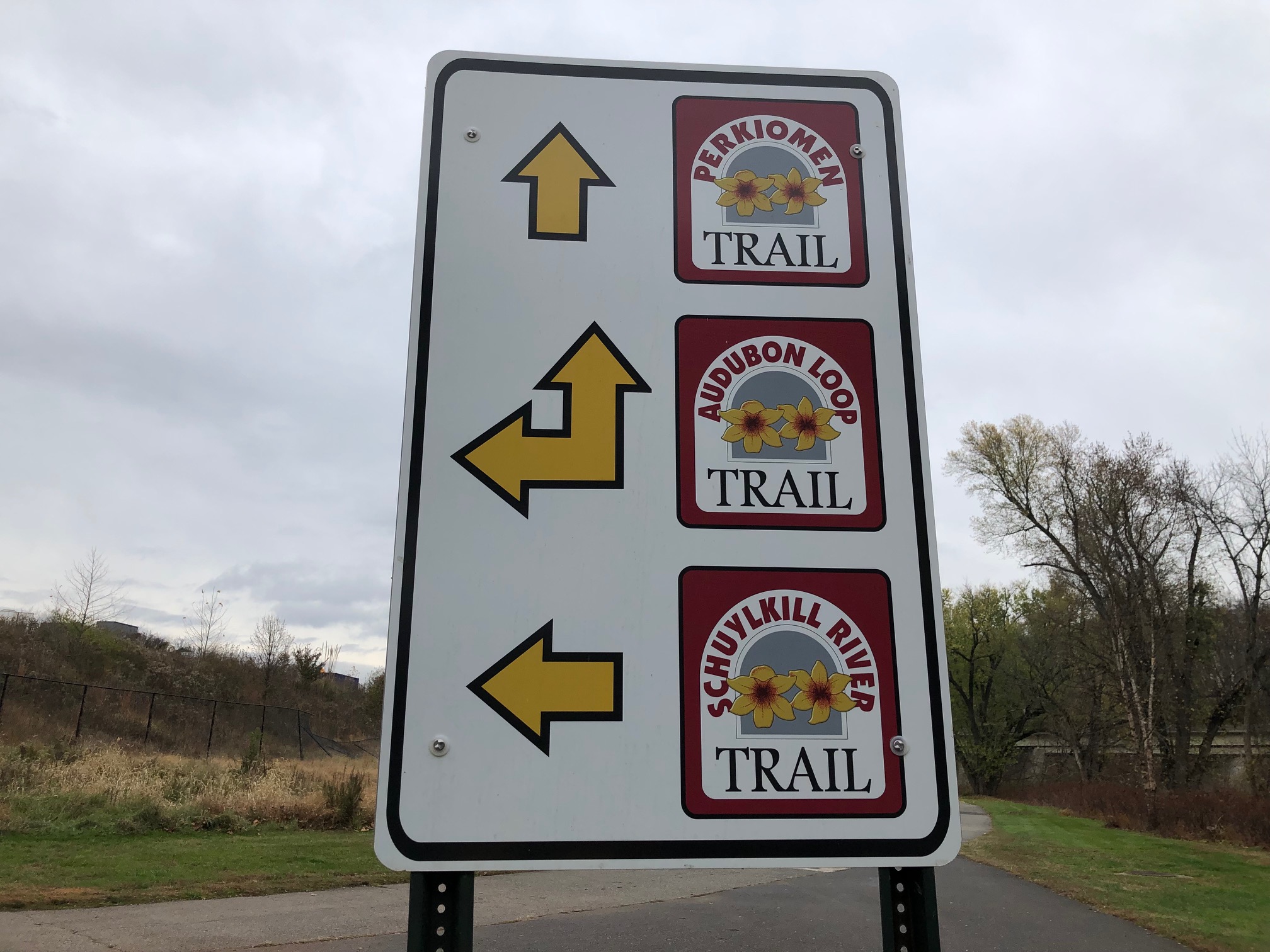
Then we’re back on pavement, pedaling past Conshohocken, Norristown, the edge of Valley Forge National Historic Park, past the turnoff for the 20-mile Perkiomen Trail (still on my list of rides) … and then do we go left on a path between a canal and the river or do we follow the bike lane sign saying Phoenixville? We take the latter … and end up on a quiet road until we reach Bridge Street. I remember it from 2015. (On the way back, we take the path. It’s the better choice.)
On to Phoenixville, Pottstown and Reading
More uncertainty: do we listen to the SRT sign that sends us to Lock 60 or another SRT sign for Phoenixville? I know the right answer is Phoenixville from 2015, but a change in the route surprises me: it no longer goes through downtown. Instead we immediately head behind the business district, across French Creek and along some new townhome communities.
It’s a bit of a shame because Phoenixville has, well, risen even more from the ashes than when I biked through seven years ago. Plenty of trendy restaurants for your lunch stop — it’s 28 miles or so from Schuylkill Banks — and did we count three breweries and a distillery? And there’s even a small independent hotel in the heart of downtown for those who see Phoenixville as an overnight stop. Perhaps start in Conshockon, aim for the Perkiomen and back, then on to Phoenixville (less than a metric century) and the next day bike to Pottstown, maybe stop for a bit of kayaking when it’s not November and then back to Conshohocken? Or keep going to Reading?
We, of course, are headed to Reading so we keep going. It’s all paved now, unlike seven years ago. Still, one nasty steep climb, then down and we eventually reach the new trailhead at Fricks Lock. Thumbs up on the bathrooms!
This is a new trail section that takes us off a road section I remember from seven years ago. Even better! It’s all smooth sailing until we reach the Route 422 bridge. The path curves up toward the bridge — and then there’s a fence. No way around it.
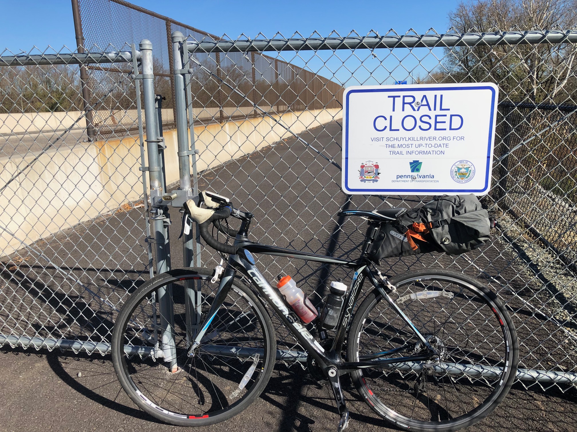
We later find out it supposedly will open in spring 2023. I can’t work out exactly what happens on the other side and how it will connect to the sidepath on Industrial Highway, but it should be more comfortable than taking Route 724 (narrow shoulder, no bike lane but modest traffic) a few miles to South Hanover Street and the bridge into Pottstown.
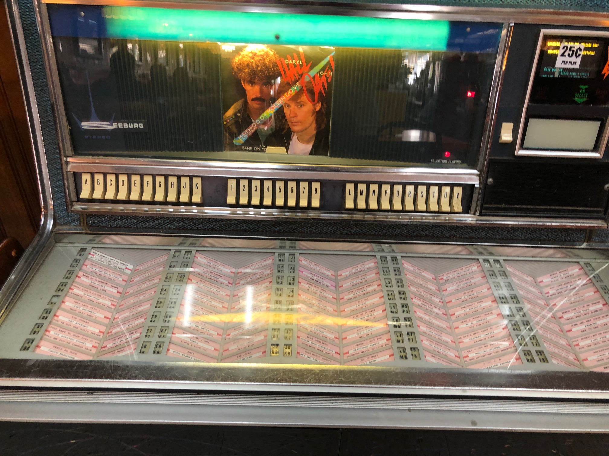
Just like seven years ago, Pottstown was the lunch stop. This time we took the recommendations of a local and stopped in The Very Best. Where else will you find a quarter-pounder for $3.45? Though what I really liked was the jukebox, even it’s a blander (1960s?) style, each play a quarter. Of course you might prefer the Pac-Man arcade game.
After Pottstown, we discover another improvement: a bridge over the Schuylkill in Douglassville that opened in 2021. One nasty road crossing eliminated! But while we aren’t dealing with Route 724 in there, we still have to cross it a few times later on in Berks County. This is where those pedestrian (or cyclist)-activiated flashing lights would be a great addition.
We’re now on the Thun section of the SRT, which has crushed stone instead of asphalt. We zip along to Birdsboro, then cross at the lights to get on a quiet road, then paved trail again toward Reading.
A change to our route
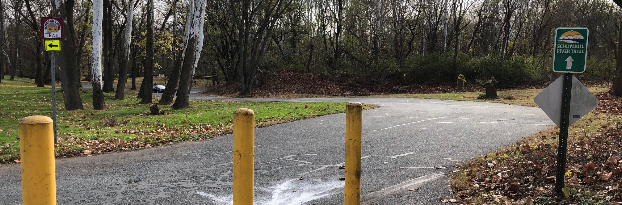
The downtown Reading hotel we stayed in back in 2015 is now condos. West Reading has plenty of choices … we end up north of downtown because, hey, enough points for a free night. But here’s another place where signage is needed. Ride with GPS picked a route that uses the fixed-up Reading Gateway — until just before the bridge over the Schuylkill River to Reading. The Garmin beeps that I’m off-course but there’s no obvious turn-off. Oh, there it is: a short, steep and rocky walk-your-bike descent that’s maybe 2 feet wide and leads to crumbled concrete that apparently is part of the West Reading bike lane network. And then we have a big hill up and down to get to downtown and onto the bike-friendly Comfort Inn and Suites.
We found a smarter way on the way back: Park Road until it ends at Parkside Drive North. Then get to Parkside Drive South, either using the trails through the park or turning right on Museum Drive. Just make sure you’ve crossed the creek in the park. There’s a trail at the intersection of Parkside South and Museum that leads you through more park to Old Wyomissing Road and a sidepath that takes you back to the SRT, no giant climb required. (You can also take Parkside South for another block and turn left of Old Wyomissing if you want to stay on the road.)
A few suggestions….
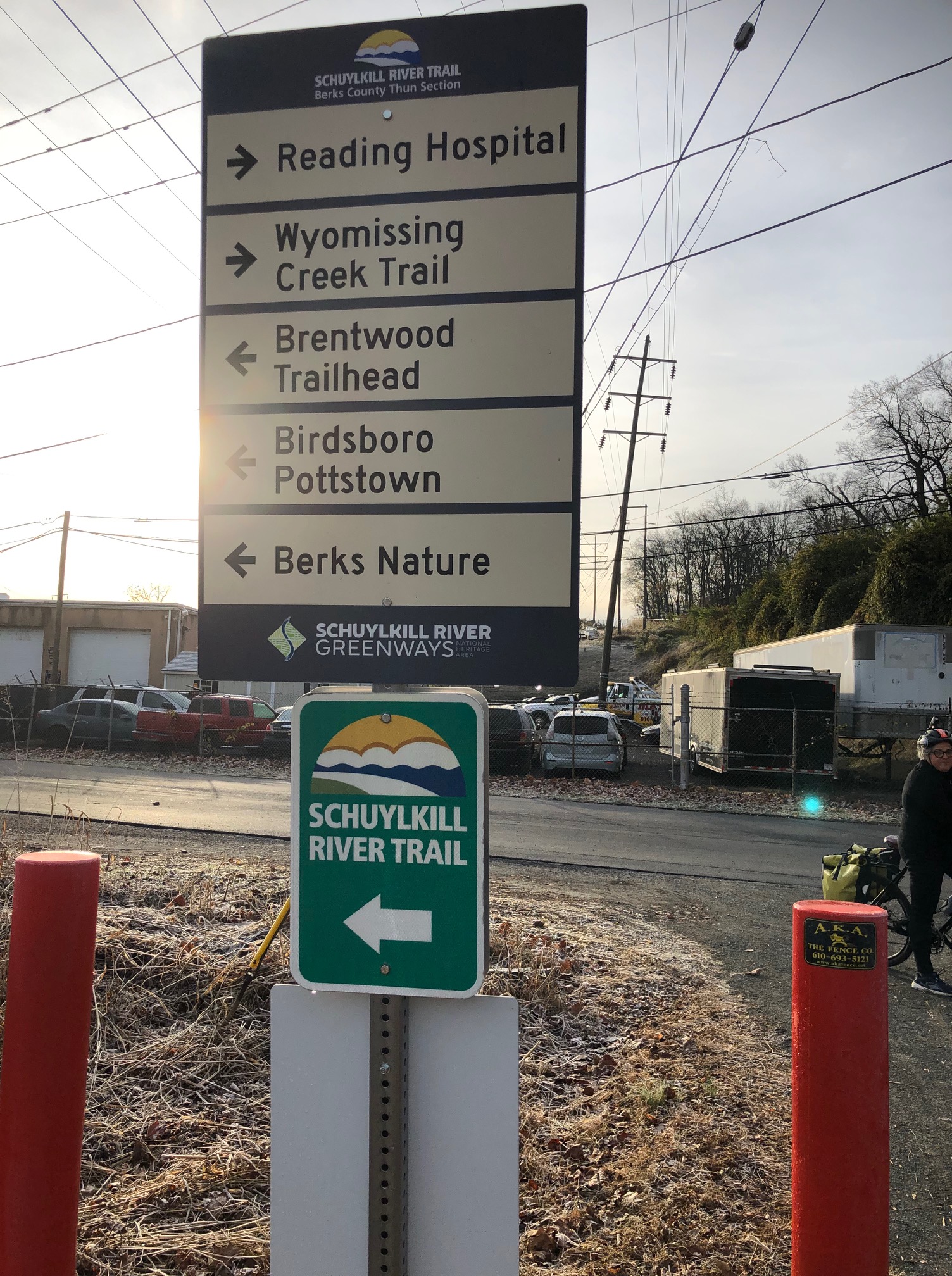
Manayunk is just one place where wayfinding signage is weak. Then there’s confusing signage. I’ve explained where Phoenixville needs help, but Pottstown does too.
And then the inconsistent branding! If I were in charge of marketing the SRT, I’d be tearing out my hair over the range of logos and be demanding an upgrade to the signs. A cheap fix! I didn’t get photos of all the different styles I saw, but here are a couple of versions. And of course Philadelphia does its own thing. And then there’s Chester County.
A more expensive upgrade would be to install some pedestrian-activated rapid-flashing beacons — those lights that start flashing when you hit the button — at crossings of busy roads like Route 724 after Pottstown. Sure, we didn’t have to wait long for a break in traffic to get across, but it’s not something more casual, road-wary riders or those with family in tow will feel comfortable with. And I feel for that police officer who told us he dreads the day he will have to respond to a call that someone has been hit.
We heard some talk that some might be in the works — but that should be something everyone involved with this trail knows is coming soon.
What about transit options?
Septa will get you between Philadelphia and Spring Mill, Conshocken and Norristown with regional rail. But what are your options further out?
Phoenixville has bus service to Norristown via King of Prussia. The bus from Pottstown to Norristown seems more direct. And there’s twice-a-day Amtrak bus service from Reading to Philadelphia, stopping in Pottstown.
There’s also Amtrak rail service from Lancaster, but that’s only if you want to keep riding and not return the way you came. Anyone have a good bike route for that? Adventure Cycling has a route that connects Lancaster to Valley Forge and back to the SRT to reach Philadelphia.

This brought back memories of using the SRT on my 2021 ride, though I only took it as far as Valley Forge park and then to Lancaster. I wouldn’t recommend that route if you’re trying to stay off the busier roads though. (Plenty of shoulder, but much noisier.)
Riding the rest of the SRT, and the Perkiomen, along with going to Wilmington all sounds fun, and I would welcome another trip through Philadelphia.
LikeLike
You’ll appreciate the connection to the Chester Valley Trail though I figure traffic after the CVT also won’t be fun. One day that trail will go further west!
LikeLike