

I stared at that tall mass of green straight ahead. This must be the nine-mile climb our route planner had flagged.
We were on the Maybrook Trail, the new connector between Hopewell Junction, where the Dutchess Rail Trail ends, and Brewster, the northern end of a trail that ends in New York City’s Van Cortlandt Park. I’m convinced it was only built because of the Empire State Trail project. Love the shade on a climb and the surprise of coming across a lake.
It’s a rail-with-trail project, presumably because Metro North wants to keep using it … never mind that some sections of track are missing near Brewster.
But a train can’t go up steep inclines, so rail-trails generally mean gentle climbs. That was the case here, with 2% grades, maybe a short burst of 3%, over 8 or 9 miles. That I could handle as part of another hot day and close to 70 miles in the saddle.
The photo above is around the highest point — my Garmin said 726 feet above sea level — and then it was downhill to Brewster. Then some more (shorter!) climbs before it was back to downhill toward New York City. I needed that today!
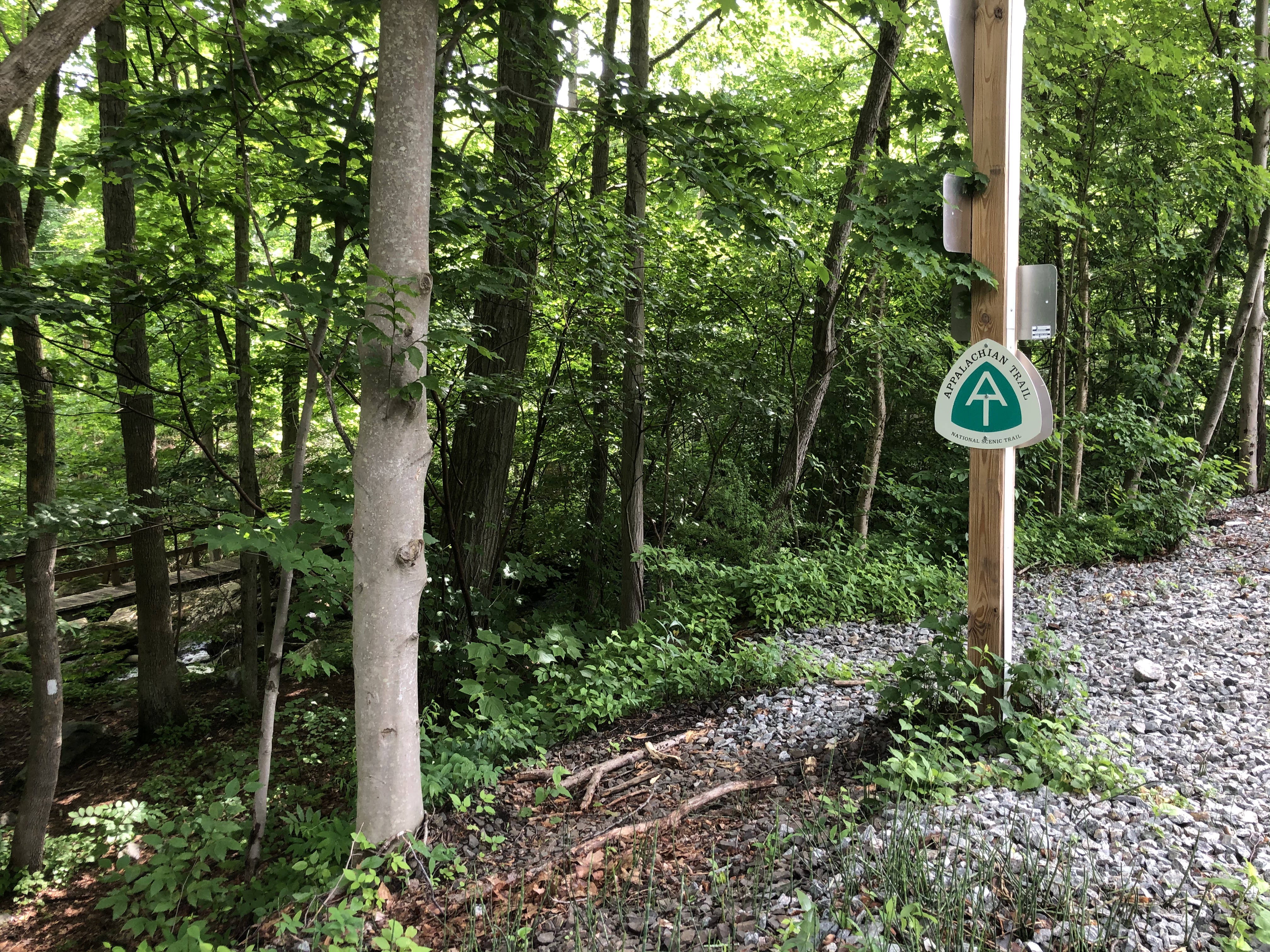
Fun fact: The Appalachian Trail crosses the Maybrook Trail (NY milepost 22.5 on the AT).
Another site you’ll see from the trail when you reach Stormville: a golf course with an XXXL American flag. That’s the tipoff that it’s a Trump golf course.
Today made me even more appreciative of that public water spigot in Kinderhook on day 1. The Maybrook Trail has almost no amenities and no obvious places to get off the trail to buy water or food. (Business opportunity for someone?) Even the North and South County trails from Brewster into Westchester County have little beyond parking lots. Sure, some have a bike repair station, including an air pump, but I didn’t see port-a-potties or water options.
Sometimes you see enough of a town to spot amenities, but there’s no special signage for cyclists. We stopped at the Mahopac library right off the trail to refill our water bottles (CVS is visible across the street at the traffic light; the library is across the street too, to your left if you’re southbound, but you may not be able to see the signage).
Keep going south and at times you feel like the trail is sandwiched between highways. Who drives along the Saw Mill River Parkway and knows a trail is just on the other side of a thin strip of trees? Or on the Taconic State Parkway? To be honest, it’s amazing that it exists at all given the demand for roadways and the fights over every scrap of land in New York City. The section of Elmsford that we’ve seen, unfortunately, seems to be decidedly bike and pedestrian-unfriendly. How about some more sidewalks? And safe access to the hotels for those not traveling by car?

We opted to stay at the La Quinta in Elmsford because it is close and walkable of sorts to Captain Lawrence Brewing, where we were meeting friends. (There are more options on the road leading to the new Tappan Zee Bridge, plus there is a Comfort Inn a bit further north.) For those who want a shorter day, Brewster has hotels too, but I have no sense of how easy they are to reach by bike.
That you can go from New Paltz to here — and then onto New York City — almost exclusively on trails is just stunning. May other states be inspired to do something similar.
Now there’s just one short day to go for us. Read about it here.

“close to 70 miles in the saddle” … How do you do it fully loaded in the heat?
LikeLike
I drenched my hair in that library bathroom to cool off!
And lots of shade on the trail helped.
I admit my load was lighter than the Brit’s…
LikeLike
good to know what to expect on the trail ! thanks!
LikeLike
Appreciate the overview as I am finding it difficult to get details about the route- I have been considering doing this ride with my 14 year old~ we did the GAP trail last year and loved it but I am concerned that there is too much on the road? Any advice or thoughts having just completed the ride?
LikeLike
Michelle, the GAP is amazing, and I hope the EST towns and others learn from it. Hopefully some people will open B&Bs just off the trail.
I found the road section on Day 2 quiet aside from that initial part of getting out of Hudson (sidewalk? be assertive in taking the lane?). It just won’t be flat like the GAP. On Day 4, the nasty bit was getting to the hotel (La Quinta), and I can’t tell whether sidewalk reaches all the hotels on Main Street in Elmsford. If you are staying in one, maybe call Elmsford police or village hall and ask? Or email Bike Tarrytown?
You could reduce the road section by taking Metro North to Poughkeepsie instead of Amtrak to Albany. Take the time to cross over the Hudson using the Walkway Over the Hudson, even if you don’t go all the way to New Paltz (that bit of road) — it’s lovely. If the 14-year-old is interested, I’d also go to the national parks sites (stay off route 9 as much as possible, especially closer to Poughkeepsie). FWIW I did consider a hotel not far from the trail in East Fishkill, but I can’t tell you what the road to it is like.
One last thought: if you’re worried about how your 14-year-old will handle traffic, do some short road rides closer to home? Even just riding through your town as a way to practice? Consider a free street skills class from Bike New York (if you live near NYC) or a free online class from CyclingSavvy or similar?
Hope you and your 14-year-old go and have a great time! And if you are looking for other overnight trail suggestions … I biked the Schuylkill River Trail from outside Philadelphia to Reading a few years ago (construction that blocks the trail squashed plans for a repeat this year). There’s also the D&L Trail (southern end is in Bristol, north of Philadelphia) … easy to Easton, a bit quirky to Bethlehem… All on the blog. Further afield, consider some sections of the East Coast Greenway.
LikeLike