
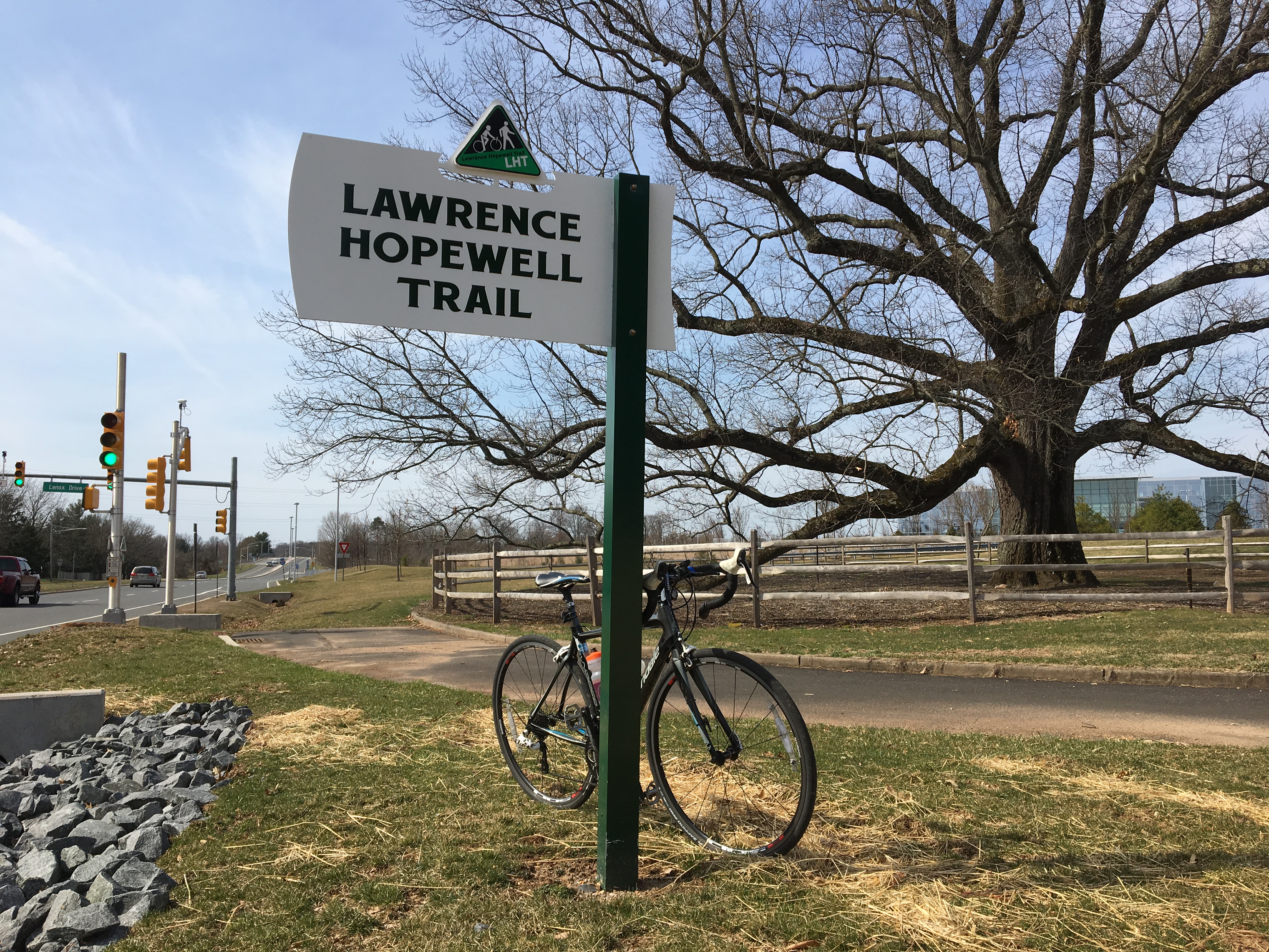
Now I have ridden sections of the Lawrence Hopewell Trail many times, even at night during the annual Moonlight Ride. But Saturday was the first time I set out to ride the entire 22-mile loop. And I have to say the whole of this New Jersey trail is better than its parts.
Put it this way: I just couldn’t stop smiling.
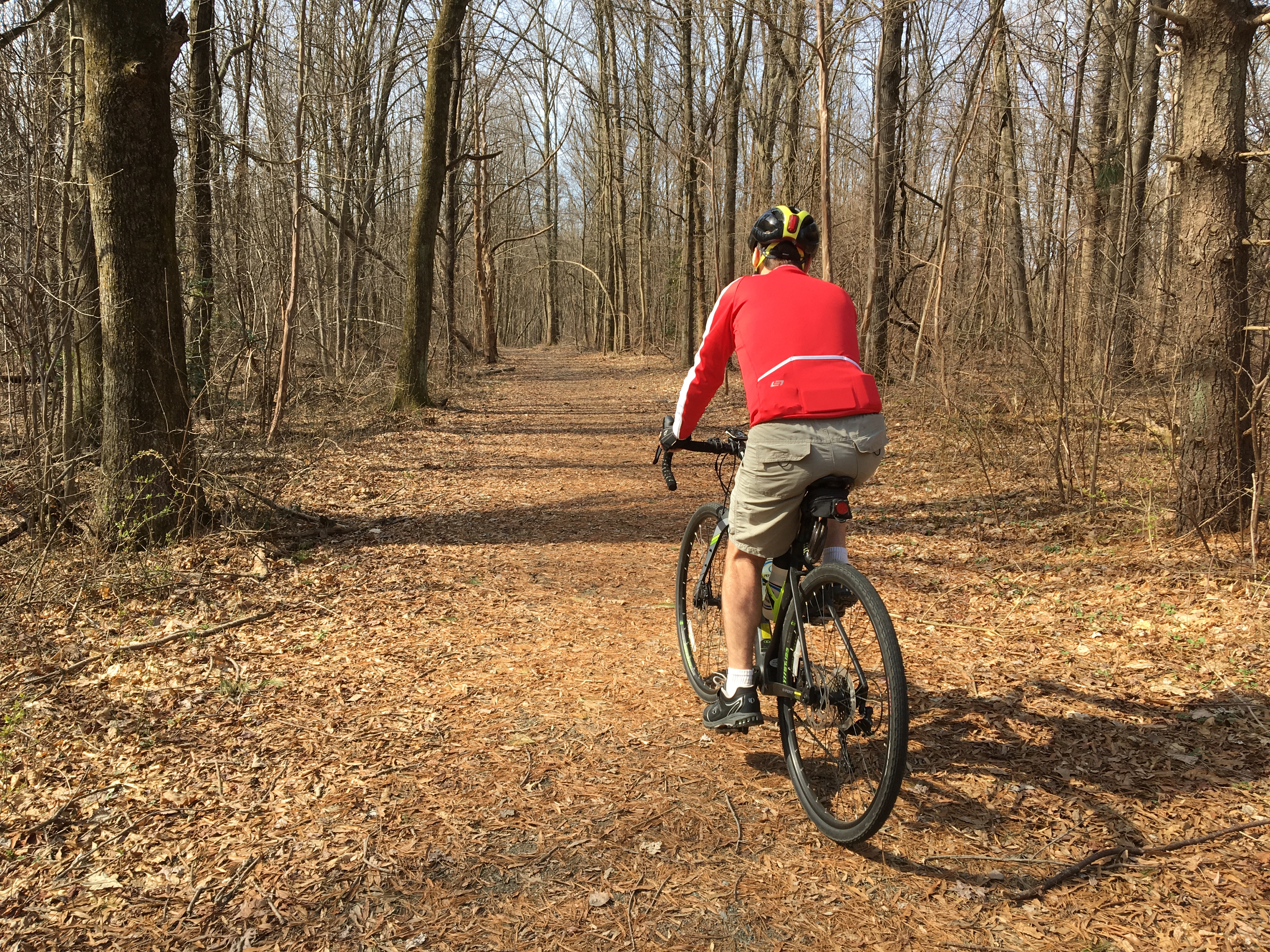
The LHT has so much variety that you can’t dismiss it with oh, trails are boring. Sometimes you’re biking through the woods, other times through the fields or next to a lake. You go for miles through Mercer County’s largest park. There’s the options for a food stop in Lawrenceville. History at the “pole farm,” where 10-story (yes, story) timber poles stood for decades, supporting antenna wires that relayed phone calls across the Atlantic. It looks like spinach is already growing at a big organic farm. Lots of curves and turns, not the straight lines of an abanonded rail line that’s been converted into a trail.
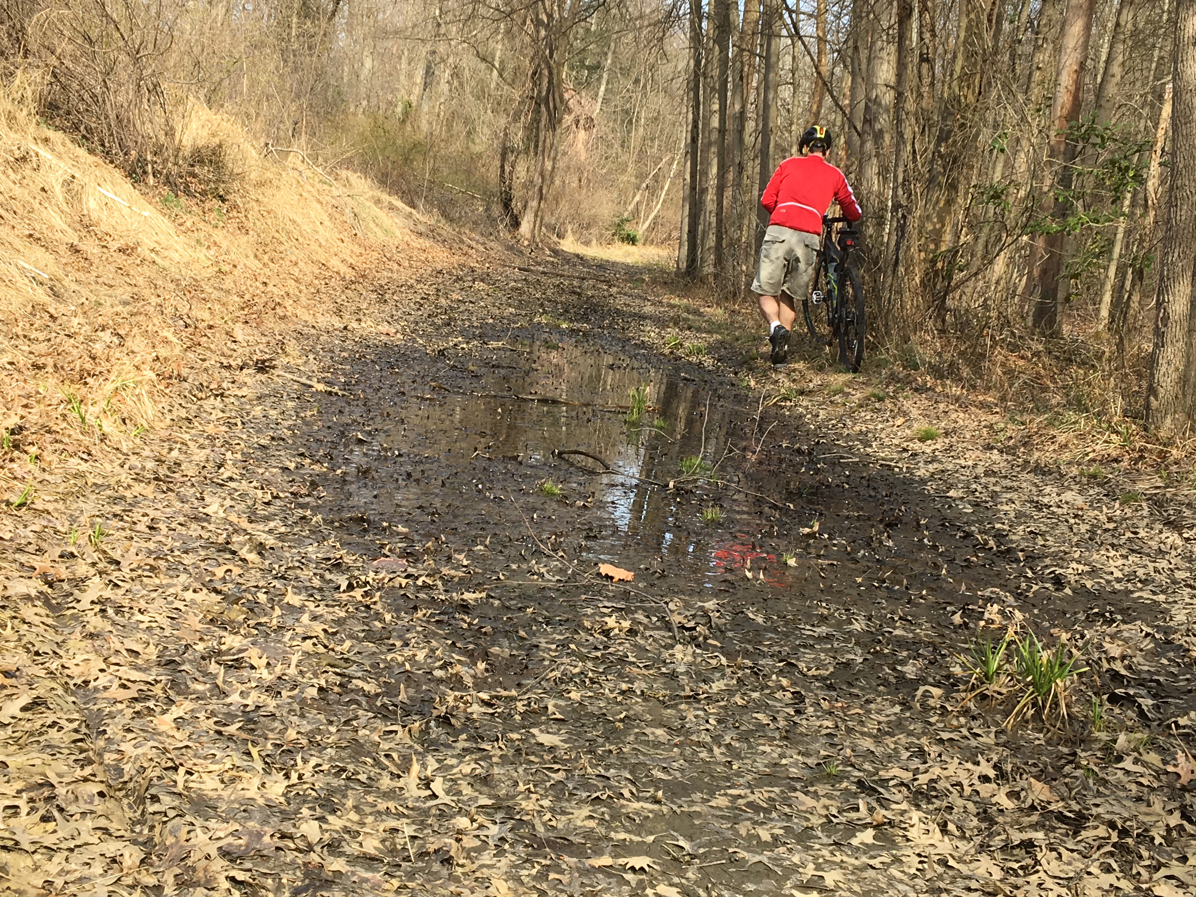
The surface changes too. Sometimes it’s paved, but there’s dirt, crushed stone too. Sometimes it felt soft on my 28 mm road-bike tires (thankfully with some tread), and I felt I fishtailed a bit. Anyone on wider tires, though, will have no problem. And there was even a bit of mud to go around or (ugh) walk through, holding up my featherweight bike.
Signage — with one exception — is perfect.
More is coming!
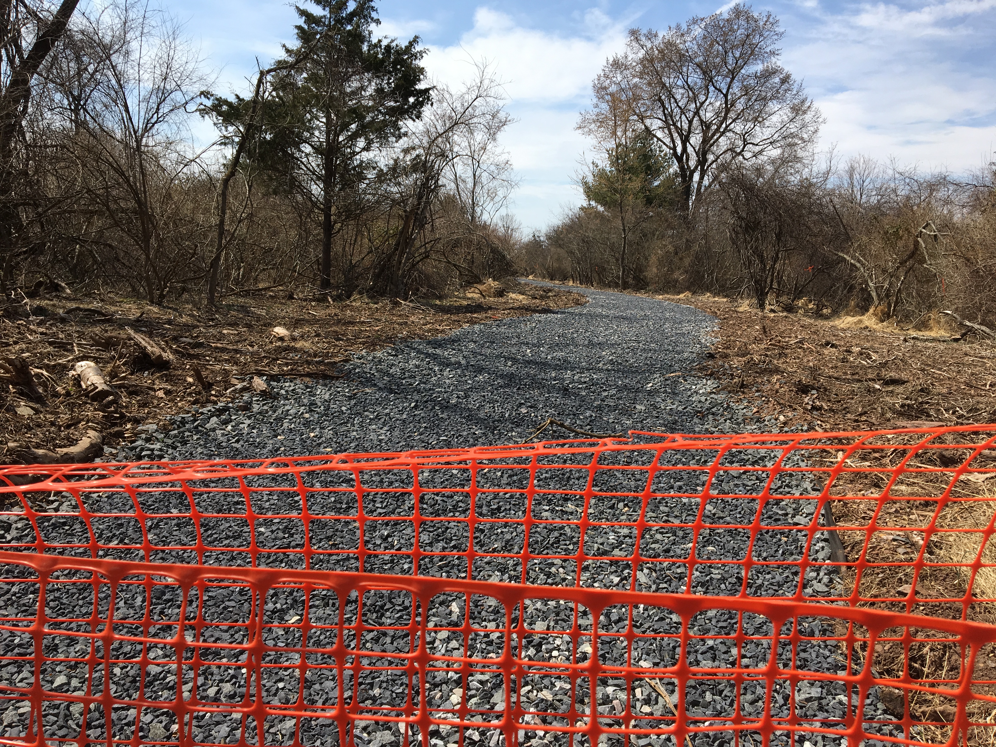
This trail is about 90% done — and it looks like we spied the next section that will be completed. This will finally connect the trail from Province Line Road roughly opposite Audubon Lane to ETS, one of the LHT’s conceivers. And it means everyone can bypass Rosedale Road — yay. I’ll update as I hear more about the construction timetable.
The LHT should be getting close to building another section that will get users off a busy road. The Delaware Valley Regional Planning Commission has provided a grant of $1 million for construction of Mount Rose Preserve section — 0.9 miles that will let people avoid the traffic on Carter Road. I’ll update when I hear more about the construction timetable.
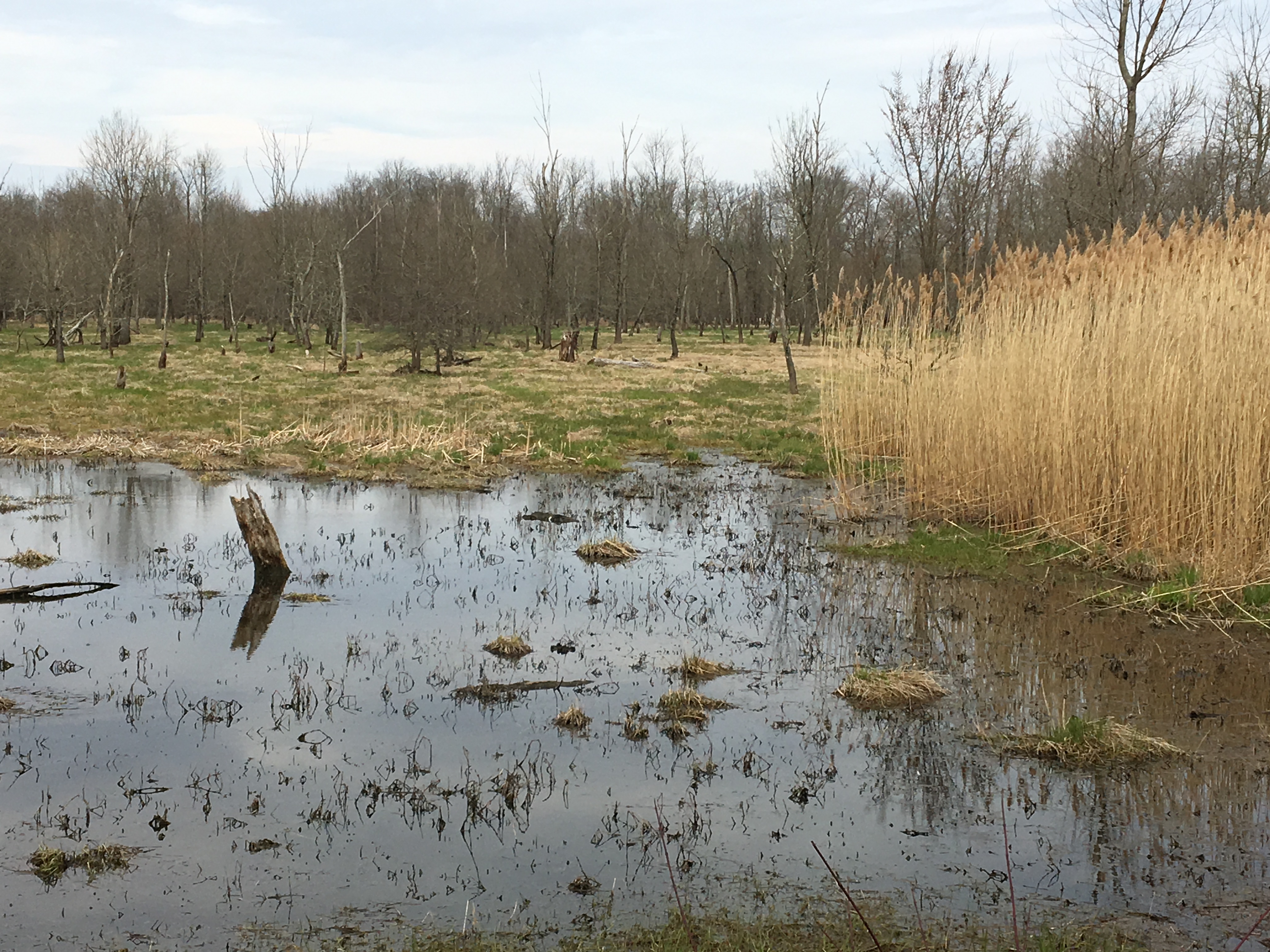
And earlier this year Lawrence Township received a grant for another trouble spot — busy Princeton Pike. The plan is to finish taking the LHT through Maidenhead Meadows Park on a combination of paved trail and raised boardwalk over wetlands for 5/8 of a mile, until it reaches an office complex on the other side of Brearley House. Construction is expected in 2020. OOPS! Now hearing 2021.
Here’s how the section that’s done there looks:
A detailed look at the route
While these three projects won’t finish the LHT, they will bring it awfully close. On our ride, we biked from home to the D&R Canal, then took Province Line Road and Princeton Pike to Maidenhead Meadows (don’t do this if you don’t like biking with traffic!). We rode a section in the park, but it eventually took us back to Princeton Pike. With a mostly decent shoulder we got ourselves just past Brearley House to a section of trail that took us past a shiny, newish Bristol-Myers Squibb office. (BMS is the other big reason the LHT exists.)
I remember biking this section when you had to take a (quiet) road. Now the asphalt path weaves around past this modern office building and to the posh Lawrenceville School. Bike through campus and you’re in the heart of Lawrenceville’s downtown.
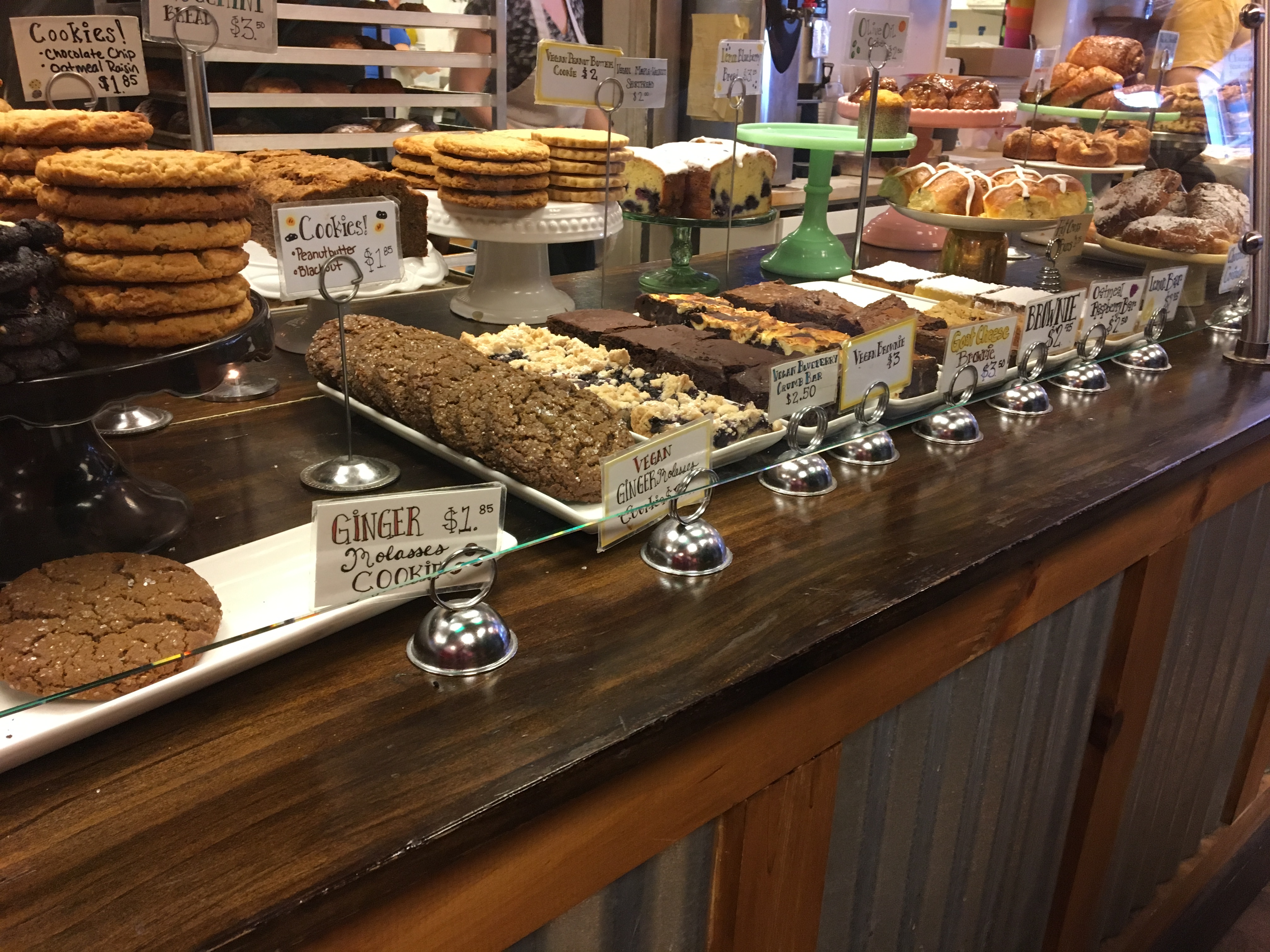
It’s a small downtown, with a few restaurants and a bakery. But this is the only place you can buy food on the entire route — plan accordingly.
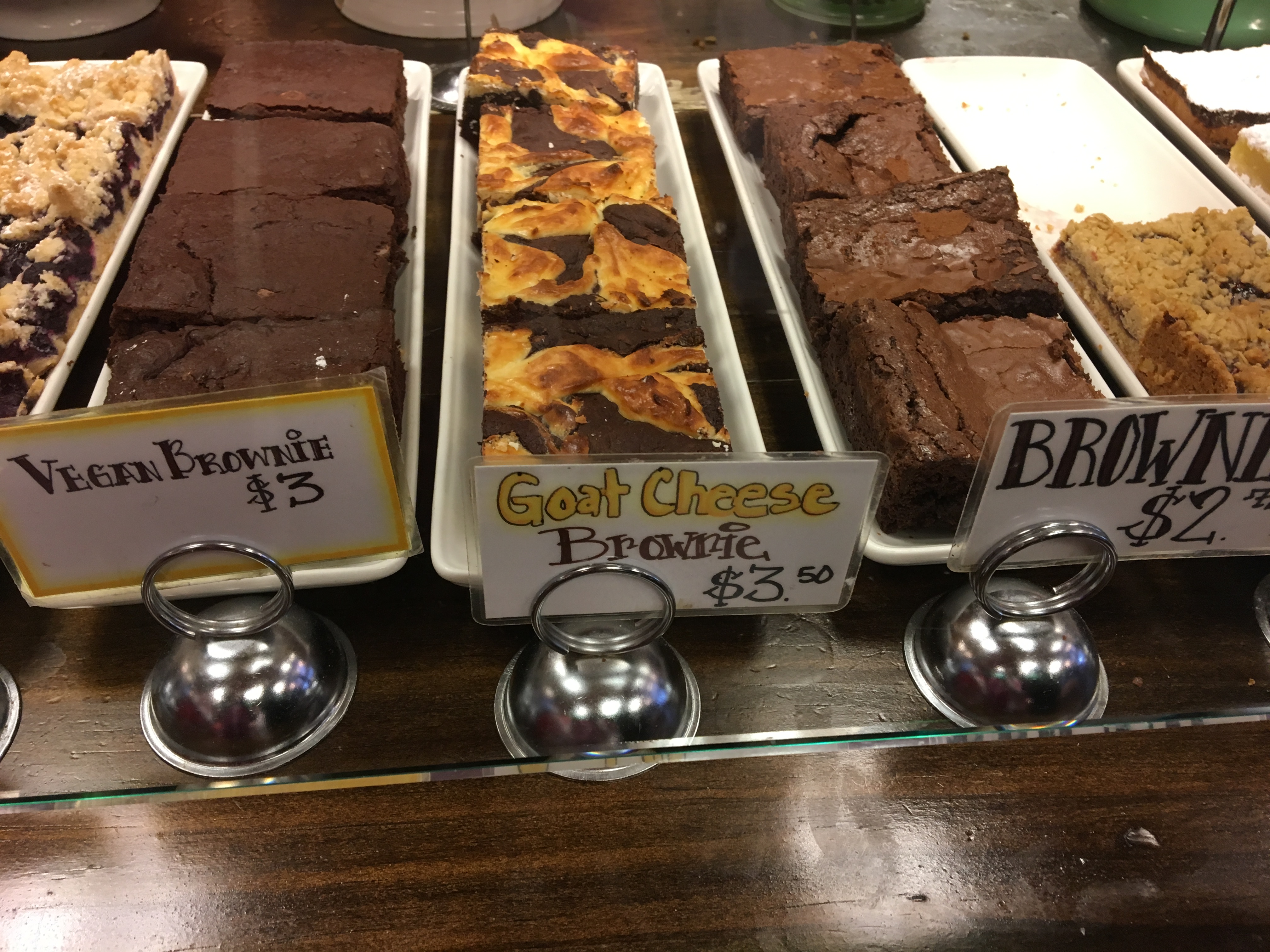
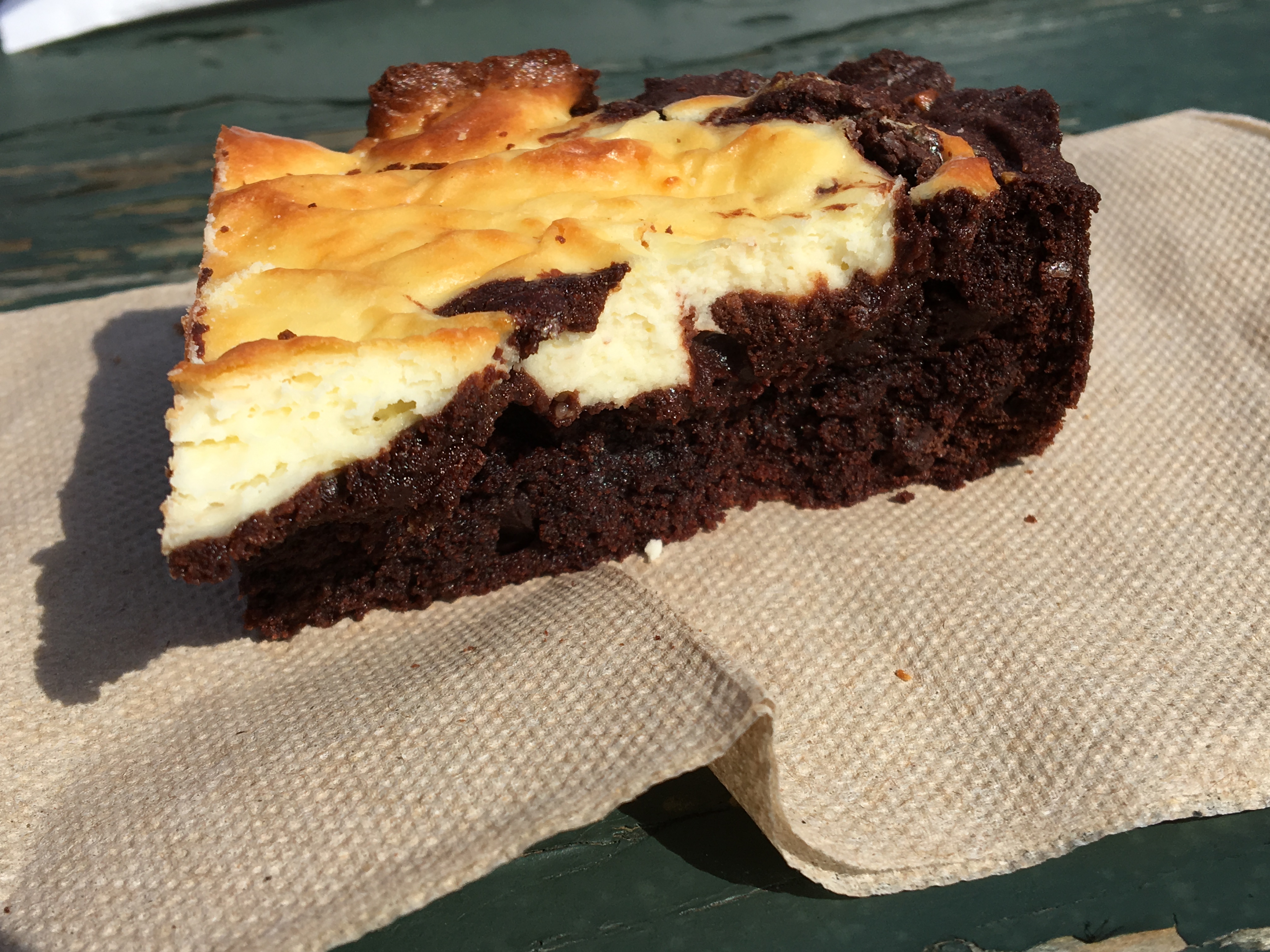
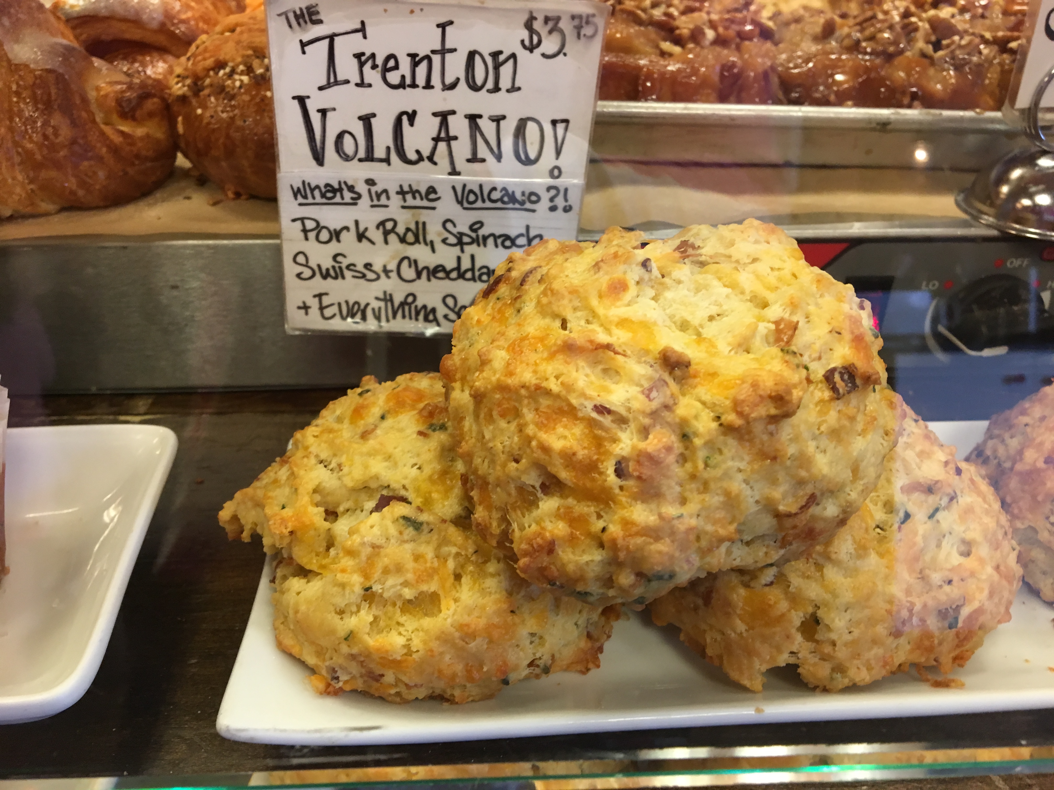
We wanderered into the bakery, called the Gingered Peach. It was packed; perhaps there was a sports event at Lawrenceville School? So much choice! Even the vegans will find something sweet here. We decided to split the goat cheese brownie. Honestly? The goat cheese didn’t have a tang; it seemed more like cream cheese. Perhaps next time I should go for the Trenton volcano?
UPDATE: Another sweet option is essentially through the parking lot behind the bakery (or just go down two doors on Main Street): The Purple Cow Ice Cream shop.
If you want to eat al fresco, it’s not far to Village Park. (You’ll pass a turn-off for the Johnson Trolley Line trail; it unfortunately can’t get across I-295.) In the past, we’ve missed a turn and ended up on road going back toward Princeton, but the signage now is spot on. It connects to Mercer Meadows with the pole farm, the Master Gardeners’ educational gardens, more park space, more trails… While the route through Village Park is paved, the vast trails of Mercer Meadows are not.
UPDATE: A new section!
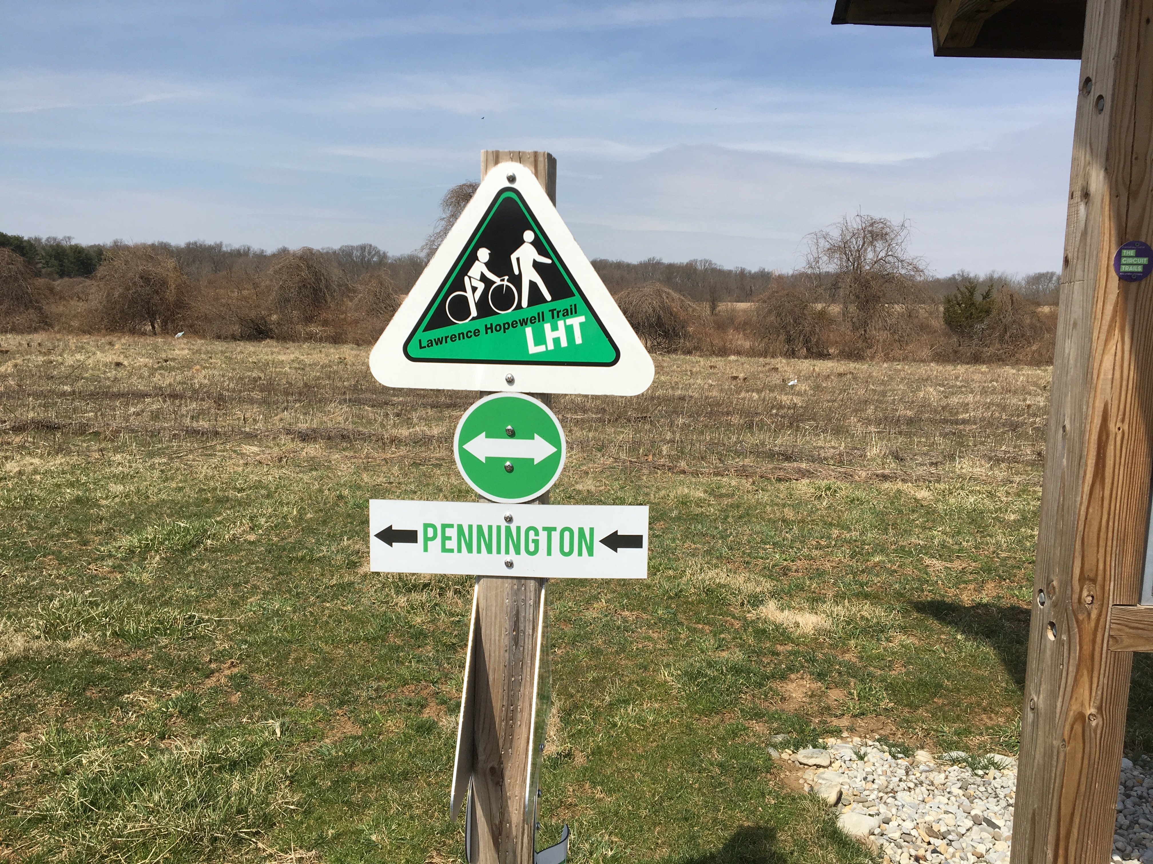
Outside the big county park, it’s yet more trail, paved and unpaved. We reach the point where you could turn left and head to Pennington (also on paved trail). Do this if you’re hungry; it’s maybe a mile.
Otherwise keep going. You’ll pass another Bristol-Myers site. Then there’s a spur to the Watershed Institute, which we visited for the first time on New Year’s Day for a muddy hike. Or turn onto Wargo Road to pass Honey Brook organic farm. (OK, you might be able to get some produce here on Saturdays in the summer.)
Watch out for the residential neighbhorhood on the right. This is the only spot we found where signage failed us. We only knew to turn right because a sign signaling go left for those coming the other way caught the corner of our eye. We had to pull over, find the LHT map on our phone and note the three roads we needed. Somehow this neighborhood got built without sidewalks; maybe those people don’t like LHT signs either?
Incredibly, we’re almost at the most northern part of this loop and aside from Princeton Pike we have yet to be on any busy roads. Actually, we’ve barely been on any roads, and they’ve been residential. This is what riding on a trail is all about! Now we’re finally at a gap — a short gap, but we needed to be on Pennington-Rocky Hill Road for a quarter of a mile. The plan is to eventually have the trail go on the northern side of the road, through what the LHT calls the Hillman property.
But we pick up a multi-use path along the edge of a pricey neighborhood, then weave through the woods and past an old distillery. This is the beautiful Mount Rose Distillery section that we discovered last year.
Unfortunately it ends at Carter Road. Opposite is yet another Bristol-Myers Squibb office complex, one they intend to vacate. This is another Mount Rose section, the one where there is at least some of the funding needed for a trail that takes users the back way to Cleveland Road. But for now it’s the road, and a section we know well, this time making a stop to admire a turkey vulture swooping low. Down Carter, left onto Cleveland, which then becomes Pretty Brook Road. Eventually there will be an off-road section here too, but for now it’s fine given the low traffic. When it ends, we turn right instead of our usual left and to a bridge that’s been closed to cars. That makes this section of Province Line Road very bike-friendly. Don’t forget to look at the mansions!
But what’s this construction? A new section of the LHT must be coming! This is the section that will take users onto the ETS campus.
UPDATE: That section is done!
Then you only need to cross Rosedale, rather than be on it, to go through yet another neighborhood and into Carson Road Woods. This is another stretch of nature and open fields, with a hay bale still left from last fall.
Then it’s back to Province Line Road and a trail taking us past yet another Bristol-Myers Squibb site (is something being torn down?), a sidepath along the other side of the road built only a few years ago, yet another neighbhorhood with outsized houses … and we’re back at our starting point.
We size up the traffic on Princeton Pike. Now it’s early afternoon, and there’s more than we’d like if we are to retrace our route to the canal towpath. It’s lighter going the other way, and we find ourselves on the shoulder of Princeton Pike until we get to the sign for Brearley House. A dirt road takes us past this historic house built by one of the signers of the Constitution and to the path connecting it to the D&R Canal. A far more civilized (and beautiful) option, even if it is a bit out of the way! The remaining section through Maidenhead Meadows can’t come soon enough.
And after nearly 37 miles we are back home.
Bonus: The Lawrence Hopewell Trail is part of the Greater Philadelphia Circuit Trails and its hundreds of miles of trails. Make it part of a weekend trip based in Princeton, as I explain here. Or keep going on the D&R Canal towpath — it’s part of the 3,000-mile East Coast Greenway.

9 thoughts on “New Jersey’s Lawrence Hopewell Trail is a gem you should discover”