
How in the world did we (Komoot? Ride with GPS?) pick this metric century route to Gap, Pa., a small town in Lancaster County?
Oh we relished 30+ traffic-free miles on the Schuylkill River Trail and Chester Valley Trail once the morning rain had passed. (I’m upgrading my view of the CVT vs the first time I biked it.) But wow did we pay for it on the hills that followed. Over one ridge and then another for about 15 miles shortly after Exton through Parkesburg.
All told, 2600 feet of climbing according to Komoot. Almost all of it was in the second half of the ride.
Kate, you would have killed us. And asked why we hadn’t followed the East Coast Greenway, the route I took nine years ago to reach DC.
Note to selves: pay more attention to the elevation profile!
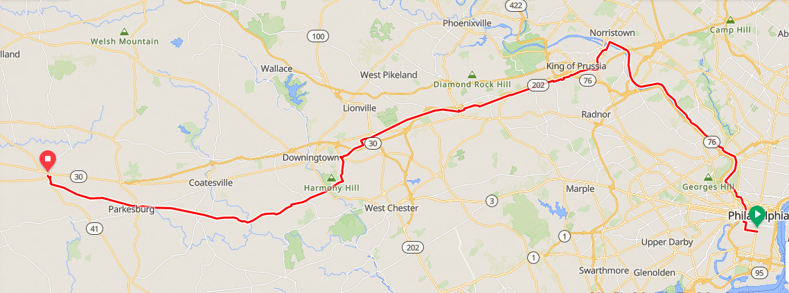
To backtrack a bit, we headed out in the rain and didn’t get very far before we pulled over and took shelter, first under a tree and then under scaffolding. We picked up the Schuylkill River Trail at Spruce Street just as the rain ended and took it all the way to Norristown. The only unasphalted section was the Manayunk towpath, and yes the bikes got filthy. After that, though, it was easy riding on the SRT. The turnoff to the Chester Valley Trail is well-marked. More smooth sailing to almost the end. Stop at a supermarket for those sanitizing wipes at the entrance to wipe off bike grime. Yes, you are within sight of highways at times, and there are lots of road crossings. But this is the first time I’ve seen three deer cross in a crosswalk! Smart deer!
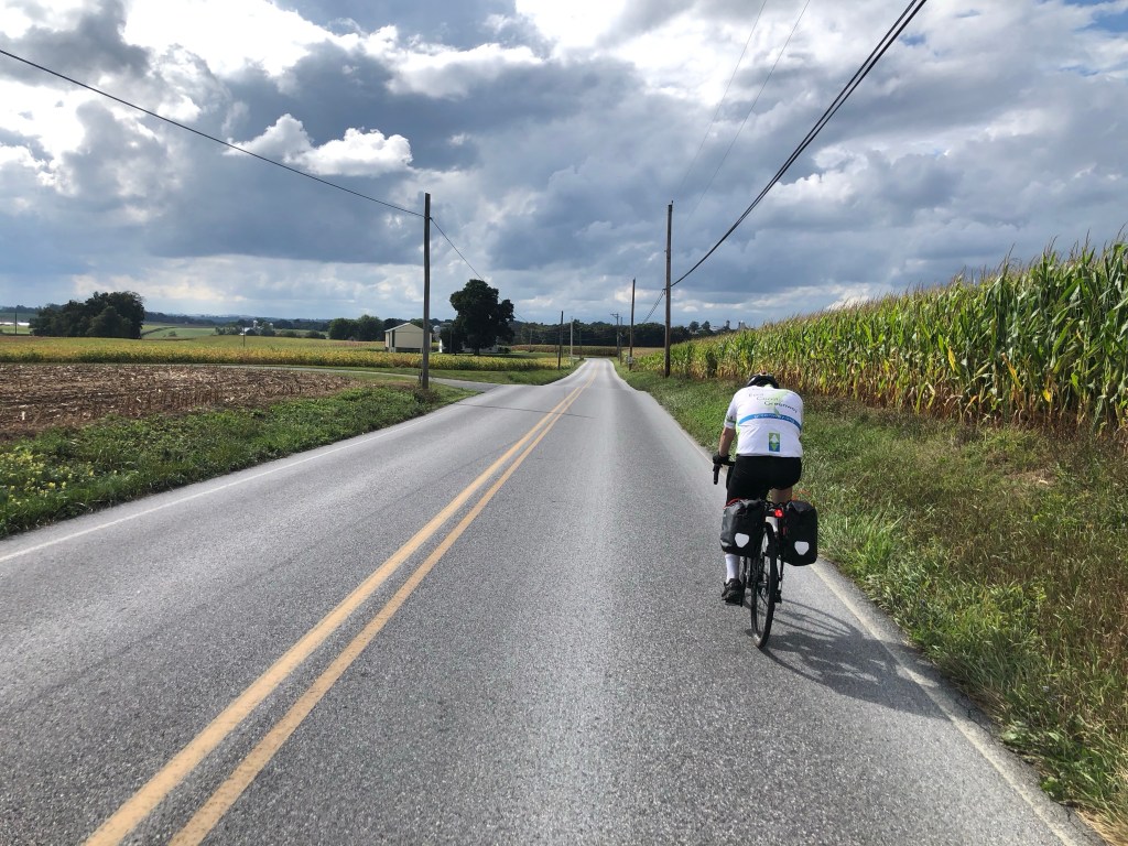
I kept wishing there was a straightforward way to extend the Chester Valley Trail to Dowington, then Coatesville. (One day?) Every extra mile would have spared me a climb, often on curvy roads with no shoulder and with more traffic than I expected. Not that roads were crazy busy. Just not empty. Would it have been easier shadowing the train tracks by zigzagging on and off Lincoln Highway and other busier roads? (Here’s a route like that I was later given from the Thorndale station — so after Downingtown — to the hotel.)
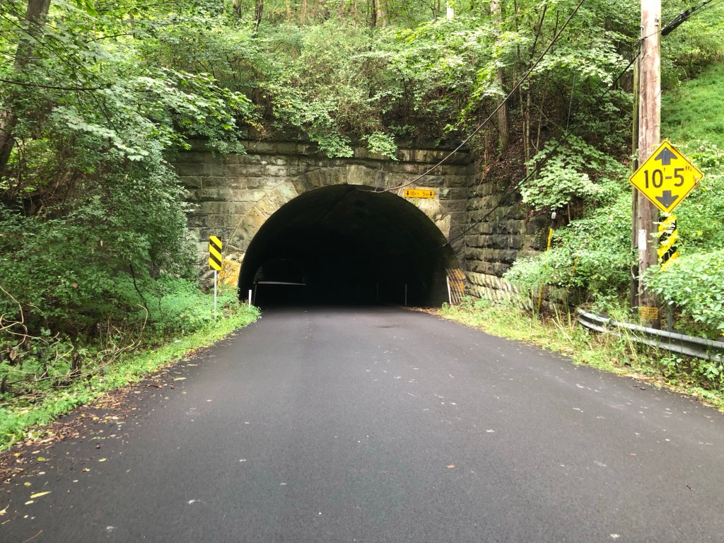
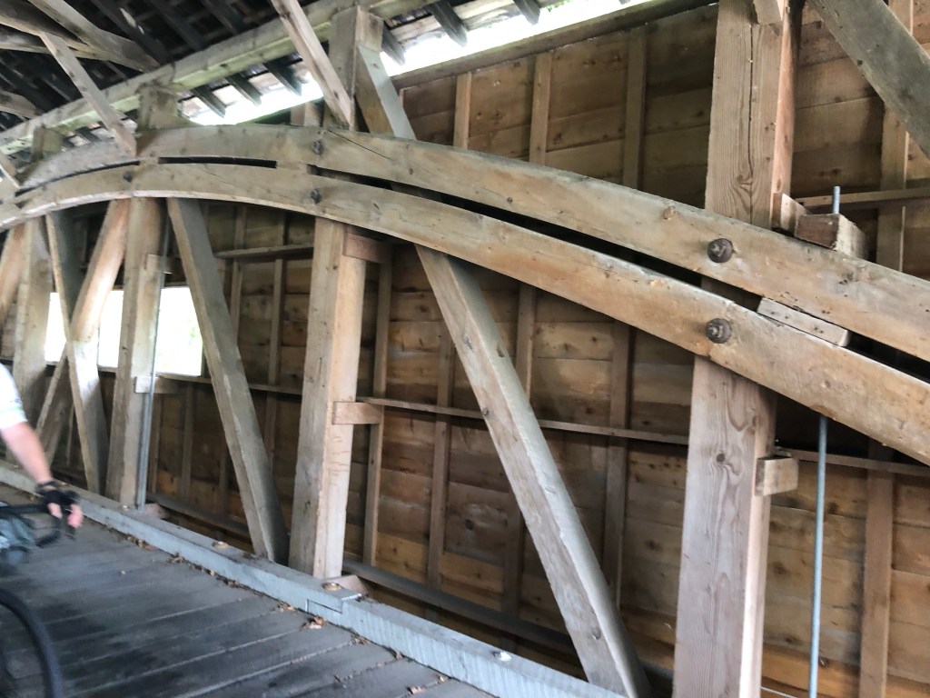
But if we had, would we have missed the double tunnel? The covered bridge?
At any rate, by the time we got to Gap and our Garmins wanted to take us up another hill, we balked. Instead we chose the shoulder of a highway. After all, if it was good enough for an Amish buggy on the other side of the road, we could zip to our hotel just a half-mile away.
Day 2: The next rail-trail that everyone will be talking about

Silvia: When I saw you on the 9th near Penn’s Landing, I had no idea you were not catching the ferry. This writeup may explain how come. My friend Kevin caught up to you and told me the news.
LikeLike