

A new section of the K&T Trail just opened in Philadelphia. It’s only 0.6 miles long so you might think it’s not worth the effort to explore.
Wrong.
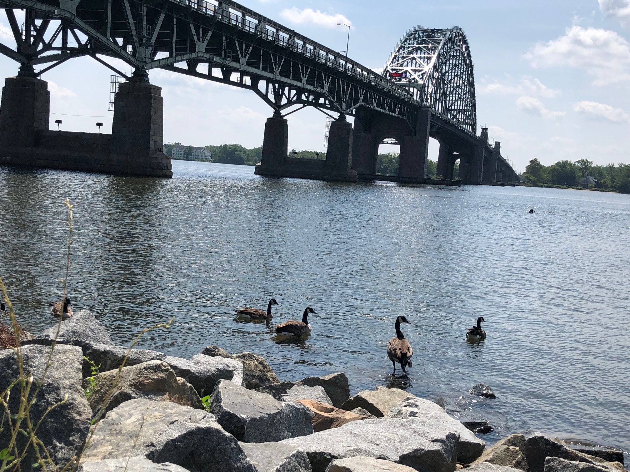
You’re right by the Delaware River, and I mean right next to the water. Ducks, maybe some boaters, the Tacony-Palmyra Bridge. Relax. Take photos.
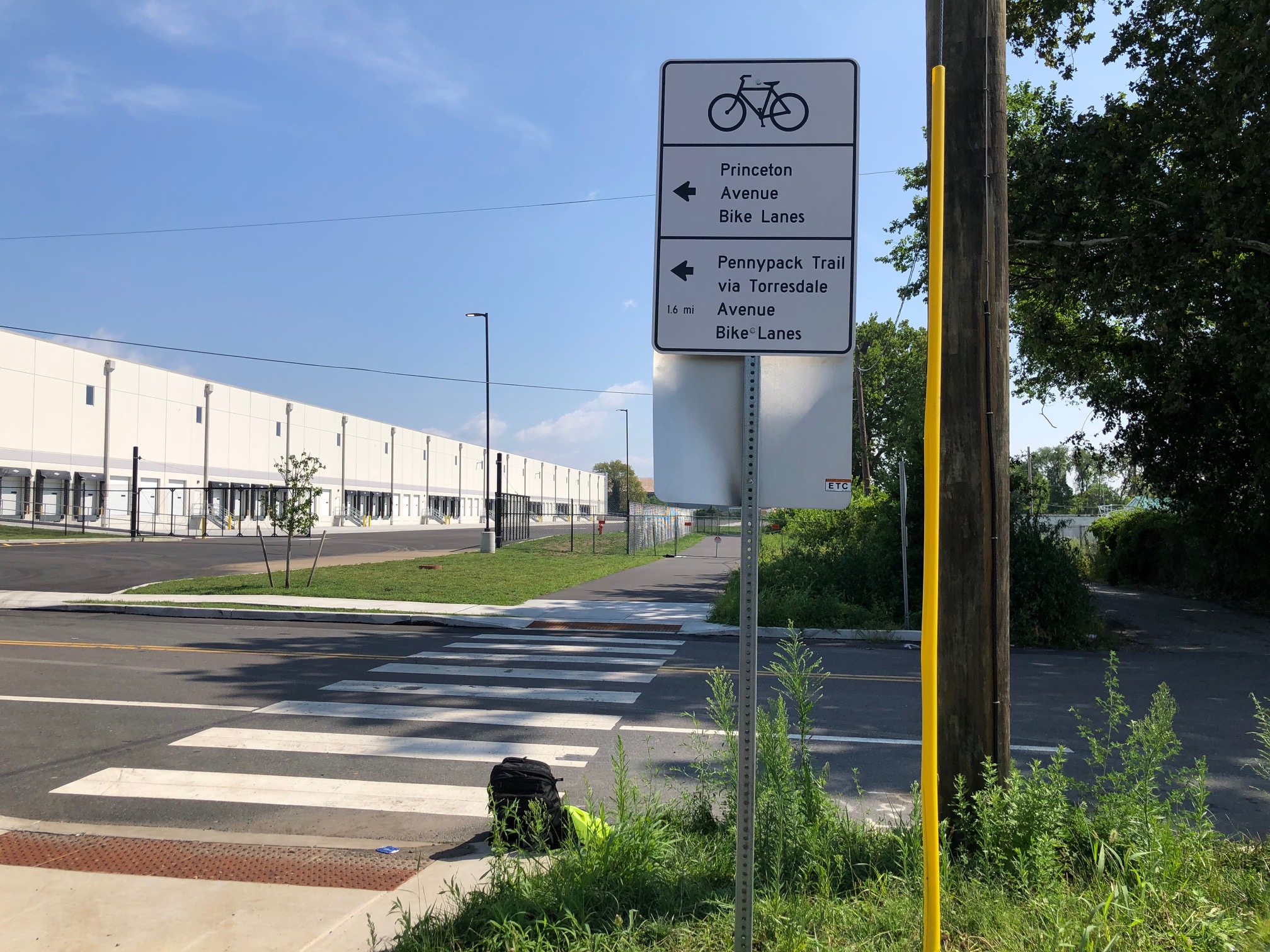
OK, ignore the other side of this paved path. It’s gritty Philly, junkyards and seemingly abandoned buildings, vestiges of a Philadelphia known as the “workshop of the world” that dates back to the aftermath of the Civil War. There’s also today’s industry: warehouses for all our online orders. This is the same neighborhood as Four Seasons Landscaping — remember its 15 minutes of fame? and the bike ride?
The other special thing about the K&T Trail is the bigger picture. This new segment means the trail is now about 2 miles long, so 4 miles roundtrip. OK, still not that big a deal if you bike a lot. It may not seem worth the detour, especially since one end is a dead end. However, it is a big deal if you live nearby and walk or use any of the three boat launches along the way.
What makes this section so great is that it’s part of a plan to open up the Delaware River to the public. And the next section, part of the Delaware Avenue Extension Project that is supposed to break ground in 2025, will add about another mile heading south over a small inlet (the Bridesburg Channel?) and all the way to a park that should be under construction this fall. So we’re up to 3 miles each way when that project wraps up in 2027 or 2028.
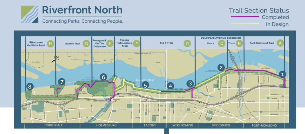
But not really. That section will connect to an existing 2-mile section that takes you under the Betsy Ross Bridge and to General Pulaski Park. Now we’re talking 5 miles of trail along or close to the river, or 10 miles round trip. Add a bit of road (how much of that will disappear and become trail because of the Northbank housing development now going up by Graffiti Pier?) and all the car-free multi-use paths/sidepaths/trails that have been built recently and you can bike traffic-free under the Ben Franklin Bridge, past the piers at the edge of Center City and deep into South Philly to near the Walt Whitman Bridge.

You’ve then got about 12 miles of trail (24 miles round trip), rather than stop-and-go roads and glass-strewn sidewalks when the roads get too crazy, plus of course dodging crazy drivers.
Wow!
And that’s just headed south.
Riverfront North, the public-private partnership behind the K&T project, is figuring out routing for the sub-mile section to the Pennypack on the Delaware Park. There you connect to the Pennypack Trail (go to Bucks County that way) or the summer-weekends-only Baxter Trail (hopefully that will change!) and a sidepath to Pleasant Hill Park. More than 2 1/2 miles. And then it’s another mile or so on bike lanes along State Road to get to Philadelphia city limits.
Right now the constant stop signs and traffic lights on Torresdale Avenue drives me crazy, so the Jersey side gets my vote as the better way to get to and from Trenton and places north. (Hello, East Coast Greenway riders.) But give Philly five years or so, and Jersey will have a lot of catching up to do.
